
| Canadian County, OK Tornadoes Prior to 1950 | |||||||||
| # | Date | Time (CST) |
Path Length (miles) |
Path Width (yards) |
F-Scale | Killed | Injured | County | Path |
|---|---|---|---|---|---|---|---|---|---|
| 05/02/1899 | 2300 | 2 | 100 | 0 | svrl | Canadian | 2 W Calumet - Calumet | ||
| 05/18/1903 | 1730 | 55 | 200 | 0 | Grady/ Canadian/ Oklahoma/ Logan | NW Oklahoma County - NE of Guthrie | |||
| 04/20/1912 | 1600 | 400 | 1 | 1 | Canadian | 3 W of Yukon | |||
| 04/27/1912 | 1230 | 85 | 880 | 15 | 39 | Kiowa/ Washita/ Caddo/ Canadian | Lugert - near Hobart - Colony - near Hinton - near Calumet | ||
| 04/11/1927 | 1800 | 52 | 500 | 1 | 7 | Caddo/ Grady/ Canadian | Near Alfalfa - near Mustang | ||
| 06/09/1937 | 1630 | 35 | 320 | 4 | 7 | Canadian/ Cleveland | W of Union City - SE of Mustang - near Moore (possibly series) | ||
| 05/21/1940 | l af | 1 | 17 | 0 | 0 | Canadian | 1.5 E Mustang | ||
| 03/15/1942 | 2310 | 12 | 1760 | 0 | 1 | Canadian/ Kingfisher | Okarche - E of Kingfisher | ||
| Canadian County, OK Tornadoes (1950-Present*) | |||||||||
| # | Date | Time (CST) |
Path Length (miles) |
Path Width (yards) |
F-Scale | Killed | Injured | County | Path |
| 1 | 02/19/1951 | 1830 | 44 | 20 | F2 | 0 | 5 | Caddo/ Canadian/ Kingfisher | Spring Creek community (8 NE Gracemont) - Ft. Reno - 6 E Okarche (southern Kingfisher County) |
| 2 | 07/07/1952 | 1330 | 4 | 50 | F1 | 0 | 0 | Canadian | 6 WSW Mustang |
| 3 | 04/14/1953 | 1850 | 16 | 440 | F2 | 0 | 0 | Canadian/ Grady | 5 SW Yukon - 8 E Tuttle |
| 4 | 11/18/1953 | 2240 | 0.1 | 17 | F0 | 0 | 0 | Canadian | 2.5 E El Reno |
| 5 | 04/29/1954 | 2100 | 2 | 10 | F2 | 0 | 0 | Canadian | 3 WSW Yukon |
| 6 | 06/03/1956 | 0355 | 0.1 | 10 | F1 | 0 | 0 | Canadian | just W of Mustang |
| 7 | 06/03/1956 | 0355 | 0.1 | 10 | F2 | 0 | 0 | Canadian | just W of Mustang - Mustang |
| 8 | 07/02/1956 | 1837 | 16 | 400 | F2 | 0 | 0 | Canadian | 15 SW - 1.5 E El Reno |
| 9 | 04/22/1957 | 2015 | 31 | 10 | F2 | 0 | 0 | Caddo/ Canadian | between Binger and Eakly - N of Calumet |
| 10 | 05/22/1957 | 1030 | 0.1 | 10 | F0 | 0 | 0 | Canadian | 5 SE Yukon |
| 11 | 06/12/1957 | 1000 | 0.1 | 10 | F1 | 0 | 0 | Canadian | 6 W Calumet |
| 12 | 03/25/1959 | 1445 | 0.5 | 200 | F1 | 0 | 0 | Canadian | 1 N El Reno |
| 13 | 03/26/1961 | 1430 | 0.1 | 10 | F2 | 0 | 0 | Canadian | 5 NW El Reno |
| 14 | 04/08/1961 | 1545 | 1.3 | 100 | F2 | 0 | 0 | Canadian | 6 ESE El Reno |
| 15 | 04/30/1961 | 1730 | 1 | 200 | F2 | 0 | 0 | Canadian | near Piedmont |
| 16 | 04/30/1961 | 1800 | 0.5 | 10 | F2 | 0 | 0 | Canadian | 11 W El Reno |
| 17 | 05/04/1961 | 1815 | 9 | 10 | F2 | 0 | 0 | Canadian | SW of Okarche |
| 18 | 05/04/1961 | 1845 | 13 | 10 | F1 | 0 | 0 | Canadian | S of Okarche - Piedmont |
| 19 | 05/04/1961 | 2025 | 0.1 | 10 | F0 | 0 | 0 | Canadian | N of Yukon |
| 20 | 06/16/1963 | 0310 | 0.8 | 150 | F2 | 0 | 0 | Canadian | Near Union City |
| 21 | 05/01/1964 | 1630 | 0.1 | 10 | F1 | 0 | 0 | Canadian/ Oklahoma | 5 WSW Yukon - NW Oklahoma City |
| 22 | 06/10/1967 | 2135 | 17 | 10 | F0 | 0 | 0 | Canadian/ Oklahoma | 4 N El Reno - 3 NW Lake Hefner |
| 23 | 04/30/1970 | 0045 | 32 | 440 | F1 | 0 | 0 | Grady/ Canadian/ Oklahoma | 6 WNW Minco - northwest Oklahoma City - 5 NW The Village |
| 24 | 04/30/1970 | 0100 | 47 | 500 | F2 | 0 | 6 | Grady/ Canadian/ Oklahoma | 4 NW Pocasset - Mustang - Oklahoma City - 2 W Arcadia |
| 25 | 06/11/1970 | 1410 | 13 | 100 | F3 | 0 | 1 | Canadian/ Oklahoma | S of Yukon - Oklahoma City (near NW 150th/MacArthur) |
| 26 | 06/19/1970 | 1745 | 0.1 | 10 | F0 | 0 | 0 | Canadian | Near Piedmont |
| 27 | 05/24/1973 | 1600 | 13 | 300 | F4 | 2 | 4 | Canadian | WNW of Union City- Union City- SE of Union City |
| 28 | 06/04/1973 | 1800 | 2 | 50 | F1 | 0 | 0 | Canadian | 2 NE Yukon |
| 29 | 04/20/1974 | 1500 | 64 | 100 | F3 | 0 | 3 | Grady/ Canadian/ Oklahoma/ Lincoln | SW of Minco - 2 SE Mustang - S Oklahoma City - Del City - Midlothian |
| 30 | 05/23/1974 | 1835 | 0.1 | 100 | F1 | 0 | 0 | Canadian | Near I-40/Mustang Road |
| 31 | 04/30/1978 | 1740 | 2 | 50 | F1 | 0 | 0 | Canadian | S part of El Reno |
| 32 | 04/30/1978 | 1740 | 6 | 50 | F1 | 0 | 0 | Canadian | 3 E El Reno - 2 SW Richland |
| 33 | 04/30/1978 | 1755 | 7 | 70 | F0 | 0 | 0 | Canadian | 4 WSW Richland - Richland - 1 NE Richland |
| 34 | 04/30/1978 | 1757 | 6 | 77 | F0 | 0 | 0 | Canadian | 2 W Richland - 1 S Piedmont |
| 35 | 04/30/1978 | 1820 | 9 | 1760 | F4 | 0 | 0 | Canadian/ Oklahoma | 2 S Piedmont- NW Oklahoma City- 9 W Edmond |
| 36 | 06/21/1978 | 1115 | 1.5 | 40 | F1 | 0 | 0 | Canadian | 3 W- 3 WNW Calumet |
| 37 | 08/22/1979 | 1814 | 0.1 | 10 | F1 | 0 | 0 | Canadian | 2 W Piedmont |
| 38 | 08/22/1979 | 1855 | 0.1 | 10 | F0 | 0 | 0 | Canadian | 3 W Union City |
| 39 | 11/20/1979 | 1420 | 0.2 | 27 | F1 | 0 | 0 | Canadian | SW of El Reno |
| 40 | 05/22/1981 | 1849 | 17 | 1333 | F4 | 0 | 0 | Caddo/ Canadian | 1 W Binger- 11 WNW Union City |
| 41 | 05/22/1981 | 1932 | 2 | 100 | F1 | 0 | 0 | Canadian | 5 WNW Union City |
| 42 | 05/30/1982 | 1940 | 0.1 | 10 | F0 | 0 | 0 | Canadian | W of El Reno |
| 43 | 05/17/1983 | 2155 | 10 | 200 | F2 | 0 | 0 | Canadian | 5 WNW- 7 NNE El Reno |
| 44 | 06/15/1988 | 1215 | 1 | 20 | F0 | 0 | 0 | Canadian | 3 N Union City |
| 45 | 05/15/1990 | 1705 | 5 | 50 | F1 | 0 | 0 | Canadian | 10 SW Calumet |
| 46 | 05/26/1990 | 1851 | 0.1 | 23 | F0 | 0 | 0 | Canadian | 1 N Concho |
| 47 | 03/26/1991 | 2343 | 0.1 | 20 | F0 | 0 | 0 | Canadian | 1 W Union City |
| 48 | 04/12/1991 | 1505 | 1 | 30 | F0 | 0 | 0 | Canadian | 8 WNW- 7 NW Calumet |
| 49 | 05/11/1992 | 1120 | 6 | 73 | F0 | 0 | 0 | Canadian/ Kingfisher | Piedmont- 2 SW Cashion |
| 50 | 10/07/1992 | 1455 | 0.2 | 23 | F1 | 0 | 3 | Canadian | SW Oklahoma City (near SW 27th/ Czech Hall) |
| 51 | 06/03/1995 | 2025-2030 | 5 | 200 | F1 | 0 | 0 | Canadian | 3 NNE Union City- 5 SE El Reno |
| 52 | 06/13/1998 | 1815 | 0.2 | 30 | F0 | 0 | 0 | Canadian | 5 WNW El Reno |
| 53 | 06/13/1998 | 1817-1822 | 0.2 | 30 | F0 | 0 | 0 | Canadian | 4 NW El Reno |
| 54 | 06/13/1998 | 1845 | 0.1 | 30 | F0 | 0 | 0 | Canadian | 2 WNW Yukon |
| 55 | 05/03/1999 | 1758-1807 | 4 | 100 | F0 | 0 | 0 | Canadian/ Kingfisher | 1.5 W Okarche - 4 N Okarche |
| 56 | 05/03/1999 | 1800 | 0.2 | 25 | F0 | 0 | 0 | Canadian/ Kingfisher | Okarche |
| 57 | 05/03/1999 | 1903 | 0.1 | 25 | F0 | 0 | 0 | Canadian | 2.5 WNW Union City |
| 58 | 05/03/1999 | 1913-1914 | 0.8 | 100 | F0 | 0 | 0 | Canadian | 2 NNE Union City |
| 59 | 05/03/1999 | 1916-1918 | 1 | 75 | F0 | 0 | 0 | Canadian | 4 NNE Union City - 5 NNE Union City |
| 60 | 05/03/1999 | 1925 | 0.1 | 25 | F0 | 0 | 0 | Canadian | 3 ESE El Reno |
| 61 | 05/03/1999 | 1929-1941 | 9 | 150 | F1 | 0 | 0 | Canadian/ Blaine/ Kingfisher | 3 NNE Geary - 7 S Omega |
| 62 | 05/03/1999 | 1934-1946 | 6 | 150 | F1 | 0 | 0 | Canadian | 6 WNW Yukon - 3 W Piedmont |
| 63 | 05/03/1999 | 1948-2000 | 8 | 200 | F2 | 0 | 0 | Canadian/ Kingfisher | 1.5 W Piedmont - 6 NNW Piedmont |
| 64 | 05/03/1999 | 1958-2022 | 10 | 150 | F1 | 0 | 0 | Canadian/ Kingfisher | N side of Piedmont - 2 W Cashion - 4 NW Cashion |
| 65 | 05/03/1999 | 2056-2058 | 1 | 50 | F0 | 0 | 0 | Canadian | SW Edge of El Reno |
| 66 | 05/03/1999 | 2103-2137 | 22 | 350 | F3 | 0 | 0 | Canadian/ Kingfisher | 1 NNE El Reno - 8 SE Kingfisher |
| 67 | 10/22/2000 | 1636 | 0.2 | 30 | F0 | 0 | 0 | Canadian | 5 SSE Calumet (at I-40 near MM 117) |
| 68 | 05/09/2003 | 2053-2054 | 0.5 | 50 | F1 | 0 | 0 | Canadian | 3.9 N - 4 N Union City |
| 69 | 03/27/2004 | 1854 | 0.1 | 10 | F0 | 0 | 0 | Canadian | 2 SSW Okarche |
| 70 | 05/29/2004 | 1817-1915 | 20 | 1760 | F2 | 0 | 0 | Blaine/ Canadian/ Kingfisher | 9 WNW Geary - 11.2 W Okarche |
| 71 | 05/29/2004 | 1904-1914 | 5 | 50 | F1 | 0 | 0 | Canadian | 2 N - 4.5 ENE Calumet |
| 72 | 05/29/2004 | 1914-1920 | 2 | 20 | F1 | 0 | 0 | Canadian | 4 NNE Calumet - 3.5 WNW Concho |
| 73 | 05/29/2004 | 1922 | 0.1 | 20 | F0 | 0 | 0 | Canadian | 2 NW Concho |
| 74 | 05/29/2004 | 1945-1947 | 1 | 50 | F1 | 0 | 0 | Canadian | 6.5 W - 5.5 W Piedmont |
| 75 | 04/24/2006 | 1823-1838 | 3 | 30 | F1 | 0 | 0 | Canadian | 5.5 W -3.1 WSW El Reno |
| 76 | 04/24/2006 | 1830-1842 | 3 | 200 | F1 | 0 | 0 | Canadian | 5.1 SW - 5 SSW El Reno |
| 77 | 03/29/2007 | 1505-1525 | 8 | 50 | EF2 | 0 | 5 | Canadian | NW Oklahoma City: near NW 39th/Sara (2 E Yukon) - N of Memorial Road / Morgan Road (3.5 ESE Piedmont) |
| 78 | 05/08/2007 | 2226-2230 | 2 | 40 | EF0 | 0 | 0 | Canadian | 2.4 W - 3.8 NW Union City |
| 79 | 05/08/2007 | 2243-2250 | 1.8 | 150 | EF1 | 0 | 0 | Canadian | El Reno (just SW of I-40/US-81 - just S of Choctaw Rd/Elm Rd. [2.5 SSE - 1 S El Reno] |
| 80 | 05/08/2007 | 2308 | 0.6 | 80 | EF1 | 0 | 0 | Canadian | 5 WSW Piedmont |
| 81 | 05/08/2007 | 2321 | 0.2 | 30 | EF1 | 0 | 0 | Canadian | 3 NNW Piedmont |
| 82 | 08/19/2007 | 0100-0106 | 3 | 30 | EF0 | 0 | 0 | Caddo/ Canadian | 1.7 ENE Cogar - 9 W Union City |
| 83 | 08/19/2007 | 0132-0138 | 7 | 75 | EF1 | 0 | 0 | Grady/ Canadian | 1 ESE Minco - 1 N Union City |
| 84 | 05/07/2008 | 1557-1609 | 8 | 120 | EF1 | 0 | 0 | Canadian/ Oklahoma | 1 E Yukon - 1 ENE Warr Acres |
| 85 | 05/10/2010 | 1546-1552 | 7 | 30 | EF0 | 0 | 0 | Canadian/ Kingfisher/ Logan | 5.5 N Piedmont - 0.5 E Cashion |
| 86 | 05/10/2010 | 1546-1554 | 4 | 40 | EF0 | 0 | 0 | Canadian | 3.5 NNE Union City - 6 SE El Reno |
| 87 | 05/24/2011 | 1450-1635 | 63 | 1760 | EF5 | 9 | 181 | Canadian/ Kingfisher/ Logan | 4 ESE Hinton - El Reno - Piedmont - Cashion - 4 NE Guthrie |
| 88 | 05/24/2011 | 1537-1539 | 1.5 | 50 | EF0 | 0 | 0 | Canadian | 3 NW Richland |
| 89 | 04/13/2012 | 2352-2355 | 2 | 75 | EF1 | 0 | 0 | Canadian | Oklahoma City (1 N - 3 NNW Mustang; near SW 54th St/Mustang - near SW 29th St/Tucson) |
| 90 | 05/29/2012 | 1926-1928 | 1 | 30 | EF1 | 0 | 0 | Canadian | 2 SW Piedmont (near NW 150th St/Richland Rd) |
| 91 | 05/29/2012 | 2015-2016 | 1 | 30 | EF0 | 0 | 0 | Canadian | 2.5 WSW Union City |
| 92 | 05/29/2013 | 1600 | 0.2 | 20 | EF1 | 0 | 0 | Canadian | 6 W Calumet |
| 93 | 05/31/2013 | 1655-1656 | 0.4 | 30 | EF0 | 0 | 0 | Canadian | 7 S Calumet |
| 94 | 05/31/2013 | 1703-1744 | 16 | 4576 | EF3 | 8 | 26 | Canadian | 8 S Calumet - 5.5 S El Reno - 6 SSW Richland |
| 95 | 05/31/2013 | 1712-1713 | 0.5 | 120 | EF0 | 0 | 0 | Canadian | 5 NW Union City |
| 96 | 05/31/2013 | 1713-1714 | 0.5 | 350 | EF0 | 0 | 0 | Canadian | 5.5 SSW El Reno |
| 97 | 05/31/2013 | 1729-1741 | 5 | 150 | EF2 | 0 | 1 | Canadian | 6.5 W - 4.5 SW Yukon |
| 98 | 05/31/2013 | 1751-1809 | 6 | 600 | EF1 | 0 | 0 | Canadian/ Oklahoma | 5 SE Yukon (NW of SW 15th/Morgan) - W Oklahoma City (near SW 15th/Meridian) |
| 99 | 05/31/2013 | 1755-1757 | 0.5 | 50 | EF0 | 0 | 0 | Canadian | 6 S El Reno |
| 100 | 03/25/2015 | 1712 | 0.7 | 50 | EF0 | 0 | 0 | Canadian | 6 WSW - 5 WSW Yukon |
| 101 | 04/26/2016 | 1908-1912 | 4 | 50 | EF0 | 0 | 0 | Canadian/ Oklahoma | 1 NE Mustang (near SW 59th/Sara - SW Oklahoma City (NE of SW 29th/County Line Road) |
| 102 | 05/18/2017 | 1605-1610 | 3 | 50 | EF0 | 0 | 0 | Canadian/ Blaine | 4 SE - 5.5 E Greenfield |
| 103 | 05/25/2019 | 2128-2132 | 2.2 | 75 | EF3 | 2 | 29 | Canadian | 2 S - 2.5 ESE El Reno |
| 104 | 10/13/2021 | 0359-0408 | 6 | 150 | EF1 | 0 | 0 | Canadian | west Mustang (SE of SH-152 and Frisco Road) - southwest Oklahoma City (SW of SW 29th St and County Line Road) |
| 105 | 10/26/2021 | 2254 | 0.3 | 20 | EF0 | 0 | 0 | Canadian | Union City (southeast side) |
| 106 | 04/23/2022 | 1815-1816 | 0.3 | 50 | EF? | 0 | 0 | Canadian | 4 SSW Mustang |
| 107 | 10/24/2022 | 0727-0733 | 3 | 50 | EF0 | 0 | 0 | Canadian | 6.5 W - 4 W Mustang |
| 108 | 02/26/2023 | 2057-2107 | 11 | 200 | EF1 | 0 | 0 | Grady/ Canadian | 3 W Tuttle - far southwest OKC - 4 WNW Mustang |
| Date | Time (CST) |
Path Length (miles) |
Path Width (yards) |
F-Scale | Killed | Injured | County | Path | |
|---|---|---|---|---|---|---|---|---|---|
| 02/19/1951 | 1830-2000 | 44 | 20 | F2 | 0 | 5 | Caddo/ Canadian/ Kingfisher | Spring Creek community (8 NE Gracemont) - Ft. Reno - 6 E Okarche (southern Kingfisher County) | |
|
This tornado struck the Spring Creek community in northern Caddo County at 6:30 pm CST, injuring 5 people from one family when a house collapsed in the area. A store and a vacant house were also damaged in the community. The tornado continued northeastward into Canadian County, striking the Fort Reno area at 7:17 pm CST before dissipating 6 miles east of Okarche in southern Kingfisher County at 8:00 pm CST. The hail that accompanied the tornado in Kingfisher County caused $500 in property damage. Estimated damage from this tornado was $32,500. The Fort Reno area incurred about $15,000 in damages and several buildings were demolished including a large barracks and large hay shed while other buildings were damaged including Lucas Hall. The weather equipment at Fort Reno was destroyed with the rain gauge being found several hundred yards from its original location. Several farms in Canadian County were also damaged. |
|||||||||
| 04/30/1970 | 0100 | 47 | 500 | F2 | 0 | 6 | Grady/ Canadian/ Oklahoma | 4 NW Pocasset - Mustang - Oklahoma City - 2 W Arcadia | |
|
The first report of damage from a tornado was located 4 miles northwest of Pocasset in Grady County, or 25 miles southwest of Oklahoma City. The tornado moved along a northeastward path through parts of Canadian and Oklahoma counties, and damaged was last reported 2 miles west of Arcadia. Only 2 or 3 people reported seeing the funnel, but a number of persons heard a loud noise, like that made by a jet engine. In several areas roofs or buildings were moved at a right angle to the path of the storm, indicating a rotating column of air. Most of the damage occurred at Mustang in Canadian County, located just southwest of Oklahoma City, and along a path up to a half mile wide from the southwest corner of Oklahoma City to the northeast corner of the city. A farmstead northwest of Pocasset received $10,000 in damages, and there was extensive damage to a home and several outbuildings 2 miles west of Arcadia. Two semi-trailer trucks were blown off the road and turn over on their sides along the westbound U.S. Interstate Highway I-40 lanes as the trucks were entering the Oklahoma City limits. At Mustang, damages were estimated at $500,000 and were confined mainly to a shopping center and the city hall in the north part of Mustang. About 3 miles northeast of Mustang, a school building was extensively damaged and had most of its windows blown out. One mile west of Mustang, wind equipment belonging to the National Severe Storms Laboratory (NSSL) recorded a wind speed of 110 mph. About 7 miles southwest of Mustang, a NSSL rain gauge measure 5 inches of rain. In Oklahoma City, the damage was estimated at $6.3 million. Damage occurred to 1,473 homes, 293 businesses, 8 schools, 12 churches, and 300 signs. Southwestern Bell Telephone Company officials reported 30,000 telephones out of service, primarily in northwest Oklahoma City and Mustang. Oklahoma Gas and Electric officials reported that 215 utility poles were downed. It is possible that several tornadoes were produced by the parent supercell thunderstorm instead of a single, long-track tornado. |
|||||||||
| 06/11/1970 | 1410 | 13 | 100 | F3 | 0 | 1 | Canadian/ Oklahoma | S of Yukon - Oklahoma City (near NW 150th/MacArthur) | |
|
This tornado destroyed two farm homes, a barn, and other outbuildings in an area just south of Yukon and the moved northeastward to northwest Oklahoma city where a nursing home was heavily damaged. One of the nursing home residents was slightly injured. |
|||||||||
 |
05/24/1973 | 1600 | 13 | 300 | F4 | 2 | 4 | Canadian | WNW of Union City - Union City - SE of Union City |
|
This violent tornado touched down several miles west-northwest of Union City and moved east-southeastward through the city before it turned more southeastward for several miles. An estimated $1 million of damage was done in Union City, with 27 homes and 18 mobile homes destroyed. In addition, 20 homes sustained major damage and 23 homes had minor damage. Severe commercial buildings and churches were also heavily damaged. Farm animals were killed and crops damaged. A total of six people were killed and two people were seriously injured. It was noted that the intensity and destruction of this tornado was immense. There were also two funnels aloft reported in the area at the time of the event. This was one of the most thoroughly studied tornadoes in history, as multiple research scientists from the National Severe Storms Laboratory documented the event through experimental Doppler radar and storm chase teams. |
|||||||||
| 04/20/1974 | 1500 | 64 | 100 | F3 | 0 | 3 | Grady/ Canadian/ Oklahoma/ Lincoln | SW of Minco - 2 SE Mustang - S Oklahoma City - Del City - Midlothian | |
|
A funnel cloud was observed 3 miles southwest of Minco in Grady County at about 3:00 pm CST. The funnel touched down about 2 miles southwest of Mustang at 3:28 pm CST and periodically lifted and touched the ground again at it moved to the east-northeast at 30 mph. This tornado dissipated in Lincoln County at 5:30 pm CST. The tornado passed about a mile south of the NWS forecast office located near the Will Rogers World Airport in Oklahoma City. Wind gusts of 66 mph along with 2-inch diameter hail were observed at the forecast office. A major portion of the reported damage occurred as the storm moved through the southern Oklahoma City and Del City areas. There was extensive damage to homes in that area as several houses were unroofed. A total of 3 injuries were reported in the great Oklahoma City area. Fortunately, none of the injuries were serious. As the continued moving to the east-northeast through eastern Oklahoma County, the next report of damage was 3 miles northwest of Harrah where several farm buildings were destroyed. Several more farm buildings were destroyed in the Midlothian area. If more data had been available at the time, it is possible that 2-3 tornadoes may have occurred with one tornado dissipating and another tornado forming near the end point of the previous tornado. However, with the data that was available at the time, it appeared that one long-track tornado occurred. |
|||||||||
| 04/30/1978 | 1820 | 9 | 1760 | F4 | 0 | 0 | Canadian/ Oklahoma | 2 S Piedmont- NW Oklahoma City- 9 W Edmond | |
|
A large, massive tornado touched down 1/2 mile north of the intersection of Oklahoma State Highways 3 and 4 in Canadian County and moved east-northeast into Oklahoma County, dissipating 9 miles west and 1 mile north of Edmond. It passed 1 mile southeast of the community of Piedmont where the heaviest damage was inflicted. At this location a housing addition was severely damaged with 15 houses completely destroyed or heavily damaged. Ten rural homes were also heavily damaged just to the east-northeast of the housing addition. Several large missiles including automobiles, oil storage tanks, and stock feeders were picked up by the tornado and carried up to a half mile. The damage path was at least a mile across throughout the tornado's life cycle. Hailstones up to 2.5 inches in diameter were also reported with the storm. The same parent supercell thunderstorm which produced this giant tornado, had also previously generated 4 tornadoes in and near El Reno and Richland in Canadian County. |
|||||||||
| 05/22/1981 | 1849 | 17 | 1333 | F4 | 0 | 0 | Caddo/ Canadian | 1 W Binger- 11 WNW Union City | |
|
This large tornado formed a mile west of Binger, OK and moved northeast through northeastern Caddo County and southwestern Canadian County before dissipating at the Canadian River, 11 miles west and 3 miles north of Union City. This large, intense tornado created projectiles from refrigerators automobiles, trucks, combines, and utility poles. Dead cattle were founded hanging from denuded trees. Large oil storage tanks, butane tanks, and motor vehicles were moved to distances up to a half mile by the tornadic winds. Fortunately, all farmsteads in the path of the tornado had underground shelters, and the occupants were able to take shelter during the storm. The tornado was rated F4, and a Fujita Scale damage path map shows the tornado path length, width and approximate damage intensity. |
|||||||||
| 10/07/1992 | 1455 | 0.2 | 23 | F1 | 0 | 3 | Canadian | SW Oklahoma City (near SW 27th/ Czech Hall) | |
|
Severe thunderstorms developed during the early afternoon of October 7th in southwest and central Oklahoma along a strong cold front. These storms later moved east into northeast Oklahoma during the late afternoon hours. The main threat from these storms was strong winds, although some hail up to quarter size was reported. A small tornado developed in southwest Oklahoma City and moved through a residential area occupied by mostly mobile homes and modular homes. Six mobile homes were damaged or destroyed, and one garage was damaged. A 60-year-old man was in one of the mobile homes with his 2 granddaughters when the home was destroyed, and all 3 suffered minor injuries. The damage was estimated at $150,000. |
|||||||||
| 03/29/2007 | 1505-1525 | 8 | 50 | EF2 | 0 | 5 | Canadian | NW Oklahoma City: near NW 39th/Sara (2 E Yukon) - N of Memorial Road / Morgan Road (3.5 ESE Piedmont) | |
|
Showers and thunderstorms developed during the morning hours of March 29th over central Oklahoma. During the afternoon hours, thunderstorms began to show brief, but persistent signs of rotation, that later resulted in three tornadoes. The most significant tornado of the day struck the western Oklahoma City metro area, producing EF2 damage. Other tornadoes were reported near Okeene, and over northwest Garfield county. Damage was reported with each of these thunderstorms, which included roof damage, tree and power line damage, and automobile accidents. No fatalities were reported, but five direct injuries were reported in western Oklahoma City. The tornado developed around 3:05 pm CST near the intersection of NW 39th Street and Sara Road in western Oklahoma City, and moved north northeast. In this area several homes suffered roof and garage door damage. The tornado continued north along and just west of the Kilpatrick Turnpike. Significant damage was noted along NW 63rd Street, where a home was heavily damaged, several travel trailers and a boat were rolled and damaged. Several vehicles were also pushed by the wind. Another area of significant damage was noted along Wilshire Blvd., just west of the Kilpatrick Turnpike. In this area a travel trailer was destroyed, with additional damage to a home and several outbuildings. Two people were directly injured in the travel trailer. In addition, several hardwood trees were snapped, indicative of EF2 damage. The tornado appeared to have been at its widest toward the end of its path along Morgan Road just north of NW 122nd Street, and it was at this point along the path where the intensity appeared to have been at its highest. Several homes sustained significant roof and siding damage and several wooden power poles were snapped. A metal building was severely damaged. Just to the east of this location, three large electrical transmission towers were damaged. Spotty light damage continued a little further north before the tornado dissipated along Morgan Road north of Memorial Road at 3:25 pm CST. Three additional people were directly injured on the Kilpatrick Turnpike. This EF2 tornado injured 5 people and caused an estimated half of a million dollars in damage. |
|||||||||
 |
05/24/2011 | 1450-1635 | 63 | 1760 | EF5 | 9 | 181 | Canadian/ Kingfisher/ Logan | 4 ESE Hinton (14 SW Calumet) - near Calumet - El Reno - Piedmont - Cashion - 4 NE Guthrie |
|
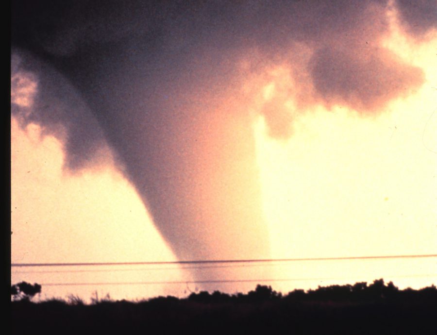
This tornado began very close to the Caddo/Canadian County border and quickly became a strong/violent tornado. The tornado destroyed numerous trees, many of which were debarked, before crossing U.S. Interstate Highway I-40. Three people died in vehicles near the I-40 Calumet exit, and two other fatalities occurred just northeast of that location. Cars were thrown thousands of feet off the roadways. It is believed that the tornado reached its maximum intensity just after crossing I-40, and it was here that a mobile radar measured winds of greater than 210 mph just off the surface. The tornado side-swiped the El Reno Oklahoma Mesonet station (located 5 miles west of El Reno) along its path, and the site measured wind gusts of 131 and 151 mph. From this location, the tornado continued northeast, narrowly missing the town of Piedmont. Widespread EF-3, occasional EF-4 damage occurred between El Reno and Piedmont. More widespread EF-4 damage was seen west and north of Piedmont. Especially hard hit was the Falcon Lake neighborhood, near the Kingfisher County border. Two children were killed at this location. The tornado entered far southeast Kingfisher County before moving into Logan County. However, EF-3 damage occurred just over the Kingfisher County border, debarking trees and significantly damaging buildings. As the tornado continued northeast, the damage was mainly considered EF-2, with damage to mostly outbuildings and trees. The tornado then continued into Logan County. The tornado moved into Logan County and resulted in two additional fatalities (both of whom were outside when the tornado struck) near Cashion. The tornado destroyed several manufactured homes (both double and single-wide) after entering Logan County. Large high-transmission line tresses collapsed. Trees were debarked with only stumps remaining. Several buildings had most of their exterior walls collapse, with only the inner walls remaining. EF-2 to occasionally EF-3 damage occurred as the tornado neared Guthrie. Luckily, most of the town of Guthrie was spared to the tornado as it moved west and then north of the center of the city. Finally, the tornado dissipated northeast of Guthrie with some minor tree damage. The tornado’s path total path length was 63 miles, and it was on the ground for nearly one hour and 45 minutes. This was the first EF-5 tornado to occur in Oklahoma since the Enhanced Fujita Scale was adopted by the National Weather Service in 2007. |
|||||||||
 |
05/31/2013 | 1703-1744 | 16 | 4576 | EF3 | 8 | 26 | Canadian | 8 S Calumet - 5.5 S El Reno - 6 SSW Richland |
|
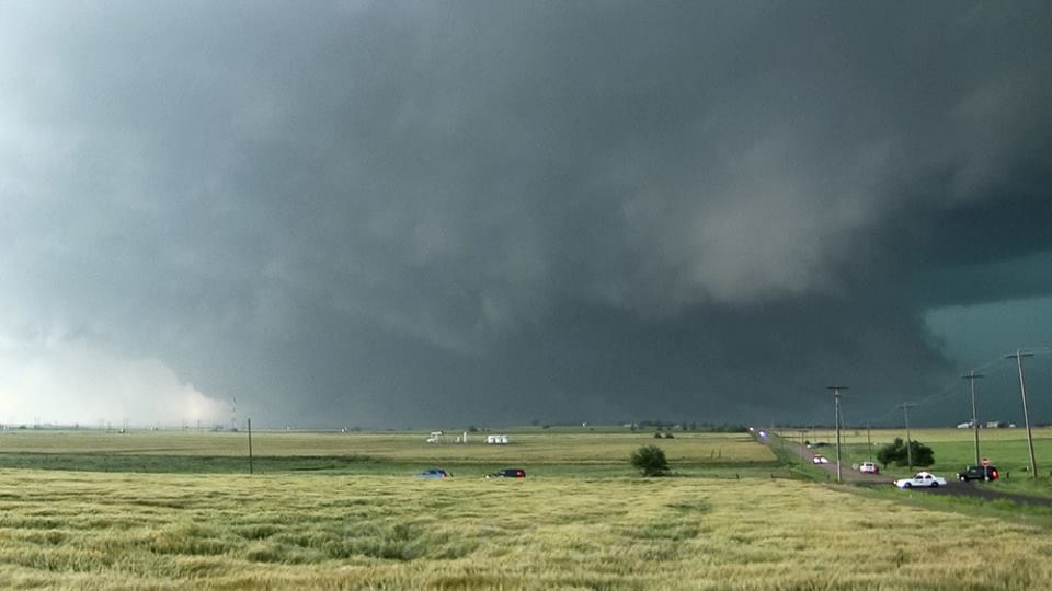
A tornado outbreak occurred during the late afternoon and early evening hours of May 31st. A stalled front and deeply mixed dryline served as a focus for thunderstorm development. The front/dryline triple point was where the most intense supercells initiated. These storms traveled eastward, eventually impacting the Oklahoma City metropolitan area. Several tornadoes occurred, including the El Reno tornado, which unfortunately claimed several lives. In addition to the tornado, very large hail and heavy rains led to flash flooding in Oklahoma City. This flash flood event ranked as one of the worst in Oklahoma City history in terms of fatalities and damages to property. The event lasted well into the overnight hours of June 1st. On May 31, 2013, an intense, long-track tornado formed southwest of El Reno. This exceptionally wide tornado took a complex path, rapidly changing in both speed and direction. The tornado spared El Reno and its airport from a direct hit, tracking just south of those locations. The tornado damaged numerous homes along with a few businesses near El Reno. Additionally, intense sub-vortices destroyed crops in numerous fields in the area. The tornado developed at 5:03 pm CST (6:03 pm CDT) just northeast of the intersection of Heaston and Reuter roads. Initially, the tornado moved to the southeast at 20 to 25 mph. At 5:09 pm CST, the tornado turned to the east, just south of Reno Road between Heaston and Brandley roads. The tornado continued to expand in size just southwest of the El Reno Municipal Air Park, where its speed increased to 30 to 40 mph. As the tornado passed just south of the airport, two satellite tornadoes formed briefly on the west side of the tornado. At 5:19 pm CST the tornado crossed Highway 81 near Reno Road as it continued to expand in size. There, the tornado abruptly turned to the north, while also accelerating to greater than 50 mph. From 5:24 to 5:26 pm CST, the tornado reached its maximum in size and intensity near the intersection of Radio and Reuter roads. The tornado, still very large, slowed down as it approached U.S. Interstate Highway 40. From 5:27 to 5:35 pm CST the tornado made a loop just north of the interstate while decelerating to less than 10 mph. After 5:35 pm CST, the tornado moved east once again, and dissipated at 5:42 pm CST near the intersection of I-40 and Banner Road. Eight people were killed in the tornado, all in vehicles. This included three severe storm researchers who were killed east of U.S. Highway 81 as the tornado overtook their position. Additionally, several other people were killed while attempting to escape the tornado near Highway 81. Finally, two people were killed along I-40 while waiting for the storm to pass. The monetary damages were estimated. This tornado was well sampled by two separate mobile research radar teams – the University of Oklahoma RaXPol radar, and the Center for Severe Weather Research’s Doppler on Wheels. Both radars captured high temporal and spatial resolution data relatively close to the large tornado. Both radars measured winds in the tornado of more than 200 mph. The RaXPol radar data shows winds of at least 295 mph very close to the surface. These intense winds were present in very small sub-vortices within the larger tornado circulation. An analysis of the high-resolution radar data combined with the results of the ground damage survey indicates that none of these intense sub-vortices impacted any structures in rural Canadian County. So, despite the measured wind speeds, surveyors could not find any damage that would support a rating higher than EF-3 based solely on the damage indicators used with the EF scale. The maximum tornado width was 2.6 miles. However, the damaging wind swath was much larger, as non-tornadic downdraft winds extended for at least a mile south of the tornado. Given the difficulty of separating this damage from tornadic damage, the OU RaXPol radar was used to help determine the width. |
|||||||||
| 05/31/2013 | 1729-1741 | 5 | 150 | EF2 | 0 | 1 | Canadian | 6.5 W - 4.5 SW Yukon | |
|
The storm damage survey and Doppler on Wheels mobile radar detected a long-lived anticyclonic tornado southwest of Yukon. Some structural damage was noted along with damage to trees. One person was injured. Damages were estimated. |
|||||||||
| 05/25/2019 | 2128-2132 | 2.2 | 75 | EF3 | 2 | 29 | Canadian | 2 S - 2.5 ESE El Reno | |
|
An intense QLCS tornado developed south of El Reno, just south of Interstate 40 and about a mile west of US-81. Initially the tornado affected rural areas, but as it moved east-northeast, it moved through the northwestern portion of an automobile dealership at the northwest corner of Interstate 40 and US-81. There it overturned or displaced a number of vehicles and removed the roof and collapsed many exterior walls of an automobile service building. Immediately northeast of the automobile dealership, the tornado moved through the southeastern portion of a mobile home park destroying many mobile homes. Although the tornado was relatively narrow, the destruction of mobile homes was complete in the path while mobile homes just a couple of blocks away suffered minimal damage. Two residents of one mobile home were killed when their home was destroyed. Just to the northeast of the mobile home park, the tornado hit a two-story motel. Most walls of the second story were collapsed in the portion of the motel that was in the most intense part of the tornado path and the tornado was rated EF3 at this motel. Crossing US-81, the tornado significantly damaged another automotive service building and produced significant roof damage to a home on SE 27th Street. The tornado weakened as it moved east-northeast along and just north of SE 27th Street damaging trees before dissipating near Alfadale Road. |
|||||||||
Records taken from the Storm Prediction Center archive data, "Storm Data", and data from the National Weather Service office in Norman. Data modified as described in NOAA Tech Memo NWS SR-209 (Speheger, D., 2001: "Corrections to the Historic Tornado Database").
Historic data, especially before 1950, are likely incomplete.


 Follow us on YouTube