
Widespread severe weather will continue across the Plains and Missouri Valley region Friday evening. Very large hail, strong tornadoes and wind damage are all possible. The severe thunderstorm activity will then shift into portions of the southern/central Plains Saturday. A Moderate Risk (Level 3/5) of excessive rainfall is also forecast from far northern Texas into Kansas Saturday. Read More >
NWS Fire Weather Forecasts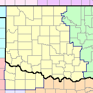 |
National Weather Service Fire Weather Page |
NWS Norman Spot Forecasts 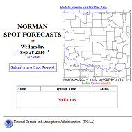 |
| Southern Plains Regional Map |
|---|
 |
| Central Oklahoma Regional Map |
 |
| Northern Oklahoma Regional Map |
 |
| SW OK/North TX Regional Map |
 |
| Northeast Oklahoma Regional Map |
 |
| Southern Plains Region (GEOCOLOR) | Southern Plains Region (0.47 µm) Blue - Visible |
|---|---|
 |
 |
| Southern Plains Region (3.9 µm) Shortwave - IR | Southern Plains Region (Fire Temperature) |
 |
 |


 Follow us on YouTube