|
|
|
Mosinee METAR |
|
|
|
LAMP Probabilities and Thresholds for Flight Categories
|
|
Mosinee Surface-20,000 Ft Wind Forecast for the Next 18 Hours |
|
|
|
||
 |
 |
||
|
|
  Infrared - Band 13 Infrared - Band 13(click for larger image) |
|
|
|
|
|
||
|
|
Click image for bigger view & interactive page |
||
|
Today's Severe Thunderstorm Potential |
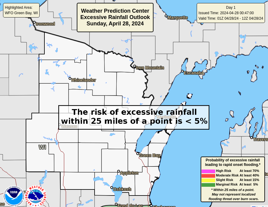
Today's Excessive Rainfall Potential |
||
|
Day 2 Severe Thunderstorm Potential |
Day 2 Excessive Rainfall Potential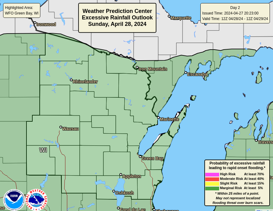 Click image for full WPC outlook and discussion |
||
Day 3 Severe Thunderstorm Potential Click image for full SPC outlook and discussion Click image for full SPC outlook and discussion |
Day 3 Excessive Rainfall Potential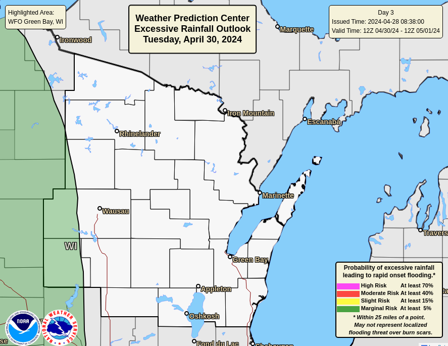 Click image for full WPC outlook and discussion |
||
Aviation Weather
Mosinee METAR
Mosinee TAF
Mosinee Impacts METAR Board
Current and Previous 72 hours of Surface Observations
Pilot Weather Briefing
More Aviation Weather Information
Aviation Weather Center
General Weather and Forecasts for Mosinee
Latest Weather and 24-hr Summary
Narrative 7-Day Forecast
Hourly Forecast - Graphical
LAMP Model Graphical Forecast
Severe Weather Potential
Hazardous Weather Outlook - For Northeast Wisconsin
Special Weather Statements - For Northeast Wisconsin (issued as needed)
More Severe Weather Information
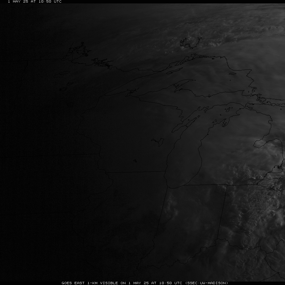
Satellite Imagery
Visible Satellite Loop
Infrared Satellite Loop
Nighttime Fog and Low Clouds
Midwest and U.S. Satellite Images
GOES Satellite Imagery
Radar Imagery
Regional Radar
Other Area Radars
Additional Information
NWS Green Bay Facebook
NWS Green Bay Twitter


 Follow us on YouTube