Marine, Tropical and Tsunami Services Branch
National Program
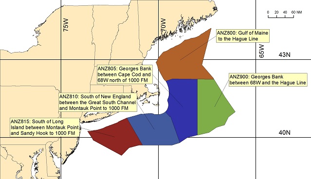
Offshore waters forecast for New England including all zones and synopsis
Offshore waters forecast synopsis for New England
Condensed Version for radio broadcast......coverage map(white stars)
Offshore waters forecasts are subdivided by zone, each identified by text description and a Universal Generic Code (UGC). These forecasts are prepared by the Ocean Prediction Center, National Hurricane Center, Honolulu Forecast Office, Juneau Forecast Office, Anchorage Forecast Office, and Fairbanks Forecast Office.
Similar webpages for Coastal/Great Lakes Forecasts by Zone and High Seas Marine Forecasts are also available.
These forecasts are also available via e-mail
NOTICE - Check time and date of forecasts. Linked data may not represent the latest forecast.
NWS Internet is available 24 hours a day, seven days a week . Timely delivery of data and products through the Internet is not guaranteed. Official NWS dissemination systems which can provide timely delivery of data and products are listed in our DISCLAIMER.
This is NOT a complete listing of National Weather Service marine forecast products. See the Marine Forecasts webpage which contains information on the dissemination of NWS marine weather forecasts including frequency and broadcast schedule information as well as links to products and related information.
US Dept of Commerce
National Oceanic and Atmospheric Administration
National Weather Service
Marine, Tropical and Tsunami Services Branch
1325 East-West Hwy, 13th floor
Communications Office
Silver Spring, MD 20910
Comments? Questions? Please Contact Us.

