National Weather Service United States Department of Commerce

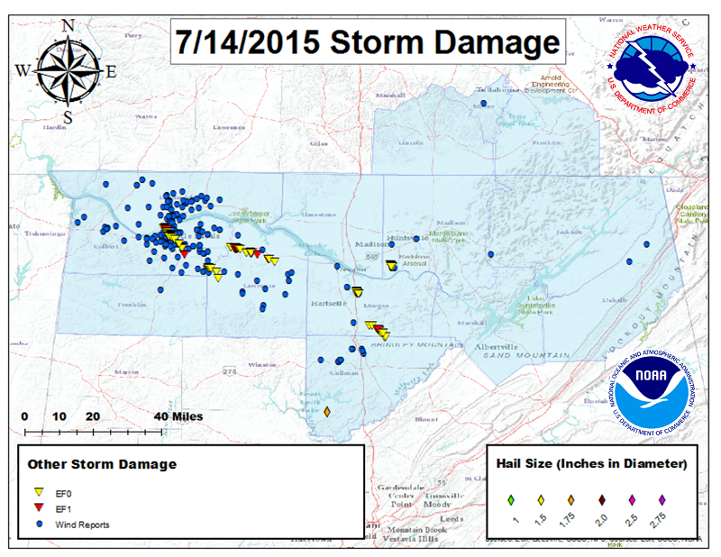
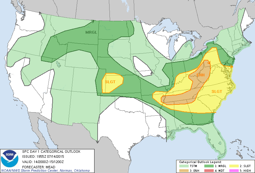
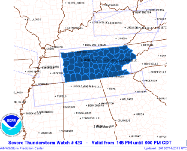
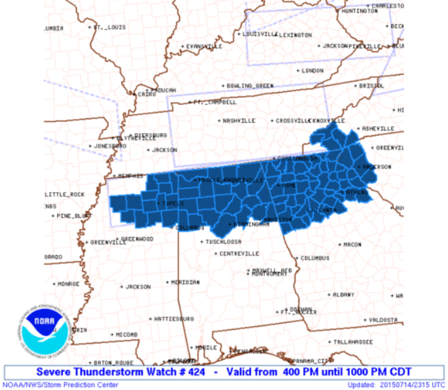
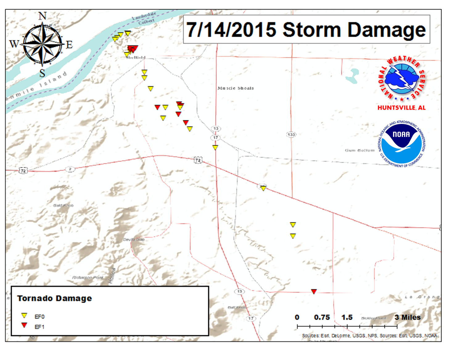
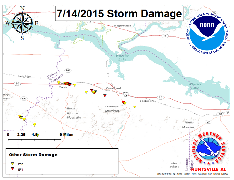
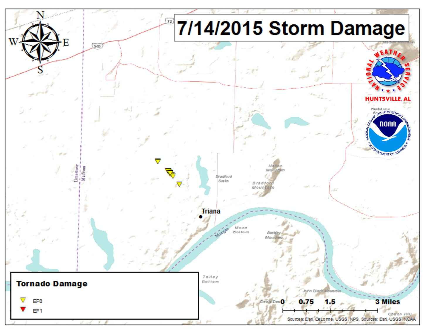
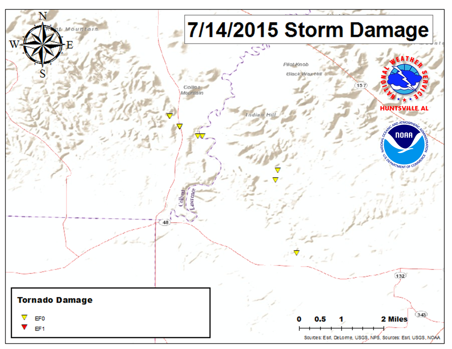
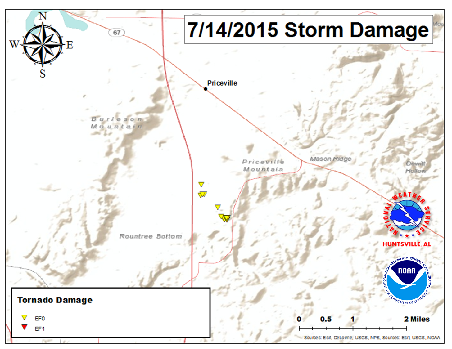
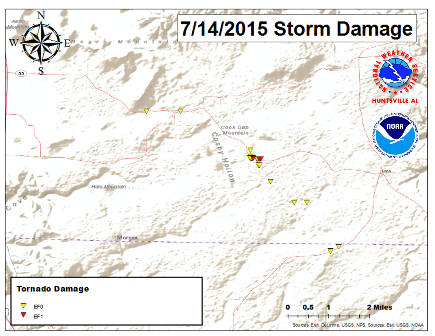
Looking Back at Severe Weather on July 14, 2015 

July 14th, 2015 Tuscumbia EFO Tornado LaGrange EF0 on July 14th, 2015 Tornado Morgan County EF0 near Priceville July 14th, 2015 Tornado Cullman/Morgan County EF1 Tornado on July 14th, 2015 Madison County EF0 July 14th, 2015 Tornado Town Creek EF1 July 14th, 2015

 Tornado Surveys Completed

(Click on the entries in the first column to see a official storm survey summary and under the last column for track information)

 Location/Clickable Detailed
Summary Link
EF Scale/Max
Wind Speed (mph) 

Injuries/
Fatalities

Path Length (Miles)

Path Width (Yards) 

Starting Lat/Lon

Ending Lat/Lon

Track Images
& Shapefiles
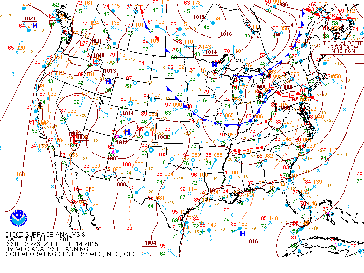
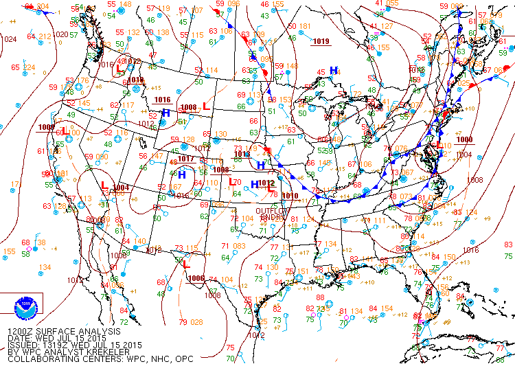
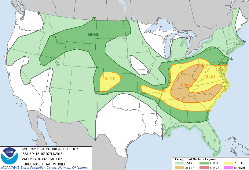
 Tuscumbia/Sheffield  
 (Colbert County) 6:00 PM CDT
 
EF-1/ 95 MPH
0/0
9.11
150 
34.7687
-87.7084
34.6575
-87.6218
PNG Track Image
 
KMZ - Points / Track
 
 Town Creek/Courtland  
 (Lawrence County) 6:14 PM CDT
EF-1/ 100 MPH
0/0
11.4
250 
34.6875
-87.4294
34.6261
-87.2426
PNG Track Image
 
KMZ - Points / Track
 
 
 Near the Huntsville Airport (Madison County) 
 6:35 PM CDT
 
EF-0/ 85 MPH
0/0
0.91
75 
34.6115
-86.7527
34.601
-86.7429
PNG Track Image
 
KMZ - Points / Track
 
 
 LaGranage (Colbert/Lawrence Counties) 
 6:18 PM CDT
 
EF-0/ 85 MPH
0/0
2.66
50 
34.6032
-87.5256
34.5813
-87.4871
PNG Track Image
 
KMZ - Points 
S of Priceville (Morgan County) 
 6:48 PM CDT
 
EF-0/ 85 MPH
0/0
0.76
100 
34.4992
-86.8958
34.4897
-86.8889
PNG Track Image
 
KMZ - Points / Track
 
 
 4.5 WNW Eva to 1.8 SW of Eva (Morgan/Cullman Counties) 
 6:59 PM CDT
 
EF-1/ 95 MPH
0/0
4.90
300 
34.3547
-86.8371
34.3055
-86.7749
PNG Track Image
 
KMZ - Points / Track


Surface Analysis at 4 PM on 7/14/2015 Surface Analysis at 7 AM on 7/15/2015
Storm Prediction Center Day 1 Forecast (Valid 11:30 AM on 7/14/2015) Storm Prediction Center Day 1 Forecast (Valid 3 PM on 7/14/2015)
   
Severe Thunderstorms Watch - Issued at 1:45 PM CDT on 7/14/15 Severe Thunderstorm Watch - Issued at 4:00 PM CDT on 7/14/2015