|
Looking Back at April 3rd, 2015 |
||||||||||||||||||||||||
|
||||||||||||||||||||||||
|
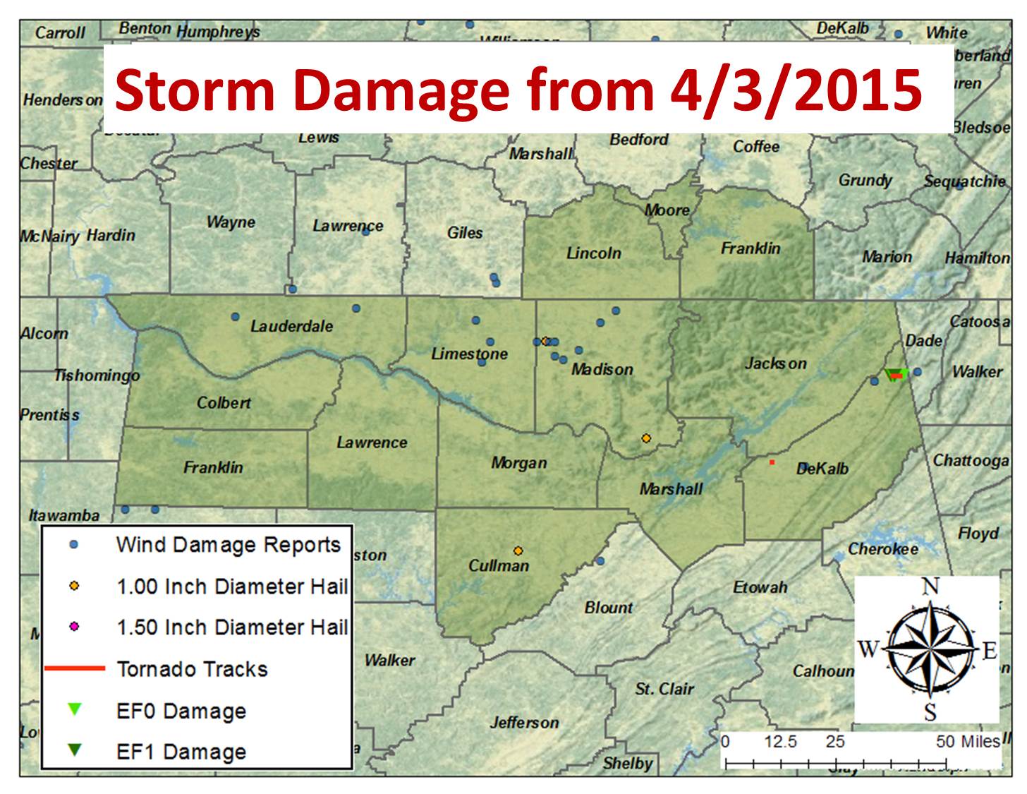
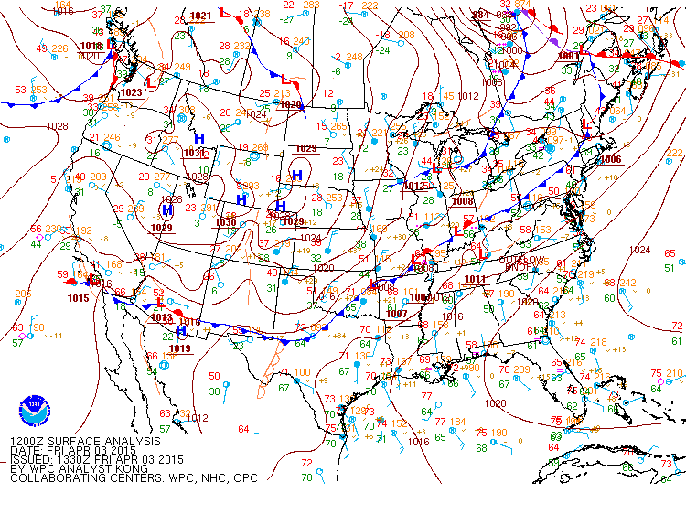
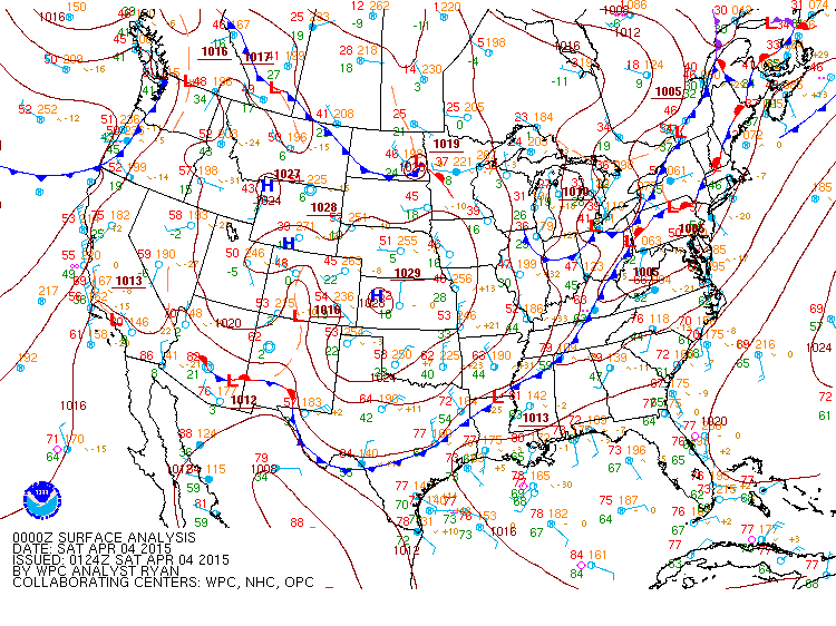
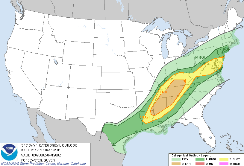
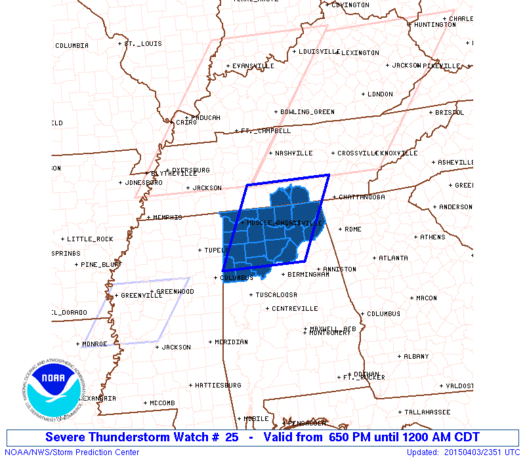
SUMMARY: A strong cold front (upper 60s ahead of the front dropping to upper 30s to lower forties behind the front) over southeastern Missouri and Indiana was in in the early morning hours on April 3, 2015. Northern Alabama and Southern Middle Tennessee were southeast of this front in a warm and moist atmosphere. Strong winds aloft (50 KTS) were present along and ahead of the front along with colder temperatures aloft. This set the stage for severe weather development during the late afternoon and evening hours on 4/3/2015. Large hail up to 1 inch in diameter, damaging winds, and a few tornadoes were experienced as this storm system moved across Northern Alabama and Southern Middle Tennessee, before exiting into Georgia and southern Alabama just before midnight. |
||||||||||||||||||||||||
|
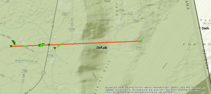
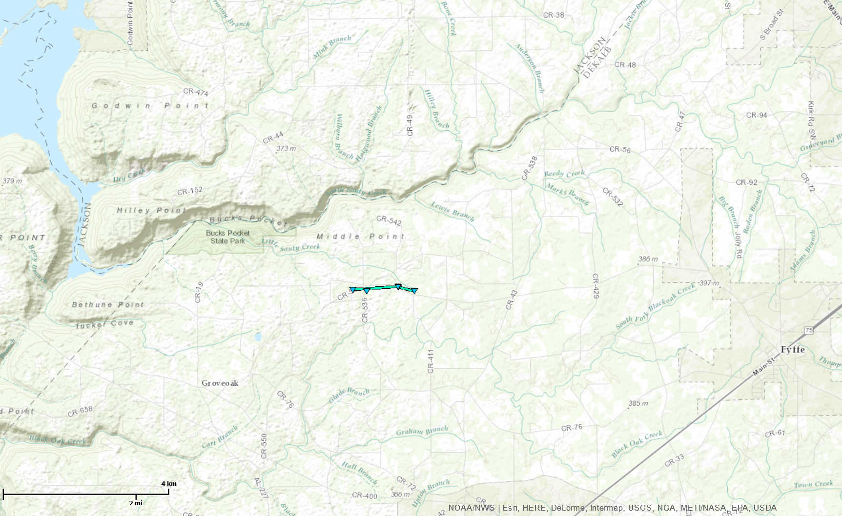
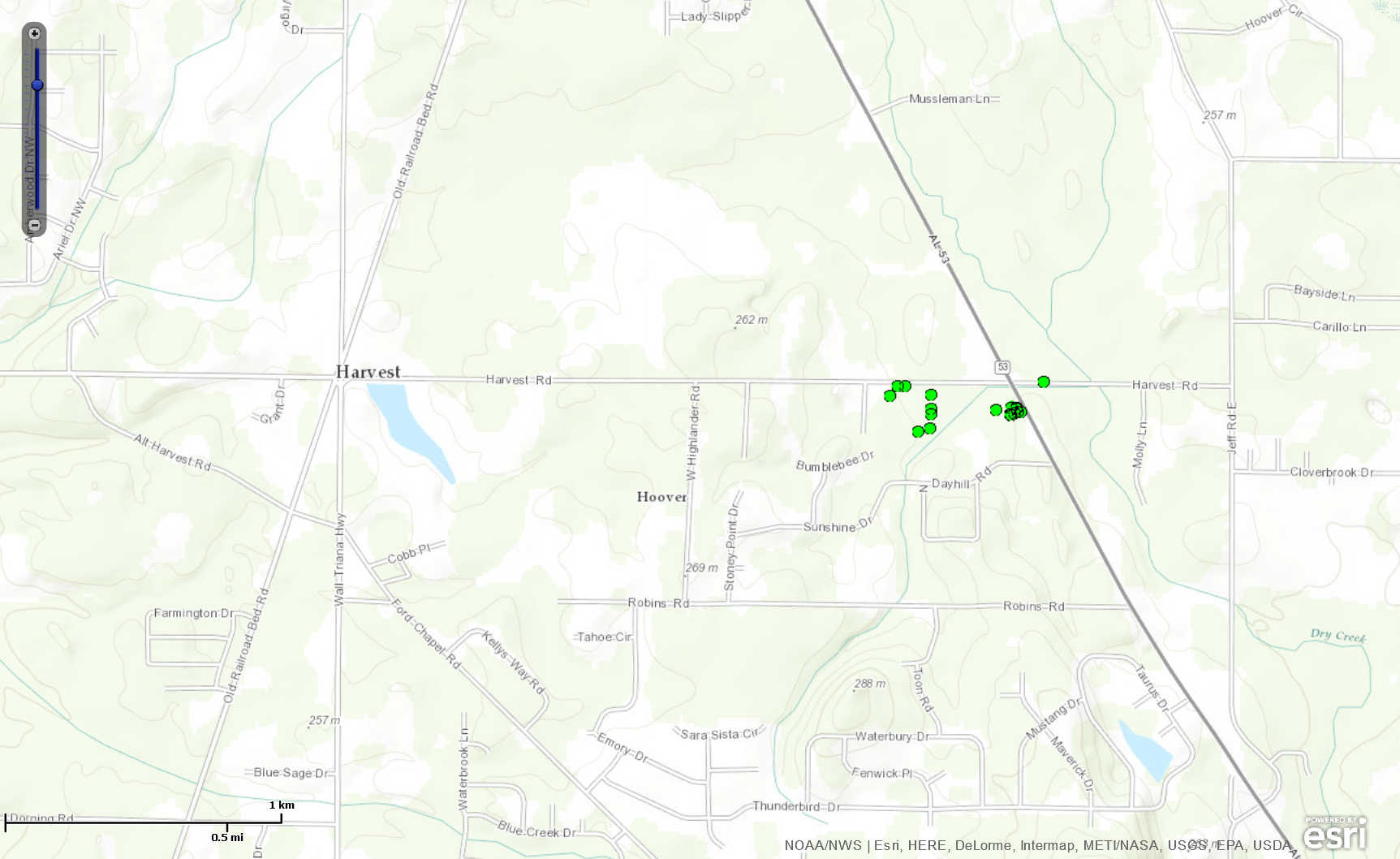
Tornado Surveys (Click on the entries in the first column to see a official storm survey summary and under the last column for track information and pictures) |
||||||||||||||||||||||||
|
||||||||||||||||||||||||
|
Straight-Line Wind Damage Surveys Completed (Click on the entries in the first column to see a official storm survey summary and under the last column for damage information and pictures) |
||||||||||||||||||||||||
|
||||||||||||||||||||||||
|
|
||||||||||||||||||||||||
|
||||||||||||||||||||||||
|
||||||||||||||||||||||||
|
|


 Local Radar
 Weather Map
 Follow us on YouTube