Prior to every flight, pilots should gather all information vital to the nature of the flight. This site is informational in nature and is designed to assist pilots and aircrews for flight planning and weather familiarization. It may be used in conjunction with other preflight information sources needed to satisfy all the requirements of 14 CFR 91.103 and is not to be considered as a sole source of information to meet all preflight action. Pilots can complete their regulatory-compliant preflight briefing by using other automated resources or from Flight Service at www.1800wxbrief.com or by calling 1-800-WX-BRIEF.


.AVIATION /23Z SATURDAY THROUGH THURSDAY/...
As of 720 PM Saturday...
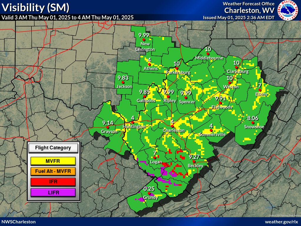
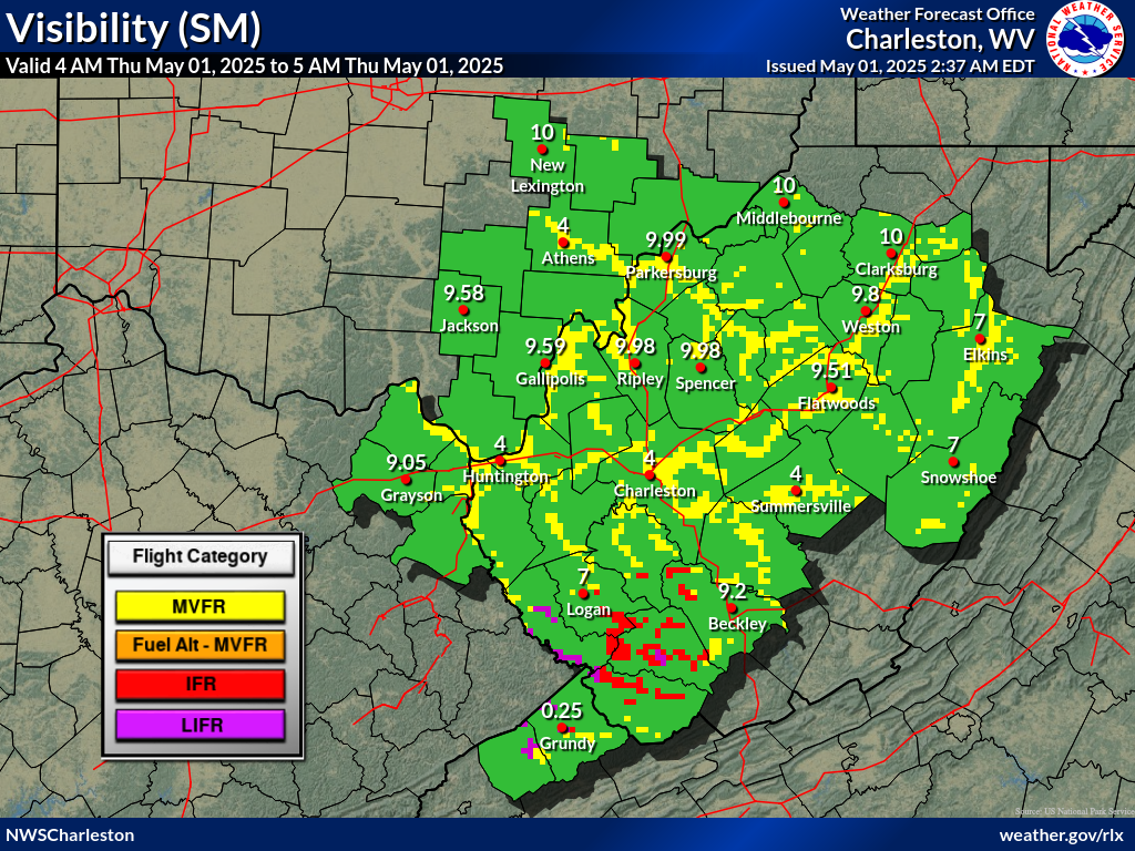
Outside fog development expected overnight, VFR will prevail.
The fog will develop under clear skies and calm wind across the
valleys at first, but then spill into all sites. IFR, even LIFR
at times, will be prevalent from the early morning hours to
late morning then lifting and scattering out by just after
sunrise. BKW may take slightly longer if dense stratus develops.
For tomorrow, look for afternoon cumulus and VFR conditons
except for maybe some lower Cu at EKN or CKB going into the mid
to late afternoon.
FORECAST CONFIDENCE AND ALTERNATE SCENARIOS THROUGH 00Z MONDAY...
FORECAST CONFIDENCE: Medium.
Click to Read the Full Area Forecast Discussion
AVIATION FORECAST CONFIDENCE
| Updated: 727 PM EDT Sat May 18 2024 |
| UTC | 21 | 22 | 23 | 00 | 01 | 02 | 03 | 04 | 05 | 06 | 07 | 08 |
| EDT | 17 | 18 | 19 | 20 | 21 | 22 | 23 | 00 | 01 | 02 | 03 | 04 |
| CRW | H | H | H | H | H | H | H | M | L | L | L | L |
| HTS | H | H | H | H | H | H | H | H | H | H | M | L |
| BKW | M | H | H | H | H | H | H | M | H | L | L | L |
| EKN | H | H | H | H | H | H | M | L | L | M | M | M |
| PKB | H | H | H | H | H | H | H | H | H | M | M | L |
| CKB | H | H | H | H | H | H | H | M | L | L | M | M |
| 9 PM | 10 PM | 11 PM | 12 AM | 1 AM | 2 AM | |
 |
 |
 |
 |
 |
 |
 |
| 9 PM | 10 PM | 11 PM | 12 AM | 1 AM | 2 AM | |
 |
 |
 |
 |
 |
 |
|
 Airports with TAFs |
  Airports without TAFs
Additional Local Information |
Regional/National Information |

