HOME
FORECAST
Local
Graphical
Aviation
Marine
Rivers and Lakes
Hurricanes
Severe Weather
Fire Weather
Sun/Moon
Long Range Forecasts
Climate Prediction
Space Weather
PAST WEATHER
Past Weather
Heating/Cooling Days
Monthly Temperatures
Records
Astronomical Data
SAFETY
Tsunamis
Floods
Beach Hazards
Wildfire
Cold
Tornadoes
Air Quality
Fog
Heat
Hurricanes
Lightning
Safe Boating
Rip Currents
Thunderstorms
Space Weather
Sun (Ultraviolet Radiation)
Safety Campaigns
Wind
Drought
Winter Weather
INFORMATION
Wireless Emergency Alerts
Brochures
Weather-Ready Nation
Cooperative Observers
Daily Briefing
Damage/Fatality/Injury Statistics
Forecast Models
GIS Data Portal
NOAA Weather Radio
Publications
SKYWARN Storm Spotters
StormReady
TsunamiReady
Service Change Notices
EDUCATION
Be A Force of Nature
NWS Education Home
NEWS
NWS News
Events
Pubs/Brochures/Booklets
NWS Media Contacts
SEARCH
Search For
NWS
All NOAA
ABOUT
About NWS
Organization
Strategic Plan
Commitment to Diversity
For NWS Employees
International
National Centers
Careers
Contact Us
Glossary
Social Media
Missouri Basin, Pleasant Hill
River Forecast Center
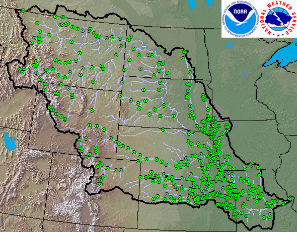
River forecast verification for MBRFC forecast points
Weather.gov
>
Missouri Basin, Pleasant Hill
> River forecast verification for MBRFC forecast points
River Observations and Forecasts
River Observations
River Forecasts
River Forecasts with Uncertainty
HEFS
Watches and Warnings
Forecast Point Product Collection
MBRFC Forecast Products
Forecast Product Guide
5-Day Significant Flood Outlook
Flash Flood Guidance
Long Range Outlook
MBRFC Long Range Outlook
Weather Observations and Forecasts
MBRFC Observed Precipitation
MBRFC Forecast Precipitation
Temperature Forecasts
Observed Precipitation (national)
Forecast Precipitation (national)
National Forecasts
Radar
Satellite
Water Supply
Drought Monitor
MBRFC Water Supply
Western Water Supply Forecasts
NRCS Interactive Map
Climate and History
Climate Outlooks
El Nino/La Nina
NOAA Climate Service
Historical Floods
Climate Portal
Probability Distributions by Climate Period
Seasonal Interest
Snow and Snow Water
River Ice
Tropical Weather
Severe Weather
Water Temperature
Frost Depth Maps (NCRFC hosted)
Soil Temperatures Maps (NCRFC hosted)
Modeled Snow Water Equivalent
Modeled Snow Water Equivalent Ranking
Accumulated Precip Plots for SNOTEL Sites
Freezing Degree Day Plots
Local Information
MBRFC Decision Support
HydroViewer
River Forecast Verification
Ensemble Streamflow Probabilistic Verification
Hydrology links
Modeled Flows
ESP Flow Trace Ensembles
Misc Products
Missouri River Stage Comparison
Twitter Setup For River Forecasts
Our Office
River Forecast Verification
Sort by WFO
Sort by Forecast Group
WFO ID
Location
ABR
Aberdeen SD
BIS
Bismarck ND
BOU
Denver CO
BYZ
Billings MT
CYS
Cheyenne WY
DDC
Dodge City KS
DMX
Des Moines IA
EAX
Pleasant Hill MO
FSD
Sioux Falls SD
GGW
Glasgow MT
GID
Hastings NE
GLD
Goodland KS
ICT
Wichita KS
LBF
North Platte NE
LSX
St Louis MO
OAX
Omaha NE
RIW
Riverton WY
SGF
Springfield MO
TFX
Great Falls MT
TOP
Topeka KS
UNR
Rapid City SD
Forecast Group
Big Blue
Bighorn
Elkhorn-Platte
Grand
James
Kansas
Loup
Lower Dakota Tribs
Lower Missouri Tribs
Lower Republican
Lower Smoky Hill
Marais Des Cygnes
Middle Dakota Tribs
Milk
Missouri Mainstem
North Platte
Osage
Siouxs
South Platte
Upper Dakota Tribs
Upper Missouri
Upper Missouri Tribs
Upper Republican
Upper Smoky Hill
Yellowstone