National Weather Service Paducah, Kentucky
Office Description:
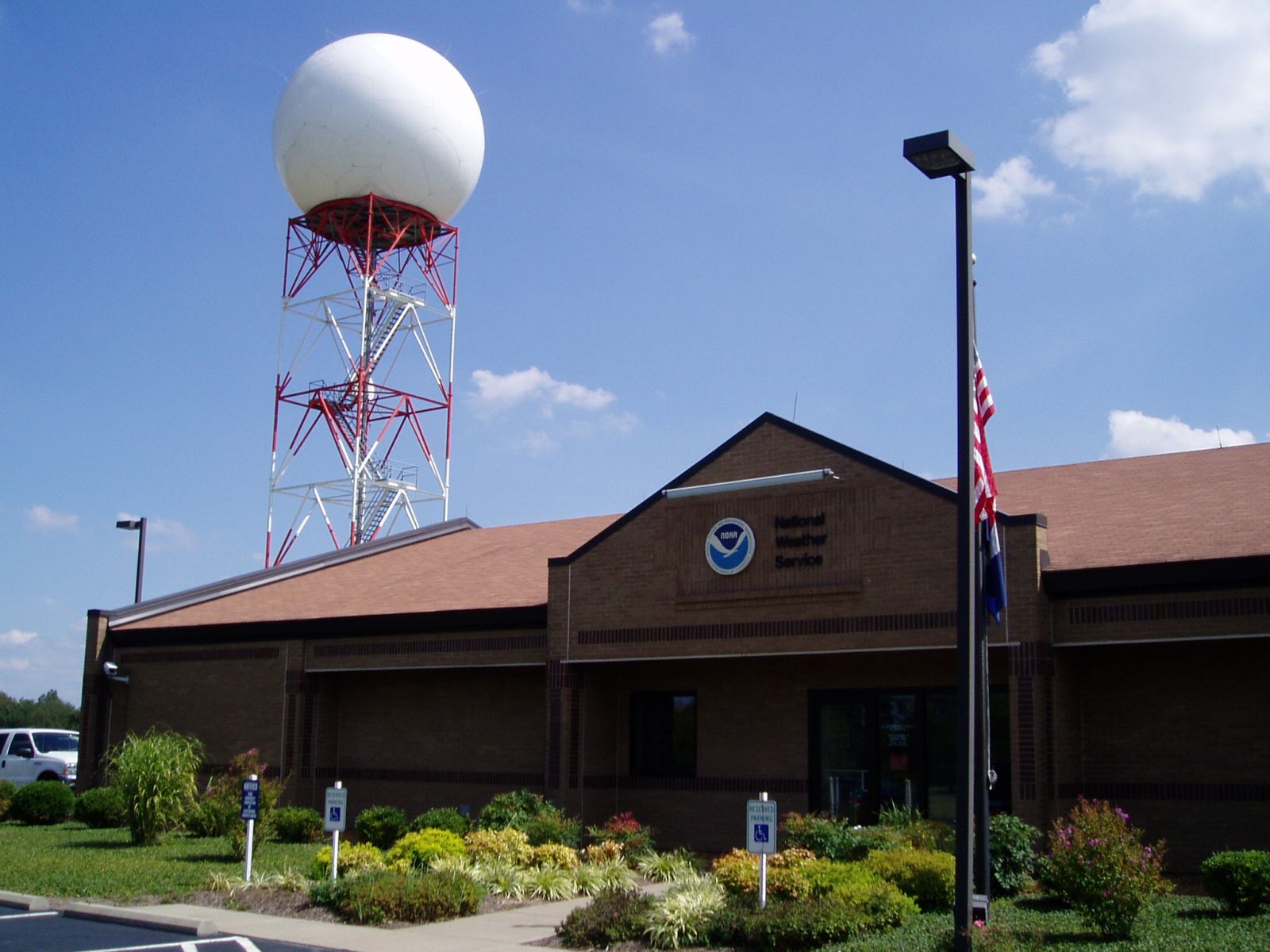
The Paducah National Weather Service is located about 9 miles west of town in McCracken County. The Paducah WSR88D NEXRAD radar sits adjacent to the office which is located just north of the Barkley Regional Airport. The office is operational 24 hours daily, 7 days a week and 365 days a year. The staff at NWS Paducah comprises twelve forecasters (5 Lead Forecasters, 7 Journeyman Forecasters), an Observing Program Leader, three Hydrometeorological Technicians, one Intern, an Electronics Systems Analyst and two electronics technicians, a Service Hydrologist, an Information Technology Officer, a Science and Operations Officer, a Warning Coordination Meteorologist, an Administrative Services Assistant and a Meteorologist in Charge.
The primary mission of the NWS Paducah office is the protection of life and property of 58 counties across portions of four different states: Western Kentucky, Southern Illinois, Southeast Missouri, and Southwest Indiana. To accomplish our mission, NWS Paducah staff issues forecasts, watches, warnings, outlooks and advisories for hazardous weather, and routinely issues public, aviation and fire weather forecasts.

In addition to standard public products:

Community Description:
The Forecast Office is located 9 miles west of ‘Lowertown’ Paducah. The area features a unique blend of Southern and Midwestern culture, centered midway between cities such as Louisville, St. Louis, Memphis, and Nashville.Paducah is known as the ‘Quilt City’, as the American Quilting Society holds its annual main event here, the “Quilt Show”, in late April. The National Quilt Museum of the United States is located downtown. Paducah prides itself in its local music and art scene, as the Artist Relocation Program has used the arts to stimulate the economy of the downtown area with the fastest growing arts district in the nation. Paducah is located in the ‘Bible Belt’, with dozens of churches catering to nearly every faith. In addition, Paducah offers an arts district which includes: The Luther F Carson Performing Arts Center, the Paducah Symphony, the Market House Theater, and the Yeiser Art Center. Paducah also has several museums, including the Market House Museum, the Railroad Museum, Tilghman Civil War Museum, the Alben Barkley Museum, the River Discovery Center and many more.
As of the 2010 census, the city had a population of 25,024, with McCracken County having a total of 65,565 people. Other population centers located within the bounds of the county warning area include Marion and Carbondale Illinois, Cape Girardeau and Poplar Bluff Missouri, Owensboro and Henderson Kentucky, with the largest being Evansville, Indiana (city: 117,429, as of the 2010 census).
History of Paducah, KY:
(Courtesy of paducahky.gov)
Paducah, originally known as Pekin, was settled around 1815. Settlers were attracted to the community due to its location at the confluence of the Ohio and Tennessee Rivers. The community was inhabited by a mix of Native Americans and Europeans who lived harmoniously, trading goods and services.
In 1827, William Clark, Superintendent of Indian Affairs for the Mississippi-Missouri region, arrived in Pekin with a title deed to the land he now owned, which was issued by the United States Supreme Court. Clark most likely took stock of the settlers that had arrived at some point before himself, and offered the land for purchase, so they could occupy it with title in their name. If they did not choose to purchase the right to occupy the land, they most likely relocated to another domicile. The town was platted out and named in honor of the largest nation of Native Americans that ever roamed North America, the Padouca Indians. Lewis and Clark had made acquaintance with many of them while on their trek west. A letter written by Clark to his son clearly states the reason for the naming of the town. (A facsimile of the letter and the original Paducah maps are on display at the Market House Museum in Paducah.) The community was incorporated in 1830.
Paducah thrived due to its port facilities along the waterways that were used by steamboats. A factory that manufactured red bricks was established and a foundry for making rail and locomotive components was built, ultimately contributing to a river and rail industrial economy.
In 1856, Paducah was chartered as a city. The community continued to capitalize on its geographic location by becoming the site of dry dock facilities for steamboats and towboats and, in turn, headquarters for various bargeline companies. Paducah also became an important railway hub for the Illinois Central Railroad (ICRR) due to its proximity to the coal fields in Kentucky and Illinois.
In 1937, the Ohio River at Paducah rose over its 50-foot flood stage. The flood was considered to be the worst natural disaster in Paducah’s history. As a result of the flood, the United States Army Corps of Engineers built a flood wall to replace the earthen levee that had once been in place. Visitors can walk along this floodwall and enjoy Paducah's history in pictures, as murals were painted by Muralist, Robert Dafford. Interpretive panels in front of each mural describe the painting.

Paducah is located in the Purchase region of Western Kentucky, in north-central McCracken County. The city is located at the confluence of the Ohio and Tennessee rivers, and just 47 miles upstream from the confluence with the Mississippi river. The terrain is increasingly flat to the west of the city, with rolling hills ranging from 300 to 500 feet in elevation to the south and east. An area of hilly terrain ranging from 400 to 1000 feet in elevation called the Shawnee Hills extends in a west to east arc across southern Illinois. The terrain rises locally over 1200 feet in the foothills of the Ozark Mountains, in the extreme northwestern portion of the CWA.
Winters are usually cool with little snowfall (annual average of 10.2”) and occasional periods of mild weather, while summers are consistently hot and humid. High temperatures in January average in the low 40s, while low temperatures average in the low to mid 20s. In July, highs are typically in the upper 80s, with lows in the upper 60s. The wettest time of year lasts from late winter through early summer, with a secondary maximum in late autumn. The driest month is August, with an average of 2.99 inches of rainfall. Severe thunderstorms can occur in any month, but are most frequent in Spring and late Winter, peaking around May 1st. A secondary maximum occurs during Autumn. Here is a tornado history of the area. The historic “Tri-State Tornado” tracked across northern portions of the county warning area in 1925. Temperature and precipitation extremes can be found here. Area snowfall climatology, and historic snowstorms.

Recreation:
Numerous recreation and entertainment opportunities are available highlighting Paducah’s local culture. ‘Downtown After Dinner’, every Saturday night from April through October, features a ‘street-fair’ type of atmosphere with live music and antique cars. Summerfest in late July has fireworks, live music, and hot air balloons. “Barbeque on the River” is a 3-day festival which attracts tens of thousands to the Riverfront area. Featuring live music and other entertainment, dozens of teams compete for a title. Live harness racing can be found at Bluegrass Downs in Paducah every spring on Thursdays, Fridays, and Saturdays. The Luther F. Carson Four Rivers Center hosts various musical artists and theater productions throughout the year. Paducah International Raceway is a 3/8 mile, high-banked clay track featuring stock and sprint car racing on Friday nights, April through October, and is co-owned by a few NASCAR stars. Demolition derby events can be found scattered around the Quad State area during the spring and summer. There are 2 private country clubs, one 18-hole golf course along with another 9-hole course. Several municipal parks can be found in Paducah, highlighted by 125-acre Noble Park, which features playgrounds, tennis and basketball courts, baseball fields, a skatepark, and an Olympic-size swimming pool. A couple miles of hiking and biking trails connect the park to a Frisbee golf course. Endless hiking and mountain biking opportunities can be found 30 to 60 minutes away in the Land Between the Lakes National Recreation Area. The ‘LBL’ is the largest inland peninsula in the country, bounded by Kentucky Lake and Lake Barkley. The lakes form a haven for boaters and sportsmen, with nationally renowned bass and crappie fishing. Additional wilderness hiking and camping opportunities abound about an hour north in the Shawnee National Forest, featuring several state parks and the unique rock formations of the Garden of the Gods natural area. The Tunnel Hill State Trail, a 45-mile long ‘rail-trail’, stretches from Harrisburg to Karnak, Illinois, and can be accessed at Vienna, about 30 minutes north on I-24. In southeast Missouri, Van Buren is a major destination for recreational floating and fishing on the famous and beautiful Current River, as well as sightseeing at one of the world's largest springs, Big Spring.
Education:
There are 22 schools in the immediate vicinity of Paducah, 18 public and 4 private, including 2 public high schools. Higher education can be found at Western Kentucky Community and Technical College and Daymar College. The University of Kentucky, School of Engineering, has a branch in Paducah. Mid-Continent University in Mayfield, Kentucky, is about a 30-minute drive south. Murray State, located in Murray, Kentucky, is 50 minutes to the south. Southern Illinois University, home of the Salukis, is located in Carbondale, Illinois, just over an hour to the north of Paducah.
Transient and Permanent Living Accommodations:
There are over a dozen hotels, most of which are located near the major intersection of Interstate 24 and U.S. Route 60, about 5 miles east of the weather office. There are several good apartment complexes within 5 to 10 miles, but there can be a waiting list depending upon the time of year. Rental costs for a one bedroom apartment generally range from $300 to $500. The average cost of permanent housing is less than the state average, ranging from $80,000 to 150,000.
Eating Facilities:
Restaurants are plentiful in and around Paducah, and the area is known for its barbecue. Dozens of casual eating establishments along with most of the national fast food chains are located within 4 to 5 miles of the office, mainly around the Kentucky Oaks Mall area. Several opportunities for fine dining are located in the downtown area, along with more unique casual dining. The world famous Lambert’s Café, home of “throwed-rolls”, is just over an hour away in Sikeston, Missouri.
Local Transportation:
Interstate 24 runs along the south and west sides of Paducah, with the closest exit to the office about 5 miles east. Paducah is about a 2-hour drive from Nashville; 2.5 hours to St. Louis; 3 hours to Louisville and Memphis. There are 6 US Interstates within a 90-mile radius. The Ozarks are located 3 to 6 hours to the west, the Appalachian Mountains about 6 hours to the east. The Gulf of Mexico can be reached in a 9-hour drive, and it takes about 9-10 hours to reach the Atlantic Ocean. Barkley Regional Airport is located adjacent to the office, and provides direct flights to the major hub of Memphis, Tennessee and Chicago, IL. In fact, passengers can reach 130 domestic and 30 international destinations with only one connection in Chicago. Car rental and taxi service is available from the airport, with a Greyhound Bus station located downtown. The closest Amtrak station is in Carbondale, Illinois, with roundtrip tickets to Chicago available for under $70.
Tax Information:
Kentucky state sales tax is 6%. Real estate tax rate per $100 is $0.12 for the state, $0.189 for McCracken County, and $0.25 for the City of Paducah. The personal property tax rate per $100 for motor vehicles is $0.45. State Income Tax rates are as follows:
Income of $5001 to $8000 – 5%
Income of $8001 to $75000 – 5.8%
Income of $75000 and over – 6%
Travel:
Distances from Paducah, KY
Metros: Outdoor Fun:
St. Louis, MO: 174 mi Land Between the Lakes Recreational Area: 30 mi
Little Rock, AR: 320 mi Mammoth Cave National Park: 160 mi
Memphis, TN: 178 mi Ozark National Scenic Riverway (Van Buren MO): 163 mi
Nashville, TN: 135 mi Bull Shoals - White River State Park, AR: 255 mi
Chicago, IL: 374 mi Garden of the Gods (Shawnee National Forest): 58 mi
Indianapolis, IN: 305 mi Natural Bridge State Resort Park: 314 mi
Pensacola, FL: 578 mi Great Smoky Mountains National Park: 355 mi
Charleston, SC: 684 mi Hot Springs National Park: 371 mi


 Follow us on YouTube