
A few severe thunderstorms capable of producing large hail and gusty winds will be possible this afternoon and evening across northwest Texas. Dry conditions and gusty winds will persist across southern Colorado today. Read More >
| F Scale Violent Tornadoes (1950-2006) | EF Scale Violent Tornadoes (2007-Present) | ||||
|---|---|---|---|---|---|
| F4 | F5 | Total | EF4 | EF5 | Total |
| 49 | 6 | 55 | 9 | 2 | 11 |
| Violent Tornadoes by Month | |||||||||||||
|---|---|---|---|---|---|---|---|---|---|---|---|---|---|
| Scale | Jan | Feb | Mar | Apr | May | Jun | Jul | Aug | Sep | Oct | Nov | Dec | Total |
| F-Scale | 1 | 0 | 4 | 18 | 26 | 3 | 0 | 0 | 2 | 1 | 0 | 0 | 55 |
| EF-Scale | 0 | 1 | 0 | 0 | 9 | 0 | 0 | 0 | 0 | 0 | 1 | 0 | 11 |
| Total | 1 | 1 | 4 | 18 | 35 | 3 | 0 | 0 | 2 | 1 | 1 | 0 | 66 |
| # | Date | Time (CST) |
Length of Path (miles) |
Width of Path (yards) |
F-Scale | Killed | Injured | County | Location |
|---|---|---|---|---|---|---|---|---|---|
| 1 | 04/28/1950 | 1905 | 5 | 200 | F4 | 5 | 32 | Hughes | Holdenville |
|
This violent tornado began 2 miles southwest of Holdenville at 7:05 pm CST and moved northeastward through the city before turning to the north and dissipating 1 mile north of Holdenville. Unfortunately, it killed 5 people and injured another 32 people. Thirty-eight homes were destroyed, and another 188 homes were damaged. The tornado cut a swath of destruction six blocks wide and eighteen blocks long in the northwest section of Holdenville. Property loss in Holdenville was estimated at $500,000 (in 1950 dollars). |
|||||||||
| 2 | 05/01/1954 | 1415 | (69) 34 |
(440) 267 |
F4 | 0 | (2) 0 |
(Foard TX/ Wilbarger TX/) Tillman/ Kiowa | (Crowell and Elliot areas TX) - E of Tipton - near Snyder |
|
This tornado began near the town of Crowell in Foard County and moved northeastward through Wilbarger County in western north Texas, passing 4 miles to the northwest of Vernon. Five outbuildings were destroyed and 3 homes were demolished. In addition, two homes and an oil mill had lost their roofs. One automobile was picked up by the tornado and thrown a half mile in distance. Only light damage was reported to crops in Texas. The tornado continued moving northeastward and crossed the Red River into southwestern Oklahoma. Damage in western north Texas was estimated at $100,000. The tornado moved north-northeastward through southwestern Oklahoma from near Grandfield in southwestern Tillman County, and then into Kiowa County near Snyder. Considerable damage occurred to 20 homes and barns, 1 school, and 1 cotton gin. The tornado was observed by many people as it passed through the area, and was accompanied by hail to the size of golf balls. Damages in Kiowa County estimated at $5,000 from the tornado and $2,000 from hailstones. Damages from the tornado in Tillman County were estimated at $400,000, with only minor hail damage occurring in the county. |
|||||||||
| 3 | 05/01/1954 | 1800 | 59 | n/a | F4 | 0 | 65 | Pottwatomie/ Lincoln/ Creek | NE of Dale - Meeker - Sparks - Davenport - near Depew |
|
The tornado was first reported at 6:00 pm northeast of the town of Dale in Pottawatomie County. It moved northeastward for 40 miles producing damage in the towns of Meeker, Sparks, and Davenport in Lincoln County. The tornado continued northeastward into Creek County, near the town of Depew. A total of 65 people were injured, but fortunately no one was killed. A large bus was carried 300 feet, and overturned on the U.S. Highway 62 just east of Meeker. Property damage was estimated at $820,000. In Lincoln County, 120 buildings were damaged or destroyed. |
|||||||||
| 4 | 05/25/1955 | 1700 | 46 | 1100 | F4 | 2 | 18 (8) |
Collingsworth TX/ Wheeler TX/ Roger Mills | 10 N Wellington TX - 12 SW of Cheyenne |
|
The tornado began near Shamrock, TX, about 10 miles north of Wellington, TX in Collingsworth County, as it touched down in an open field. It moved northeastward through Wheeler, TX in Wheeler County where 5 people were injured. The tornado crossed into Oklahoma 15 miles west of Wheeler, and continued through Roger Mills County in west central Oklahoma between 6:00 and 7:00 pm before dissipating 12 miles west of Cheyenne. Two people were killed 12 miles west of Cheyenne and another eight were injured along the tornado’s path in Roger Mills County. The tornado caused $5,000 damage to crops and $250,000 damage to other property. Portions of a highway were lifted and hailstones to the size of baseballs were reported. |
|||||||||
| 5 | 05/25/1955 | 2126 | 28 | 500 | F5 | 20 | 280 | Noble/ Kay/ Sumner KS | 8 W Marland - E of Tonkawa - Blackwell - SE of South Haven KS |
|
This violent tornado initially touched down about 8 miles west of Marland around 9:00 pm CST. It caused some light damage as it moved almost due north into Kay County. The tornado passed to the east and northeast of Tonkawa and destroyed a few homes while its parent supercell storm also produced baseball-sized hail in Tonkawa. The tornado continued north and moved through the east side of Blackwell at 9:27 pm CST, causing complete destruction in much of the east side of town. Nineteen people were killed in Blackwell, as well as one person to the northeast of Blackwell. Another 280 people were injured. Approximately 80 blocks in town were damaged or destroyed. The damage was massive with 500 homes damaged, 400 homes destroyed, 20 business establishments leveled, and 40 additional businesses were damaged. The tornado passed east of Braman, then turned to the north-northwest and dissipated to the southeast of South Haven, in south central Kansas. Damage to crops in the area was estimated at $15,000 and damage to other property was estimated at $8,000,000. The supercell thunderstorm also produced another tornado that touched down about 4 miles north of Peckham that moved into Kansas, eventually killing 80 people in and near Udall, KS. Both the Blackwell tornado and Udall, KS tornadoes were rated F5, although the Udall tornado produced minimal damage in Oklahoma. |
|||||||||
| 6 | 05/25/1955 | 2200 | 56 | 1320 | F5 | 80 (0) |
273 (0) |
Kay/ Sumner KS/ Cowley KS | S of Ashton KS - Udall KS - N of Atlanta KS |
|
At about 10:00 pm CST, this tornado touched down in northern Kay County about 4 miles north of Peckham and then moved north into Kansas. No injuries or deaths were reported, and the tornado damage was minimal in Oklahoma. This tornado was produced by the same parent supercell thunderstorm that had generated the violent tornado that struck Blackwell, OK earlier that evening. The tornado crossed the Kansas state line due south of Ashton, KS and moved northward across the extreme eastern part of Sumner County to near Oxford, passing along the west side of Geuda Springs. At 10:15 pm CST, the tornado was located five miles south of Oxford. As is moved northward, it swung eastward around the town of Oxford to a farm three miles north-northeast of Oxford where it took the lives of five children of one family. At 10:30 pm CST, the tornado plowed into the town of Udall, KS which had population of 500 people in 1955. It almost completely destroyed the town, killing 75 of the inhabitants, causing major injuries to 165 persons, and less serious injuries to 105 others. After exiting Udall, the storm was reported to have moved to the east-northeastward, passing the town of Rock on the south and lifting just north of Atlanta. However, the damage east of Udall may have been caused by downburst winds. The main damage was along a path which varied in width from 1/4 to 1/2 mile. The path was irregular and indicated occasional swinging of the funnel as much as a mile on either side of a smoothed path. Farm buildings and farm implements sustained heavy damage. No estimate was computed of the amount of crop damage left by this storm. Damage to other property was estimated at $2.225 million. This storm is still the deadliest tornado in Kansas history. Although it is listed as a F5 tornado for Oklahoma, the F5 damage produced by this tornado occurred only in Kansas. |
|||||||||
| 7 | 04/02/1956 | 2130 | 108 * | 880 | F4 | 2 (0) |
29 (2) |
Kay/ Cowley KS/ Chautauqua KS/ Elk KS/ Greenwood KS/ Woodson KS/ Coffey KS | * Likely tornado family. 6 SE Newkirk - near Hardy - near Gridley KS |
|
Although listed a single tornado, this event was probably a family of tornadoes produced by the same supercell thunderstorm. The initial tornado began in Kay County 6 miles southeast Newkirk, OK at 9:30 pm CST, and only minor damage was reported in this area. This tornado apparently lifted before it reached the Arkansas River. What was probably the second tornado in the series touched down east of the Arkansas River and continued moving northeast. It had a multiple vortex phase as witnesses observed several funnels merged into one southwest of the town of Hardy, OK in Kay County. This violent tornado hit Hardy, and 2 people were injured in Hardy when their home was leveled. Many farm buildings were completely destroyed as well in the area as well. Six cattle and a horse were killed on one of the farms. The tornado appears to have crossed the Kansas state line into southeastern Cowley County and moved northeast south of Maple City, KS at 9:45 pm CST. It continued northeast passing 3 miles east of Grenola, KS and ended 5 miles northwest of Howard, KS. No fatalities occurred with this storm, but a total of 25 people were injured including the 2 persons in Oklahoma. Numerous houses, barns, businesses, and sheds were damaged or completely demolished along the tornado's path. The wind velocities from the tornado were so strong that a plastic belt was driven into a piece of tree by force in Maple City-Otto area. Witnesses reported the tornado as sounding like a loud roar or a whistle. This tornado may have traveled through Kay County in Oklahoma, and Cowley, Chautauqua and Elk Counties in Kansas. Another tornado then formed 4 miles southwest of Toronto, KS and struck the Toronto area at 10:58 pm CST. The tornado produced F4 damage to a home 1 mile north of Toronto a killed one person there. The continued to the northeast before turning more to the north and dissipating 2 miles southeast of the town of Gridley, KS in Coffey County. A baby was killed in a home 3 miles south of Gridley and the body was carried for over a mile from the home. West of Toronto, KS a house simply “fell apart” when the tornado hit. Several reports showed that other people were also carried variable distances in the air. In addition to the 2 fatalities, another 4 were injured by this tornado. This violent tornado may have traveled through Greenwood, Woodson and Coffey Counties in Kansas. |
|||||||||
| 8 | 04/03/1956 | 0010 | 42 | 400 | F4 | 0 | 59 (46) |
Ottawa/ Cherokee KS/ Jasper MO | Near Narcissa - Miami - Quapaw - Baxter Springs KS - near Joplin MO - near Cartersville MO |
|
This violent tornado was part of an outbreak tornadoes that occurred in Kansas, Oklahoma and Missouri during the evening and early morning of April 2-3, 1956. It struck around midnight near Narcissa, OK in Ottawa County and moved northeast, hitting the towns of Miami and Quapaw, OK. In all, 21 homes were destroyed and 35 were heavily damaged in Miami. Five homes were destroyed in Quapaw. Property damage was estimated at $500,000 in Oklahoma. No fatalities were reported in Oklahoma, but 46 persons were injured in Miami, with 16 of people being hospitalized and 3 sustaining critical injuries. The tornado continued northeast across the Kansas state line where additional damage was done in Cherokee County. The tornado struck the Southeast Corner of Cherokee and the southeast edge of Baxter Springs. Damage estimates were $125,000 in Kansas as 14 homes were destroyed and another 13 were damaged. A total of 6 people were injured by the tornado in Kansas. This tornado then became a "tri-state tornado" when it crossed into Missouri in Jasper County. It passed west of Joplin and Web City, eventually dissipating in north central Jasper County. Two people were injured in Missouri and damages totaled $100,000. The tornado destroyed a factory roof, damaged merchandise, destroyed some garages, and damaged 30 houses. |
|||||||||
| 9 | 01/22/1957 | 0645 | NA | 880 | F4 | 10 | 20 | Sequoyah | Gans |
|
This tornado touched down around 6:45 am CST near the town of Gans and moved to the east-northeast, striking the southwest corner of the little community in Sequoyah County. Massive, widespread damage occurred, and the tornado dug numerous holes into the ground. The holes were about 10 feet in diameter and about one and one-half feet deep. Ten people were killed in this event and another 20 persons were injured. The half mile wide tornado traveled for 5 miles, but dissipated before it reached the Arkansas state line. The body of one person was carried for about half mile from their home while some refrigerators were carried similar distances. |
|||||||||
| 10 | 04/02/1957 | 1729 | 5 | 200 | F4 | 2 | 6 | Marshall | Lake Texoma - near Cumberland - near Little City |
|
The tornado began in Marshall County and moved north-northeast from near Cumberland and 8 miles south of "Pure City." The tornado destroyed a fishing camp at Lake Texoma and 15 homes were destroyed at Pure City. Two larger homes were swept clean from their foundations. One fatality and one injury occurred when a car was tossed over 200 yards. A second death occurred at a home near Little City, OK. In all, 2 people were killed while 6 others were injured. |
|||||||||
| 11 | 04/02/1957 | 1758 | 8 | 200 | F4 | 3 | 3 | Bryan | Calera - Durant - N of Durant |
|
The tornado touched down in Bryan County at the northeast edge of Calera where a drive-in theater and a large stock barn were destroyed. The tornado moved northeast and caused extensive damage to homes and businesses in the city of Durant. Nine blocks in the southern and southeastern portions of the city were destroyed while other damage occurred in 20 more blocks. About 135 homes and 20 businesses were destroyed or damaged. One home was completely leveled about 5 miles north-northeast of Durant near the end of the tornado's damage path. Two people died when the roof of service station collapsed. A total of 3 people were killed and three others were injured. |
|||||||||
| 12 | 05/24/1957 | 1730 | 22 | 880 | F4 | 4 | 5 | Cotton/ Comanche | Near Ahpeatone - Just S of Lawton |
|
This violent tornado originated east of the town of Ahpeatone in northwestern Cotton County and moved northeast to 7 mile southeast of Lawton in Comanche County before it lifted. The tornado had a multi-vortex phase as observers reported seeing 3 funnels at one time on the ground. Unfortunately, 2 couples were killed when their 2 homes were leveled. One person was seriously injured when his house was destroyed. Four other persons received minor injuries from flying debris. At least 12 homes and many farmsteads were also destroyed along the damage path, and F4 damage occurred 6 miles south of Lawton. A total of 5 cars were also destroyed, and fences were rolled into 50-foot in diameter balls. Up to 70 head of cattle and a number of chickens were killed. |
|||||||||
| 13 | 09/14/1957 | 1730 | f68 | 440 | F4 | 2 | 6 | McClain/Cleveland/ Pottawatomie/ Seminole | NW of Wayne - Southern Cleveland County - near Sacred Heart - near Konawa |
|
This tornado formed northwest of the town of Wayne in McClain County near the Canadian River and moved nearly eastward along a hit-and-miss path. In southern Cleveland County, a damage path 3 miles long and 1/4 mile wide was documented. In this area, 3 barns were destroyed, trees snapped, and crops flattened by wind, rain, and hail. The tornado continued almost due east and the worst damage was inflicted in a 7-mile-long area near Sacred Heart in southeastern Pottawatomie County and southwestern Seminole County. A tornado was observed near , 2 miles northwest of Konowa at 6:55 pm CST. Two persons killed and 6 injured in 3 homes which were completely leveled along this path. Many other homes and buildings were damaged. Extensive damage occurred to oil field equipment and a total of 8 rigs were destroyed with losses estimated at $40,000. Other wind damage was reported near Wetumka, but this damage was probably unrelated to this tornado, and may have been related to another in a series of tornadoes produced by the same parent supercell thunderstorm or another supercell. It is possible that the damage caused in Wetumka was due to straight-line winds. |
|||||||||
| 14 | 05/09/1959 | 1840 | 6 | 900 | F4 | 7 | 12 | Pontotoc | N of Harden City- 3 N Stonewall |
|
This violent tornado touched down just north of Harden City in Pontotoc County and moved northeastward to one mile west of Stonewall before dissipating 3 miles north of Stonewall. Three farmsteads were leveled along the 6-mile path, with 7 people killed and other people injured on these farms. Cars, trucks, and machinery at the farms hit were also completely destroyed. The tornado also hit a small, cement block cafe near Stonewall, completely destroying it and injuring several people. Miraculously, nine people survived by taking refuge behind the counter in the cafe. In addition, 6 cars and a truck parked at the cafe were almost all a total loss. Over 20 oil derricks in an oil field north of Harden City were destroyed. Many cattle were killed as well. Trees were stripped to stumps and the ground was swept clean. Two funnels aloft had also traveled with the tornado. One was believed to have joined the main tornado funnel over the cafe, and a loud blast was noted by patrons who took shelter in the cafe. |
|||||||||
| 15 | 09/27/1959 | 1800 | 20 | 440 | F4 | 1 (0) |
1 (0) |
Craig/ Labette KS | S of Hollow- SW of Chetopa KS- 3 SE Oswego KS |
|
This violent tornado moved slowly to the north-northeast through mostly open country from just south of Hollow to across the state line into Kansas, southwest of Chetopa. However, one motel was destroyed in Oklahoma. Five farms were torn apart in southeast of Oswego, KS and where F4 damage was documented at 3 of the farms. Hail up to 1.25” in diameter fell over an area 7 miles long and 3 miles wide north of Welch to the Kansas border. Unfortunately, 1 person was killed and another was injured in Kansas as the tornado moved through Labette and Cherokee counties. |
|||||||||
| 16 | 05/04/1960 | 2005 | 8 | 400* | F4 | 0 | 0 | Pottawatomie/ Seminole | 2 W - 5 N Konawa |
|
This violent tornado formed just 2.2 miles west of Konawa and moved northeast before lifting 5 miles north of Konawa. Along the 8-mile damage path a total of 4 farmsteads that were completely destroyed. One new home was completely swept away. Fortunately, there were no fatalities or injuries as people in and near Konawa had taken refuge in their storm shelters. This was the first of 5 violent tornadoes that would occur during a two-day period in Oklahoma on May 4-5, 1960. |
|||||||||
| 17 | 05/04/1960 | 2116 | 31 * | 150 | F4 | 0 | 3 | Choctaw/ Pushmataha | Soper; near Snow *not continuous |
|
The tornado touched down at 9:16 pm CST near and south of Soper in Choctaw County and traveled northward through the town. A block-wide path was cut out of the center of the community, and up to 100 homes and businesses were destroyed or damaged. The reported injuries resulted from flying debris, but most residents of the town had received warning information before the storm hit and sought refuge in their storm cellars. Two farms located just south and north of Soper were destroyed. One farmer had 11 head of cattle killed by the tornado. The tornado moved north and then northwest, lifting several miles north of Soper. At least one home was completely swept from its foundation. Tornadic wind damage was reported 30 miles to the northeast near Snow, OK in Pushmataha County, where two farms were hit and outbuildings and trees were damaged. However, it is probable that another tornado was generated in Pushmataha County by the same parent supercell thunderstorm. |
|||||||||
| 18 | 05/05/1960 | 1700 | 72 | 800 | F5 | 5 | 81 | Pottawatomie/ Lincoln/ Okfuskee/ Creek | S of Shawnee- between Paden and Prague- Iron Post- Sapulpa- NE of Sapulpa |
|
This violent tornado was initially observed as it formed in the North Canadian River bottomlands just south of the city of Shawnee. Several farmsteads and the Resthaven Cemetery were damaged or destroyed 2 miles east of Shawnee. Several more farmsteads were destroyed and general destruction occurred in the Econtuchka area. At least 14 farmsteads were destroyed between Prague and Paden at 5:27 pm CST. There was extensive destruction in the area. The tornado was described as a huge, white, barrel-shaped cloud that stayed completely on the ground. Northeast of Prague, a million-dollar refinery received about $750,000 in damage. Several company homes were destroyed. Farmsteads were damaged and destroyed all along the rest of the rest of the long path northeastward. Two people were killed and eleven injured in the Iron Post area south of Bristow. This tornado caused the most damage as it moved through the west and north portions of Sapulpa at 6:32 pm CST. Three persons were killed and 70 injured, and a total of 1000 people were homeless. There were about 300 homes destroyed or damaged. Of this total approximately 100 homes were completely destroyed with 100 more receiving heavy damage and another 100 homes incurring partial damage. A school and 2 churches were also destroyed, and trees and utilities were heavily damaged. The storm damaged a 12-15 block area in Sapulpa. The funnel lifted northeast of Sapulpa and was observed aloft over Tulsa at 7:00 pm CST. High winds destroyed a house in Tulsa and other general damage was reported. Large hail fell east and northeast of Shawnee, and some hail was observed near the entire path of the tornado. |
|||||||||
| 19 | 05/05/1960 | 1910 | 62 | 200 | F4 | 16 | 106 | Latimer/ Haskell/ Sequoyah | Wilburton- Keota- SW of Sallisaw |
|
This tornado touched down at 7:10 pm CST in the Bandy Creek valley just south of Wilburton, and then swept through the city of Wilburton. An area 1 to 2 blocks wide was completely destroyed in Wilburton, and the path through the city measured 3 miles in length. Thirteen people were killed and another 100 persons were injured in the city. Five people died and scores were injured in the little Calvary Baptist Church where 57 members had gathered there for a church supper honoring students from the Eastern A&M College in Wilburton. A total of 600 buildings were damaged or destroyed. One business block was destroyed, 82 homes were destroyed, and another 156 homes were damaged. Damage in Wilburton was estimated at $1.5 million. Hail larger than hen eggs fell ahead of the tornado and produced $200,000 in damages. At 7:15 pm CST, 6 houses were destroyed at Center Point, 3 miles north of Wilburton. The tornado then skipped northeastward and the next evidence of damage was found at Keota, where 3 people were killed, 6 persons injured, and 24 homes and buildings were destroyed. Damage in the Keota totaled $250,000. Hail up to 5 inches in diameter along with rainfall totals of 5 inches caused considerable crop damage. The last evidence of tornadic wind damage was southwest of Sallisaw where 10 houses were destroyed, but no deaths or injuries were reported. This was probably a family of tornadoes produced by one parent supercell thunderstorm instead of a single, long-track tornado. |
|||||||||
| 20 | 05/05/1960 | 1940 | 5 | 200* | F4 | 5 | 13 | Sequoyah | Roland |
|
This tornado began at 7:40 pm CST just south of U.S. Highway 64 and 1 mile south of Roland and then moved north to just east and northeast of Roland. Two men were injured when the tornado picked up their truck from the U.S. Highway 64 and threw it 300 yards into a field. A small truck was also thrown 300 yards, causing 1 injury. Five deaths and 6 injuries occurred when the tornado completely destroyed a home where a family was residing. Other injuries occurred when other homes were destroyed or damaged by the tornado in the Roland area. |
|||||||||
| 21 | 05/05/1961 | 1720 | 26 | 400 | F4 | 16 | 58 | Le Flore | 1 S Talihina- Reichert- Howe |
|
This violent and deadly tornado initiated one mile south of Talihina at 5:20 pm CST and destroyed an outbuilding on a farmstead. The storm continued to the northeast, moving over Winding Stair Mountain before striking the communities of Reichert and Howe. Both cities were extensively damaged with at least 70 homes demolished in the same locations that the deaths and injuries occurred. Unfortunately, 16 fatalities were reported and 58 people were injured. A total of 12 deaths occurred in Howe while 4 were killed in Reichert. However, it is possible that the tornado may have lifted before it reached Winding Stair Mountain, and a new tornado (spawned by the same parent supercell thunderstorm) struck the communities of Reichert and Howe. |
|||||||||
| 22 | 05/25/1962 | 1828 | 7 | 250 | F4 | 0 | 9 | Washita | 3 W Dill City- Dill City- 4 W Cordell |
|
This tornado touched down onto two farms three miles west of Dill City, destroying buildings and killing 400 turkeys. As the twister moved eastward toward Dill City, it was observed without a full condensation funnel. The tornado was spotted by a Highway Patrol Unit at 6:20 pm CST west of the city. The storm was described by witnesses as having two distinct vortices rotating within the main tornado circulation. The tornado was observed with a full condensation funnel as it approached the west edge of town at 6:28 pm CST. The tornado cut a 750-yard damage swath across the northern part of Dill City before continuing east, causing destruction to farms for another 3 miles before it veered to the north. The tornado then traveled across OK State Highway 152, about 5 miles west of Cordell, and headed northeast. It continued for 1 more mile, demolishing all buildings on a farm, before it dissipated. Nine people were injured from the storm, although no serious injuries were reported. The toll of damage along the 7-mile path included 29 homes (including 2 trailer homes) destroyed. A total 12 more homes received major damage while 13 had minor damage, and 7 farm buildings were destroyed. A total of 60 families were affected by the damage. Thirty-five vehicles were lost, trees were snapped, and 26 utility poles downed. |
|||||||||
| 23 | 05/26/1962 | 2000 | 10 | 400 | F4 | 0 | 1 | Cotton | 4 S Randlett - 4 E Cookietown |
|
This tornado formed 4 miles south of Randlett and heavily damaged one farmstead. It then moved to an adjoining farm where the home and outbuildings were leveled, a car was demolished, and the door was torn from the storm cellar where the family was taking shelter. The tornado then moved northeast, damaging a home and destroying other buildings and machinery. A nearby cemetery had two-thirds of the grave headstones blown over. The tornado then crossed a local road and lifted an unoccupied house, moving it over 100 yards before placing it down intact in a pasture. The tornado then turned north, leveling buildings on three farms. One owner of the damaged farms sustained badly cut hands as he fought to hold the storm cellar door down against the twister above. His pickup truck, which held 65 bushels of wheat, was hurled 350 feet and crushed. The storm continued on northeastward, damaging two more buildings, and destroying timber along a creek before lifting 4 miles east of Cookietown. Ten head of cattle were killed while others were injured. Some crop damage was also reported. |
|||||||||
| 24 | 03/16/1965 | 1640 | f83 | 300 | F4 | 0 | 7 (2) |
Grant/ Kay/ Sumner KS/ Cowley KS | 6 SSW Nash- 2 N Jefferson- 4 N Braman- Geuda Springs KS- 6 E Winfield KS |
|
Although this event is listed a single tornado with an 83-mile track, it is most likely that a series of at least 4 tornadoes touched down in Oklahoma and Kansas, with at least one violent tornado occurring within this tornado family in Oklahoma. Two funnels were first reported before a tornado formed 5.7 miles south-southwest of Nash at 4:40 pm CST where the Liberty Church and adjacent parsonage were leveled along with a steel granary. The storm moved northeastward and quickly dissipated east of Nash at 4:55 pm CST. This tornado was probably the first in a series of tornadoes produced by the same supercell thunderstorm. Observers noted a fast movement of the thunderstorm along with numerous tornado touch-downs. A tornado, probably the second in the series, was observed moving to the northeast 2 miles north of Jefferson. It then caused heavy damage along a 6-mile path from U.S. Highway 81, 3 miles southwest of Medford to U.S. Highway 64, 4 miles east of Medford. Five farmsteads were heavily damaged here and 1 woman was injured. The greatest damage and longest track occurred when what was probably the third tornado in the series initiated 5 miles northwest of Deer Creek in Grant County, and then moved northeastward to the Grant-Kay County line 5 miles south of the Kansas border. One man was injured 6 miles northeast of Deer Creek when he was caught inside his house, which was leveled. Fifteen farmsteads were hit, 6 of which were completely destroyed, and 3 received major damage. Data from this event suggest that the tornado continued into the west corner of Kay County, destroying 10 summer cabins and trailer homes near Lake Blackwell and downing 70 power poles. The tornado was last sighted in Oklahoma about 1 mile south of the Kansas line and just east of Interstate 35 before it moved northeast into Kansas about 5 miles southeast of South Haven, KS. It was in a multi-vortex phase as it crossed the state border. From there the tornado moved rapidly to the northeast at 45 mph, hitting Geuda Springs, KS before dissipating 6 miles east of Winfield, KS. Additional data from the event suggest that a fourth tornado also blew down signs along Interstate Highway 35, 3 miles south of Braman and then moved north-northeast, toppling a 262-foot microwave tower (rated to withstand 175 MPH winds) just north of Braman at 5:53 pm CST. A nearby compressor station also sustained major damage when one home and a 150-foot cooling tower were blown down. Damage was also reported 4 miles north of Braman. |
|||||||||
| 25 | 04/27/1966 | 1900 | 10 | 300 | F4 | 0 | 2 | Johnston/ Atoka | 4 NW Fillmore- 3 E Coleman |
|
This tornado formed and was first reported 4 miles northwest of Fillmore on top of a hill in Atoka County. After demolishing the farm and home on the hill, the tornado path swept along the ground east-southeastward for 6 miles. It then skipped along for another 4 miles before dissipating 3 miles east of Coleman. Only two people were injured, one with head cuts and another with severe bruises. The tornado caused damage to 17 farms and 10 homes. Seven homes, 6 barns and numerous outbuildings were destroyed. Ten utility poles were downed and many trees were uprooted. Complete destruction occurred at one farm with 2 cars and a truck being overturned and blown into a gulley some distance from the house. A food freezer was also found a mile away. In one instance, a piece of sheet iron roofing was blown edgewise against a 4-strand barbed wire fence and neatly sheared into 5 strips. Spotty occurrences of hail were also reported along the path with stones averaging 3 inches in size. |
|||||||||
| 26 | 06/10/1967 | 1704 | 9 | 300 | F4 | 4 | 1 | Custer | 3 S Hammon- 6 ENE Hammon |
|
A supercell thunderstorm developed south of Cheyenne and moved northeastward across Hammon. The storm then produced a tornado which touched down 3 miles south of Hammon at 5:04 pm CST. Major damage first occurred at 5:10 pm CST 3 miles east and a quarter mile south of Hammon where a farmstead was leveled. One woman and three children were killed, and the husband was injured. Five other farm homes, equipment, and numerous outbuildings were either destroyed or heavily damaged as the tornado swept a zig-zag path to the east-northeast and dissipated 6 miles east and 2 miles north of Hammon at about 5:50 pm CST. In addition to the tornado, hail covered the ground with the largest size being 4 inches in diameter. The hail destroyed crops and stripped trees, and the total damage was listed at $252,000. |
|||||||||
| 27 | 06/10/1967 | 2045 | n/a | n/a | F4 | 0 | 0 | Blaine | 6 E Watonga |
|
This violent tornado struck an OG&E transformer station 6 miles east of the town Watonga in Blaine County. The greatest damage occurred when the tornado lifted a 30-ton of steel structure from the plant and dropped it 150 feet to the east of the plant. One farm was leveled and other farmsteads along the 5-mile path received heavy damage to both homes and outbuildings. Some heavy steel buildings were also destroyed. Wind gusts up to 110 mph were reported by the Oklahoma Highway Patrol in Watonga, and residents there also reported hailstones of 1.5 to 2 inches for about an hour. |
|||||||||
| 28 | 10/05/1970 | 1542 | 25 | 150 | F4 | 4 | 84 | Pottawatomie/ Lincoln/ Okfuskee | Shawnee- Prague- 2 N Paden |
|
The only violent tornado to occur in October in Oklahoma since records began in 1950 did immense damage to the towns of Shawnee and Prague. It formed over Shawnee in Pottawatomie County, and traveled through the center of the town before moving northeast and crossing U.S. Interstate Highway 40 about 6.5 miles northeast of Shawnee. The tornado cut an intermittent path to the northeast and then hit the town of Prague in Lincoln County. The tornado sliced through the southwestern portion of Prague before it dissipated 2 miles north of Paden, in Okfuskee County. Four persons were killed and another 80 injured in Shawnee. At Prague, four people were injured. In Shawnee, the storm damaged 157 businesses, 564 residential homes, 12 public buildings, 10 churches, and 5 schools. In Prague, 14 homes and 1 business establishment were damaged. |
|||||||||
| 29 | 04/19/1972 | 1700 | 28 | n/a | F4 | 5 | 6 | Carter/ Murray/ Garvin | 5 SW Ratliff City- 5 NW Davis |
|
This tornado touched about 5 miles southwest of Ratliff City at 5:00 pm CST, and then moved east-northeastward along an intermittent, 27-mile path at approximately 35 mph. The condensation funnel was visible on the ground for about 20 percent of the time, and at tree top level for the remainder of the time. The heaviest damage from the tornado was concentrated in an area extending from 2 miles south of Ratliff City to northwest of the junction of U.S. Interstate Highway 35 and OK State Highway 7. Ten to fifteen buildings were damaged along the storm path. Three injuries occurred when a wood frame house was completely destroyed south of Ratliff City. Approximately 7 miles west-northwest of the town of Davis, a home was leveled with only a few concrete blocks remaining around the foundation. At this home, five deaths and three injuries occurred. |
|||||||||
| 30 | 05/24/1973 | 1600 | 13 | 300 | F4 | 2 | 4 | Canadian | WNW of Union City- Union City- SE of Union City |
|
This violent tornado touched down several miles west-northwest of Union City and moved east-southeastward through the city before it turned more southeastward for several miles. An estimated $1 million of damage was done in Union City, with 27 homes and 18 mobile homes destroyed. In addition, 20 homes sustained major damage and 23 homes had minor damage. Severe commercial buildings and churches were also heavily damaged. Farm animals were killed and crops damaged. Two people were killed and while a total of four people were injured with two people being seriously injured. It was noted that the intensity and destruction of this tornado was immense. There were also two funnels aloft reported in the area at the time of the event. This was one of the most thoroughly studied tornadoes in history, as multiple research scientists from the National Severe Storms Laboratory documented the event through experimental Doppler radar and storm chase teams. |
|||||||||
| 31 | 05/26/1973 | 1600 | 4 | 500 | F4 | 5 | 25 | Muskogee | .25 WSW Keefeton- Keefeton- 3 ENE Keefeton |
|
This tornado touched down at 4:00 pm CST about 1/4 mile southwest of Keefeton in Muskogee County and moved to the east-northeast. It cut a damage swath 1/4 to 1/3 of a mile wide along a 4-mile path. Eight homes were destroyed while another 4 received major damage and 25 had minor damage. In addition, 4 mobile homes were destroyed and 1 had major damage, while 15 farm buildings were destroyed. About 75% of Keefeton was damaged or destroyed. A pickup truck was and carried or rolled for a half mile and all 4 members of one family were killed. Another person died from injuries received when his house was destroyed. |
|||||||||
| 32 | 06/08/1974 | 1555 | 29 | 400 | F4 | 14 | 150 | Payne/ Creek/ Tulsa/ Osage | 3 SW Drumright- Drumright- Olive- Lake Keystone- 7 WSW Sperry- W of Skiatook |
|
This tornado touched down 3 miles southwest of Drumright in Payne County and struck the Oak Grove Community at about 3:55 pm CST, heavily damaging the school. The tornado moved east-northeast into Drumright a few minutes later, causing extensive damage through the northwestern portion of the community. Six people were killed in a nursing home and another 6 persons died at various locations in the city. It continued moving northeast and struck the community of Olive, destroying parts of the school along with 2 mobile homes and several frame homes. One person was killed in Olive. The tornado then continued to the northeast course and damaged Pier 51 on Lake Keystone. It destroyed several mobile homes about 7 miles west-southwest of Sperry and one person was killed in this area. The tornado then turned to the north-northeast and produced damage to several brick homes west of Skiatook before it dissipated. A total of 14 people were killed, including 12 in Drumright, one in the town of Olive, and one near Sperry. Approximately 150 people were injured along the path of the storm. |
|||||||||
| 33 | 03/26/1976 | 1450 | 11 | 440 | F4 | 1 | 4 | Latimer/ Le Flore | 2 W Talihina- NE of Talihina |
|
This tornado touched down 2 miles west of Talihina in the rural community of Falfa. The general movement of the tornado was from the southwest to the northeast, but oddly followed a zigzag path at times, traveling eastward and then changing directions, moving toward the southeast. Unfortunately, one man was killed and 4 people were injured with no serious injuries reported. Altogether, 12 homes and a church were completely destroyed. Eighteen homes and 3 businesses sustained moderate to severe damage. A total of 8 head of cattle were killed. |
|||||||||
| 34 | 03/26/1976 | 1528 | 12 | 440 | F5 | 2 | 64 | Le Flore | 4 E Bokoshe- Spiro |
|
This tornado touched down 4 miles east of Bokoshe and 0.75 miles north of OK State Highway 31 in Leflore County at 3:28 pm CST. It began moving to the northeast, crossing OK State Highway 59 about 2 miles south of the intersection of Highway 59 and OK State Highway 9. A local business structure and a mobile home were destroyed in this area. The tornado then continued its northeast path and entered the southeast portion of Spiro. Great destruction occurred in this area, and railroad cars, trailer homes, houses and business buildings were destroyed. The tornado then crossed OK State Highway 9 where additional homes were either damaged or demolished. A survey of the damage in this area indicated that the tornado reached F5 intensity after crossing OK State Highway 9 and entering the rural Murray Spur area east of Spiro. One man was killed, seven homes were destroyed, and one mobile home was demolished in the Murray Spur area. The tornado then turned toward the east after crossing the Lock and Dam/Fort Coffey Road where 3 mobile homes were destroyed. The eastward movement continued for about 1 mile at which point the tornado crossed OK State Highway 9 for a second time. The tornado lifted about 3/10 of a mile east of the point where it had crossed OK State Highway 9 at 3:45 pm CST. Along the total path of the tornado two people were killed and another 64 persons were injured. A total of 28 homes and 2 business buildings were destroyed. Another 63 homes and a vo-tech training center building sustained major damage. Approximately 20 cattle and 20 horses were killed by the storm. Many cars and farm vehicles were also destroyed. Eye witness claimed that 2 separate funnels occasionally traveled in close proximity to each other along the path. |
|||||||||
| 35 | 04/17/1976 | 0412-0444 | 33 | 440 | F4 | 0 | 6 | Caddo | 8 W Apache- near Broxton- Washita |
|
This violent tornado touched down 8 miles west of Apache on OK State Highway 19 in southwestern Caddo County. It moved northeastward at 35 mph along a 33-mile path to north of Broxton, and then through the west edge of the town of Washita, before dissipating in northeastern Caddo County. The tornado was estimated to be on the ground for 32 minutes. Six people were injured, 3 of which were admitted to a hospital. Fortunately, there were no serious injuries. The F4 damage occurred to the north of Broxton and the tornado caused extensive damage to 6 cooling towers at a power plant in Washita. |
|||||||||
| 36 | 05/18/1977 | 1250 | 38 | 440 | F4 | 0 | 0 | Cimarron/ Baca CO | 8 SE Boise City- Keyes- 24 SE Walsh CO |
|
This violent tornado touched down about 8 miles southeast of Boise City in the Oklahoma Panhandle during the afternoon hours on this date in 1977. The tornado moved toward the northeast until it brushed the west edge of Keyes. From Keyes the tornado continued toward the northeast, moved out of Cimarron County into Baca County, Colorado, and dissipated 24 miles southeast of Walsh. The large tornado carved a path 38 miles long and up to a quarter of a mile wide. Witnesses described seeing two large tornadoes side by side at one point. Damage in Keyes was limited to corrals and a grain elevator. The main damage along the rural portion of the path was to a farm 4 mile southwest of Keyes where some outbuildings were destroyed. Hail up to the size of baseballs fell in a swath that was parallel to and west of the tornado track. |
|||||||||
| 37 | 04/30/1978 | 1820 | 9 | 1760 | F4 | 0 | 0 | Canadian/ Oklahoma | 2 S Piedmont- NW Oklahoma City- 9 W Edmond |
|
A large, massive tornado touched down 1/2 mile north of the intersection of Oklahoma State Highways 3 and 4 in Canadian County and moved east-northeast into Oklahoma County, dissipating 9 miles west and 1 mile north of Edmond. It passed 1 mile southeast of the community of Piedmont where the heaviest damage was inflicted. At this location a housing addition was severely damaged with 15 houses completely destroyed or heavily damaged. Ten rural homes were also heavily damaged just to the east-northeast of the housing addition. Several large missiles including automobiles, oil storage tanks, and stock feeders were picked up by the tornado and carried up to a half mile. The damage path was at least a mile across throughout the tornado's life cycle. Hailstones up to 2.5 inches in diameter were also reported with the storm. The same parent supercell thunderstorm which produced this giant tornado, had also previously generated 4 tornadoes in and near El Reno and Richland in Canadian County. |
|||||||||
| 38 | 04/10/1979 | 1520 | (29) 11 |
880 | F4 | (11) 0 |
(67) 1 |
(Foard TX/ Wilbarger TX/) Tillman OK | (2 N Thalia- Lockett- Vernon-) ENE of Davidson OK |
|
This violent tornado formed 2 miles north of Thalia in Foard County. The tornado touched down 1.5 miles southeast of the first tornado, which was still on the ground at 3:20 pm. The tornadoes traveled as a pair for 5 miles, with the second tornado continuing into Wilbarger County at about the time the first tornado ended near the Pease River. The Wilbarger County tornado moved along and just north of Highway 70 in the Lockett area, causing heavy farm and home damage. The tornado became a killer as it crossed Highway 70 about 1 mile north of Lockett. Mrs. Cecilia Neason of Thalia died when her car was thrown about 200 yards off of the road into a pasture. After striking the Lockett area, the tornado continued its northeastward movement toward Vernon. Photographs from Vernon show that the approaching tornado was very wide, appearing as a giant, boiling cloud on the ground. Tornado spotters had difficulty identifying the storm at first because of its massive size. However, tornado sirens were blown several minutes prior to the storm, an action that alerted many residents to the approaching danger. Fortunately, the tornado just missed the business district, but dealt a crippling blow to southern and eastern Vernon after entering the town at about 3:45 pm. In southern Vernon, a multi-block residential area was destroyed, with some of the worst damage on Gordon and Atlanta Streets. At least three people were killed in their homes within this area. The tornado then moved into east Vernon where the Sands Motel, Canton cafe, a truck stop, Merchants Motor Freight, and Cardinal Equipment Building Company were all demolished. The Wilbarger Exhibit Building and the Texas Highway Department Warehouse were also destroyed. Seven people were killed when the tornado swept a number of cars and trucks off Highway 287. The cars were nothing more than compacted masses of twisted metal after being blown off the road. After killing 10 people in Vernon and 1 in Lockett, the tornado crossed the Pease River killing a number of cows on the north bank. After striking Vernon, Texas, the tornado moved northeast and crossed the Red River to the southwest of Davidson, Oklahoma and several miles west of the confluence point of the Pease and Red Rivers at 3:45 pm. The tornado moved east-northeast of Davidson and dissipated around 4:00 pm. At least 3 homes were destroyed with 5 more sustaining major damage. Many cattle were killed or injured. One man was injured when his car was thrown into a ditch. The tornado was on the ground in Oklahoma for a distance of 8 miles. In its wake, the tornado left $27,000,000 in damage, with other damage coming from large hail and strong straight-line winds in the Vernon area. The tornado was on the ground for 26 miles in Texas and 11 miles in Oklahoma, with its parent thunderstorm producing three additional tornadoes in Oklahoma. |
|||||||||
| 39 | 04/10/1979 | (1750)-1830 | (27) 11 |
1760 | F4 | (42) 0 |
(1740) 0 |
(Archer TX/ Wichita TX/ Clay TX/) Jefferson OK | (3 ENE Holliday- Wichita Falls-) 4 E Byers- NNE of Waurika OK |
|
The "Wichita Falls" tornado began of the southwest flank of its supercell thunderstorm about 3 miles east-northeast of Holliday. Witnesses say the several distinct, small vortices were visible during the formative stage of the tornado as it moved along the Fort Worth and Denver railroad into Wichita County. Two oil storage tanks were blown away and several homes were unroofed near Farm Road 2650 as the tornado approached Wichita Falls. Six cross-country steel transmission towers were destroyed just east of Farm Road 2650. About the time the tornado entered Wichita Falls, it changed appearance, becoming one large black cloud of condensation and debris. The tornado was about a half-mile wide when it struck Memorial Stadium, snapping light standards and causing heavy damage to the field house. McNeil Junior High school was next in the path of the tornado and the school was severely damaged. The western portion of the school building was crushed by the intense winds. The tornado then moved east-northeast into the Western Hills neighborhood, south of Southwest Parkway. Several apartment complexes and many homes were destroyed, with several of the first deaths occurring in this area. The tornado expanded in size as it crossed Southwest parkway, throwing automobiles about and leveling a number of businesses, including a bank and a fire station. The twister was almost a mile wide when it entered the Faith Village neighborhood on the north side of the east-west oriented Southwest Parkway. Most of the homes in Faith Village were demolished. Ben Milam Elementary School was heavily damaged, as the cafeteria-auditorium was completely destroyed and exterior class rooms were pummeled by flying debris. The inner hallways would have been the only relatively safe shelter in the building. Surprisingly, very few fatalities occurred in Faith Village. Most people heeded the warnings and took shelter inside interior, small rooms in their homes. Most of the destroyed homes had some of these interior walls still standing after the tornado. After moving out of Faith Village, the tornado flattened several businesses, including a restaurant, on Kemp Boulevard. Three people were killed in the restaurant. A number of people were also killed or injured in the parking lot of Sikes Senter (sic) Mall, also on Kemp Boulevard. Some of these people attempted to run to their cars from the mall. Inside the mall, portions of the JC Penney store collapsed while other stores sustained light to moderate damage. No one was killed and only several major injuries occurred among the approximately one thousand shoppers who were in the mall. The mall was on the north side of the tornado path and appeared to escape the most violent winds. Near the center of the tornado and about a half mile south of the mall, a church was demolished with one person killed inside the building. The tornado then crossed a short span of open fields before moving into the Colonial Park area. More widespread home destruction occurred in Colonial Park and several more apartment complexes were demolished. The heaviest damage in the apartments occurred in the second story of two-story buildings. The tornado then swept through the Southmoor area, destroying homes and a shopping center. After crossing Highway 281, the twister then struck the Sun Valley neighborhood and destroyed additional homes, apartments, and businesses on the south side of Highway 287. A large number of cars were smashed and some people were killed along Highway 287. Some of these people had stopped their cars under an overpass on the highway, seeking shelter from the storm. The tornado leveled a mobile home park on the north side of Highway 287, but residents had evacuated that area and no fatalities occurred in the park. The tornado then destroyed several industrial plants before moving into Clay County just south of Highway 79. The tornado was 1.5 miles wide as it passed through 8 miles of residential area in Wichita Falls. The intense damage averaged between one quarter and one half of a mile in width. Forty-two people were killed outright by the storm and 3 others died as a result of heart attacks. Further statistics reveal that 25 of the deaths were auto-related. Sixteen of these 25 were people who entered their cars trying to evade the tornado. Eleven of the 16 people left homes that were not even damaged. Eight persons were killed outside, 4 were killed in homes or apartments, and 4 others died in public buildings. Seventeen hundred injuries were reported in Wichita Falls. Total damage in Wichita Falls was estimated at $400,000,000 (in 1979 dollars). Three thousand and ninety-five homes were destroyed and 600 were damaged. One thousand and sixty-two apartment units and condominiums were demolished and 130 damaged. In addition, 93 mobile homes were devastated. It is estimated that 5,000 families, consisting of almost 20,000 people, were left homeless in Wichita Falls. The most damaging single tornado in history (as of 1979) continued into Clay County, resulting in no deaths, but 40 additional injuries. About $15,000,000 of damage occurred as the tornado destroyed homes immediately south of Highway 79, from Wichita Falls into the Dean and Petrolia areas. The tornado exited Texas about 4 miles east of Byers, and crossed the Red River into Oklahoma at 6:30 pm. Over 200 trees on both sides of the river were uprooted. After crossing the river, the tornado made a gradual turn to the east-northeast and passed just to the southwest of Waurika. It then dissipated to the north-northeast of Waurika at 7:00 pm. Heavy rain and large hail up to 3 inches in diameter were reported with the storm. The path of the tornado in Oklahoma covered 11 miles. The hardest hit area in Oklahoma was to the southwest of Waurika along Noble Wray Road. Civil Defense officials reported that approximately 20 homes were destroyed or damaged in that area. A new brick home was completely demolished. A pickup truck was lifted off the ground and smashed into a nearby car. Several mobile homes were destroyed. One mobile home frame was twisted badly and carried one quarter of a mile to the southwest of its original location. The path length of the tornado was 36 miles in Texas, and 11 miles in Oklahoma. Minor wind damage and hail to 2 inches in diameter occurred north of the tornado track in Wichita Falls, in conjunction with the supercell thunderstorm. Also, tornado survivors said that some golf ball size hail fell prior to and immediately after the tornado. There is no doubt that hundreds of lives were saved by the news media and siren warnings. Amateur radio storm spotters turned in the first report of the storm, which allowed 5 to 10 minutes of valuable warning time. This followed an earlier warning at 5:08 pm, due to the Rocky Point tornado. Undoubtedly, this earlier warning and the afternoon Vernon tornado had primed the Wichita Falls populace to the threat of additional tornado activity. |
|||||||||
| 40 | 05/02/1979 | 1615 | 21 | 880 | F4 | 1 | 25 | Major/ Garfield | 4 NE Cleo Springs- 1 NE Meno- Lahoma- Far SW Enid |
|
The tornado formed 3 miles north and 8 miles east of Cleo Springs and moved along an east-southeast path causing only minor damage until it reached OK State Highway 58 about 2 miles north of Ringwood, OK where it destroyed 2 mobile homes. The tornado then grew wider and intensified, producing heavy damage to about a dozen farms in eastern Major County. It leveled all buildings at a farm northeast of Ringwood. About 1 mile east and 1 mile north of Meno, the twister hit a farmhouse as the occupants were trying to flee in a pickup truck. Two people were injured and a girl was killed when she was thrown about 100 yards from the home. At 4:55 pm, the tornado moved through the southern and eastern parts of Lahoma, OK. Three mobile homes were destroyed and about 6 more were damaged. Two houses were heavily damaged with others receiving less damage. The high school, town hall and fire department building were also damaged, and minor damage occurred to other numerous structures. The tornado weakened and narrowed as it moved east-southeast, striking the Perry Acres housing development west of Enid, OK. A pickup truck was overturned and a van was heavily damaged. Several other vehicles also received damage. A barn was destroyed and several homes received significant damage. The chimneys for at least two homes collapsed within the houses. At one location, a travel trailer was thrown 50 feet in one direction while a stock tank was carried about 0.25 miles in the opposite direction. The tornado then moved through the Imo area, about 4 southwest of Enid. One man suffered a heart attack and died while seeking shelter at a grain elevator near lmo. His two sons were injured while trying to break glass in a window to get access to a telephone. The grain elevator was damaged, and two persons were injured when the structure later collapsed onto their pickup. The tornado then dissipated about 1 mile east of Imo at 5:15 pm. Large hail and heavy rains accompanied the storm. |
|||||||||
| 41 | 05/17/1981 | 1900 | 34 | 600 | F4 | 0 | 2 | Seminole/ Okfuskee/ Okmulgee | 2 SSE Little- N of Okemah- W edge of Lake Okmulgee |
|
A long track tornado began 2 mile south-southeast of Little, OK in Seminole County and moved northeast into Okfuskee County. The tornado passed north of Okemah at about 7:35 pm, finally dissipating at the west edge of Lake Okmulgee in Okmulgee County. Damage occurred to houses, trailer houses, outbuildings, livestock, cars, a church, trees, and other vegetation. Softball size hail accompanied the storm. |
|||||||||
| 42 | 05/22/1981 | 1849 | 17 | 1333 | F4 | 0 | 0 | Caddo/ Canadian | 1 W Binger- 11 WNW Union City |
|
This large tornado formed a mile west of Binger, OK and moved northeast through northeastern Caddo County and southwestern Canadian County before dissipating at the Canadian River 11 miles west and 3 miles north of Union City. This large, intense tornado created projectiles from refrigerators automobiles, trucks, combines, and utility poles. Dead cattle were founded hanging from denuded trees. Large oil storage tanks, butane tanks, and motor vehicles were moved to distances up to a half mile by the tornadic winds. Fortunately, all farmsteads in the path of the tornado had underground shelters, and the occupants were able to take shelter during the storm. The tornado was rated F4, and a Fujita Scale damage path map is available here. |
|||||||||
| 43 | 03/18-19/1982 | 2355 | 88 | 880 | F4 | 0 | 12 (7) |
Moore TX/ Hansford TX/ Ochiltree TX/ Beaver | 5 SE Sunray TX- Bryans Corner |
|
This tornado touched down 5 miles southeast of Sunray, TX in Moore County and moved northeastward across Hansford County into the Oklahoma Panhandle. This large tornado produced a damage path up to a half mile in width. Five persons injured, but no one was killed. Most damage occurred to farms, ranch buildings and farm equipment, as was rated F4 during the Texas portion of the damage path. Damages of one million dollars occurred in Hansford County with fifty thousand dollars of damages occurring in Moore County. The tornado then crossed into Oklahoma from the Texas Panhandle and skipped along a 20-mile path including the Bryans Corner area in Beaver County. It injured 7 people in Oklahoma, and destroyed 2 houses, 2 mobile homes, a dairy barn, irrigation equipment, cars, fences, power lines, etc. It was rated F3 during the Oklahoma portion of the path. |
|||||||||
| 44 | 04/02/1982 | 1550 | 53 | 500 | F5 | 0 | 29 | Choctaw/ McCurtain | S of Speer- near Messer- Hugo Lake- S edge of Broken Bow- 4 SE Eagleton |
|
A powerful, long, wide-tracked tornado touched down just south of Speer in Choctaw County and moved east-southeastward near Messer and across the Hugo Reservoir. It then moved nearly due east to just north of Valliant, to just south of Wright City and through Golden, It continued through the south tip of Broken Bow before eventually dissipating 4 miles southeast of Eagletown in McCurtain County, The total path length for this tornado was 53 miles, and it had a maximum width of 1.5 miles near Golden. The physical state of this tornado varied as it morphed between multiple vortex and solid funnel phases during its lifetime. In the Messer area, a new house that was destroyed even had the carpet pulled up, and all that remained on the slab were the carpet tack strips. In addition, a 2'x4' board was driven through an oak tree in the area. The Tri-Night Motel sign of Broken Bow was found 30 miles away in Arkansas. A total of 29 people were injured by the storm. Damages to real property estimated in excess of $7 million and losses for timber and other crops was in excess of $1 million. Approximately 30-40 houses and 30-40 large barns were destroyed. About 10-15 large chicken houses were also destroyed with significant losses of poultry occurring. A total of 5-10 trailer houses as well as a motel, lumber yard, church, airplane, farm equipment, vehicles, power lines, timber, etc. were also destroyed by the tornado. This tornado was part of the April 2, 1982 tornado outbreak which produced 56 tornadoes in 11 states, killing 30 persons and injuring another 383 people. This was the only F5 Tornado that occurred in the 1980's in Oklahoma. |
|||||||||
| 45 | 04/26/1984 | 2205 | 22 | 880 | F4 | 3 | 37 | Creek/ Pawnee | N of Oilton- Terlton- W of Westport |
|
This tornado touched down just north of Oilton in Creek County and moved northeastward across Terlton, OK in Pawnee County at 10:13 pm CST. It dissipated just west of Westport, OK in Pawnee County. A total of 120 structures were either damaged or destroyed. Three people were killed and 37 more person injured. Damages were estimated at $2.5 million. |
|||||||||
| 46 | 04/29/1984 | 0920 | 27 | 200 | F4 | 1 | 60 | Creek/ Pawnee/ Osage | 7 ENE Shamrock- Olive- Mannford- New Prue- NE of New Prue |
|
This tornado touched down 2.8 miles north and 6.3 miles east of Shamrock in Creek County and moved northward along a 26-mile path through Pawnee and Osage counties. The tornado struck the Olive area, then moved through Mannford and New Prue before dissipating just northeast of New Prue. The storm did considerable damage in Mannford and New Prue. One person was killed and 60 people were injured. Damage estimates for the storm were near $10 million. |
|||||||||
| 47 | 04/26/1991 | 1730-1855 | 66 | 1500 | F4 | 0 | 6 | Garfield/ Noble/ Osage | 3 E Garber- 5 SE Billings- 9 WNW Pawhuska |
|
The "Red Rock" tornado was the third in a series of 9 tornadoes that occurred in Oklahoma during the April 26, 1991 tornado outbreak. The tornado touched down 2.5 miles east of Garber at approximately 5:30 pm CST and moved northeast. The tornado increased to F3 intensity as it passed 4.5 miles south of Billings. Oil tanks were destroyed, well pumps toppled, and power poles snapped. The path width at this point was estimated at 0.5 miles. The tornado grew to a width of 0.75 miles and destroyed a home 5 miles southeast of Billings. The tornado strengthened to F4 intensity as it neared Interstate 35, debarking many trees and destroying a home. The tornado continued east-northeast across Noble County, passing south of Marland and north of the Otoe Indian Agency, destroying at least two farms along the way. The tornado continued on into Osage County, where its intensity dropped to F3, and moved just to the north of Fairfax where many trees were uprooted and a house was damaged. Ten miles west of Pawhuska a large oil rig with an 18-inch foundation was toppled. The tornado lifted at 6:55 pm CST 9 miles west-northwest of Pawhuska, with a total path length of 66 miles. Damage was estimated at $500 000. Damage incurred at one totally-destroyed farm alone was estimated at $200,000. Several county roads were destroyed when large sections of asphalt were blown away. There were six injuries in this tornado, but none were serious. |
|||||||||
| 48 | 04/26/1991 | 1910 | 32 | 1700 | F4 | 1 | 24 | Pawnee/ Osage | 1.5 WSW Terlton- Westport- 1 NNW Skiatook |
|
The "Westport" tornado was the sixth in a series of 9 tornadoes that occurred in Oklahoma during the April 26, 1991 tornado outbreak. This tornado went along a 32-mile path from 1.5 miles west-southwest of Terlton to 1 mile north-northwest of Skiatook, OK. It began at 7:10 pm CST and ended at 8:27 pm CST. The tornado narrowly missed the town of Terlton as it moved east-northeast. Northeast of Terlton and west of OK State Highway 48, the tornado was weak (F0 damage to trees.) The tornado strengthened as it crossed Highway 48, 0.5 miles south of the Cimarron Turnpike, and produced F1 and F2 intensity damage to structures and power poles. Up to that point it had been one-eighth mile in width. After crossing OK State Highway 48, the tornado widened rapidly to about 1 mile and intensity increased to F4 strength as it crossed the turnpike. Several cars were swept off the turnpike with five injuries and one fatality. A man was killed when his car was overturned. The tornado then crossed into the Keystone Airpark at 7:30 pm CST and caused significant damage to four hangers, and seven aircraft were destroyed. Two of the planes were tossed into trees. The fire station at the airport was demolished, with one of the fire engines pushed across the runway and flung into an area of trees about 0.25 miles away. The Ridgemont Estates Subdivision 1 mile east of Westport, OK was hard hit, with F4 damage occurring to homes and trees. In the Westport area, 54 homes were completely demolished, 8 homes suffered substantial damage, and 32 homes suffered minor damage. Also destroyed were 70 vehicles, 5 mobile homes, 18 outbuildings, and 3 travel trailers. The community center at Westport suffered damage. There were no fatalities and no reported injuries at Westport. The tornado was 400-yards wide in the Westport area. The tornado crossed Keystone Lake into Osage County at 7:44 pm CST, and briefly lifted in the vicinity of New Prue, OK. The tornado then touched down again east-northeast of New Prue, 0.5 miles southwest of the John Zink Scout Ranch and destroyed the lodge there, where a group of Girl Scouts had taken cover. There were no reported injuries among the scouts. All trees along the path of the tornado were snapped off or uprooted, as it continued to the northeast, to the extreme south edge of Skiatook Lake, where some boat docks and a marina were damaged. The tornado continued to 1.5 miles west of Skiatook, OK on OK State Highway 20 where there was damage to a propane company at 8:15 pm CST. The tornado moved on to a subdivision 1 mile west-northwest of Skiatook, where 32 homes were destroyed, 11 homes suffered major damage, and 45 homes suffered minor damage. There were 19 injuries in the Skiatook area. The damage was rated at F3 intensity. The tornado continued northeast for a short time and lifted at 8:27 pm CST, shortly before crossing the Tulsa County line. Damage was estimated from this storm at close to $3 million. |
|||||||||
| 49 | 04/26/1991 | 2045 | 4 | 1300 | F4 | 0 | 22 | Rogers | 1 W- 3 NE Oologah |
|
The "Oologah" tornado was the seventh in a series of 9 tornadoes that occurred in Oklahoma during the April 26, 1991 tornado outbreak. It was produced the most damage of the tornadoes that occurred in Oklahoma on April 26th, 1991. The tornado touched down 1 mile west of Oologah, OK in Rogers County at 8:45 pm CST and moved northeast along a short but devastating 4-mile path. It traveled through a subdivision 1 mile north of Oologah. There were 60 homes and 16 trailers completely destroyed in the Oologah area. Sixteen apartments and thirty barns were also destroyed. There were 22 injuries in tile Oologah area, with 1 serious injury. Major tornado damage occurred at the Oologah School Complex where all buildings (kindergarten through high school) had significant structural damage. The damage was rated F4 intensity with a 0.75-mile-wide path. Significant damage also occurred due to downbursts on the southern flank of the tornado path. The damage was in a consistent "starburst" pattern; from 5 miles southwest of Oologah, to the town itself where a few trees were blown down and roof damage occurred. Heavy damage also occurred to several homes and two mobile homes 1.5 miles southwest of Oologah. Large towers supporting high tension wires from the Oologah power plant were blown down. All the towers along a 1-mile stretch were blown down toward the east-southeast. The tornado lifted at 8:55 pm CST just west of Oologah Lake. Damage was estimated at close to $15 million, and $12 million alone in damage to the Oologah School Complex. |
|||||||||
| 50 | 05/11/1992 | 1500 | 10 | 400 | F4 | 0 | 3 | Pittsburg | 3 NW Kiowa- 4 SE Savanna |
|
This violent tornado was the 11th that occurred during an outbreak of 22 tornadoes in central and eastern Oklahoma during the late morning and afternoon of May 11, 1992. The tornado formed 3 miles northwest of Kiowa and moved along a 10-mile path and ended 4 miles southeast of Savannah in Pittsburg County. The tornado completely destroyed 2 houses and 2 barns. Four houses sustained major damage and several others had minor damage. Two concrete high line transmission poles were pulled from their footings. A 500-gallon propane tank that was 3/4 full was thrown 1/2 mile. Three occupants of a mobile home were seriously injured by this tornado. |
|||||||||
| 51 | 04/24/1993 | 1750-1803 | 6 | 250 | F4 | 7 | 100 | Tulsa/ Rogers | E Tulsa- Catoosa- 1 N Catoosa |
|
This tornado touched down in East Tulsa near 6th Street and 135th East Avenue at 5:50 pm CST. The tornado moved northeast for about a mile before entering Rogers County at 5:53 pm CST. There, a truck stop located near U.S. Interstate Highway I-44 and 161st East Avenue took a direct hit from the tornado. Numerous tractor-trailers and cars were destroyed in the vicinity of the truck stop. Six people were killed at or near the truck stop. The tornado then continued northeast into Catoosa where several residential neighborhoods and the Colonial Port Mobile Home Park received heavy damage. The seventh and final fatality associated with this tornado occurred at the mobile home park. The tornado dissipated at 6:03 pm CST, 1 mile west of OK State Highway 66 north of Catoosa. Total damage was estimated at $500,000. |
|||||||||
| 52 | 05/03/1999 | 1726-1848 | 38 | 1760 | F5 | 36 | 583 | Grady/ McClain/ Cleveland/ Oklahoma | 2 SSW Amber - far N Newcastle - SW Oklahoma City - N Moore - S Del City - W Midwest City |
|
This violent, long-lived tornado was the most infamous of nearly 60 tornadoes that struck central Oklahoma during an unprecedented outbreak on this Monday afternoon and evening of May 3, 1999. The tornado was the 9th of 14 tornadoes produced by a supercell thunderstorm during the tornado outbreak. It formed around 5:26 pm CST about 2 miles south-southwest of Amber, and grew rapidly to monstrous proportions as it headed to the northeast, paralleling U.S. Interstate Highway I-44. It moved across Bridge Creek and rural parts of northwest Newcastle, causing continuous F4 and sporadic F5 damage. The tornado was estimated to be a mile in diameter in this area. It weakened to F2/F3 intensity and narrowed to less than 1/4 mile in width as it crossed U.S. Interstate Highway I-44 and the South Canadian River northeast of Newcastle and entered far south Oklahoma City southwest of 149th Street and May Avenue around 6:12 pm CST. But it regained F4/F5 intensity and widened again to 1/2 to occasionally 3/4 mile as it moved northeast across south Oklahoma City, entering Moore just west and north of 12th Street and Santa Fe. Still moving northeast and still producing F4 and occasional F5 damage, it crossed U.S. Interstate Highway I-35 at the Shields Boulevard junction and moved into northeast Moore, at which point it weakened slightly to F3/sporadic F4 intensity and began a gradual turn to the left. This turn took the tornado more to the north-northeast as it crossed U.S. Interstate Highway I-240 between Bryant Avenue and Sunnylane Road. It crossed southeastern Oklahoma City and entered Del City as an F4 tornado, width 1/3 to 1/2 mile, along SE 44th Street between Sunnylane and Sooner Roads, and continued north-northeast to the northwestern part of Tinker Air Force Base, near SE 29th Street and Sooner Road. Continuing to turn slowly, it moved almost due north but maintained F4 intensity as it crossed I-40 just east of Sooner Road and continued north to between SE 15th Street and Reno Avenue. The tornado then weakened rapidly to F0/F1 intensity as it crossed Reno Avenue, and at 6:48 pm CST dissipated about 3 blocks north of Reno between Sooner Road and Air Depot Boulevard. Totals from this tornado include 36 direct fatalities (12 in Bridge Creek, 1 in Newcastle, 9 in southern/southeastern Oklahoma City, 5 in Moore, 6 in Del City, and 3 in Midwest City), 5 indirect fatalities during or shortly after the tornado, 583 direct injuries, numerous indirect injuries (too many to count), 1800 homes destroyed, and 2500 homes damaged. The tornado was also the 118th tornado to strike the Oklahoma City area since 1890. Total damage was estimated at $1 billion. |
|||||||||
| 53 | 05/03/1999 | 2010-2038 | 15 | 880 | F4 | 1 | 11 | Kingfisher | 4 SSW Dover - Dover - 3 NE Dover - 7 ESE Hennessey |
|
This killer tornado was the 6th of seven tornadoes produced by a supercell thunderstorm in northwestern Canadian and Kingfisher counties during the May 3, 1999 tornado outbreak. The tornado produced a damage path 15 miles long and ½ mile wide as it tracked through Kingfisher County. The city of Dover, OK took a direct hit. About one-third of Dover's structures were destroyed. The tornado formed 4 miles south-southwest of Dover, and traveled north-northeast crossing U.S. Highway 81 on the north side of Dover, dissipating about 7 miles east-southeast of Hennessey. F4 damage was observed on the west side of Dover where a steel-reinforced concrete building only had a few walls remaining; large vehicles were rendered apart; mobile homes' frames were wrapped around tree trunks; and trees lost all their branches and most of their bark. One woman was killed inside a large frame home that collapsed. Approximately 34 mobile homes and houses were either damaged or destroyed in Dover. Outside of Dover, damage was rated primarily F1 and was confined to trees, telephone poles, farm equipment, and outbuildings. Total damage was estimated at $2.5 million. |
|||||||||
| 54 | 05/03/1999 | 2025-2145 | 39 | 1760 | F4 | 2 | 26 | Logan/ Payne/ Noble | 3 SW Cimarron City - Cimarron City - Mulhall - 3 ENE Perry |
|
This violent tornado, which killed two people, was the last of 20 tornadoes produced by one cyclic supercell thunderstorm which moved over Caddo, Canadian, Kingfisher, Logan, Payne and Noble counties during the May 3, 1999 tornado outbreak. The tornado formed about 7 miles southwest of Crescent, OK and tracked northeast for 39 miles before dissipating east of Perry, OK in Noble County. A very unusual event took place in Logan County where this tornado, and a second tornado produced by another supercell thunderstorm about 80 minutes later, affected much of the same area between Crescent, OK and Mulhall, OK in Logan County. Assessment of damage from the individual tornadoes was difficult, and in some areas nearly impossible, due to overlapping damage paths. Damage from the tornado was first observed about 2 miles west of the intersection of OK State Highway 33 and OK State Highway 74 near Twin Lakes Road, where 2 homes and other businesses were damaged. The width of damage is believed to have increased to nearly 1 mile as it tracked east of Crescent, OK where numerous homes suffered major damage. Damage to one brick residence 3 miles east-southeast of Crescent was rated F4. All walls were knocked down, and part of the foundation was removed. The tornado then tracked through the small community of Abell, OK (6 miles southwest of Mulhall, OK), where 1 woman was killed in her home, and 6 people were injured, and then finally through Mulhall. Approximately 60%-70% of Mulhall's 130 homes were severely damaged or destroyed. In addition, Mulhall's primary water source, a water tower, and the Mulhall/Orlando Elementary School were destroyed. Lesser damage continued to about ½ mile west of the Logan/Payne County border where tombstones and fences were blown over. Along U.S. Interstate Highway I-35 in northwest Payne County, a semi-truck trailer was overturned, and 2 cars were flipped. The driver of one of the cars was killed when his vehicle, parked under the Interstate 35 overpass at mile-marker 176.5, was picked up and dropped on its top. In Noble County, the tornado produced major structural damage in the Boonsboro Addition, a mobile home park located along OK State Highway 86, 6 miles south of Perry, OK. Approximately 20 mobile homes were destroyed, and dozens of others were damaged. Damage continued northward to a location 3 miles east of Perry, where 3 homes suffered major damage on U.S. Highway 64 and 1 critical injury was reported. In total, approximately 25 homes were destroyed in Noble County, and 50 homes were damaged. Total damage was estimated at $13.1 million. |
|||||||||
| 55 | 05/08/2003 | 1610-1638 | 17 | 700 | F4 | 0 | 134 | Cleveland/ Oklahoma | 1.5 W Moore - 3NNE Moore - 2.5 SSE Choctaw |
|
This violent tornado formed rapidly at 4:10 pm CST (5:10 pm CDT) near Santa Fe Avenue and NW 5th Street in Moore, OK and quickly strengthened to F3 intensity as it moved east-northeast through Moore. During this phase it paralleled the path of the May 3, 1999 F5 tornado, but tracked 1/4 mile or less farther south. The most intense damage in Moore (F3) occurred just west of U.S. Interstate Highway I-35 and north of 12th Street, where several businesses were leveled. The tornado then moved northeast and weakened to F2 intensity as it crossed into Oklahoma County just west of Bryant Avenue. In this area, the damage track coincided exactly with that of the May 3, 1999 tornado. This tornado then turned more to the east-northeast, crossing U.S. Interstate Highway I-240 near Sooner Road and causing F3 and sporadic F4 damage along U.S. Interstate Highway I-240 from near Sunnylane Road east to Air Depot Boulevard. The tornado struck the General Motors assembly plant near U.S. Interstate Highway I-240 and Air Depot Boulevard, inflicting F4 damage, then crossed the southeastern part of Tinker Air Force Base. Continuing northeast, the tornado inflicted F3 and sporadic F4 damage mostly to residential and rural areas in far southeast OKC and south and east sides of Choctaw, before turning more to the east and ending at 4:38 pm CST just southwest of Reno Avenue and Indian Meridian Road. Damage was estimated in $370 million. |
|||||||||
| 56 | 05/10/2008 | 1620-1755 | 76 | 1760 | EF4 | 6 (21) |
150 (350) |
Craig/ Ottawa/ Newton MO/ Barry MO | 9.2 NNW Welch - Picher - Quapaw - 3 NE Peoria - Granby MO - Newtonia MO - 3.9 NNE Fairview MO - Purdy MO - 0.2 WSW McDowell MO |
|
This tornado developed at 4:20 pm CST in northeastern Craig County and continued into Ottawa County. The tornado moved rapidly eastward toward the town of Picher, OK where it destroyed about 200 homes, killed 6 people, and injured another 150 people at about 540 pm. Damage in and around Picher was rated EF-4 on the Enhanced Fujita Scale. The tornado began moving more southeasterly near Picher and struck the north side of Quapaw, OK. While this tornado was beginning to weaken east of Quapaw, the supercell produced another tornado a few miles east-northeast of Quapaw that merged with this tornado just east of U.S. Interstate Highway I-44. After the merger of the two tornadoes, a single tornadic circulation re-intensified and became about a mile wide for several miles before moving into Newton County, MO. The EF-4 tornado crossed into Missouri just north of Iris Road, and tracked east-southeast all the way across Newton County to just north of Fairview, MO. Several people were killed in automobiles, including a firefighter who was storm spotting, as the tornado briefly reached EF-4 intensity near the intersection of MO State Highway 43 and Iris Road. One vehicle at this location was thrown 5/8s of a mile. The tornado then extended to a mile wide and EF-3 intensity as it tracked across the intersection of MO State Highway 86 and MO State Highway BB. Many of the 14 fatalities and 200 injuries occurred from just west of MO State Highway 43 to MO State Highway 86. The communities of Granby, MO and Newtonia, MO were also directly impacted from this tornado. The tornado weakened to EF-2 intensity as it tracked across much of Barry County, but it remained deadly as it directly impacted the community of Purdy, MO. One man was killed as he was taking shelter in a mobile home. Numerous structures, trees, and power poles were destroyed. Damage was estimated at $15.6 million in Oklahoma and $60.6 million in Missouri. This was the first EF-4 tornado to occur in Oklahoma since the Enhanced Fujita Scale was adopted by the National Weather Service in 2007. |
|||||||||
| 57 | 02/10/2009 | 1848-1943 | 37 | 880 | EF4 | 8 | 46 | Montague TX/ Jefferson/ Love/ Carter | Near Spanish Fort TX - 1 W Petersburg - Lone Grove - 4 SSE Springer |
|
This long track tornado developed over extreme northern Montague County in north Texas, near the Red River, and continued northeast into Jefferson and Love Counties crossing through rural farmland north of Courtney, Rubottom and Oswalt. The tornado then crossed into Carter County, with sporadic damage noted in the sparsely populated areas in the southwest part of the county. The tornado appeared to reach its maximum width and intensity as it approached and moved through Lone Grove, OK. The tornado destroyed or severely damaged numerous mobile homes, homes and businesses in and around Lone Grove. Numerous mobile homes were completely obliterated with few recognizable pieces left. EF-4 damage was noted at two locations, one in Lone Grove and the other in the Majestic Hills area north of Ardmore, OK. Numerous vehicles were rolled or thrown, some for considerable distances. Six of the fatalities occurred in mobile homes and one in a well-built home that sustained EF-4 damage. The eighth fatality occurred when a truck driving south on U.S. Interstate Highway I-35 was hit by the tornado killing the driver. The tornado continued northeast, with major damage reported in the Majestic Hills addition and crossing U.S. Interstate Highway I-35 about a mile and a half north of the Prairie Valley Road exit. At least eight homes and a small private school were destroyed in the Majestic Hills neighborhood. It moved through rural areas of Northeast Carter County to the east of Springer, OK. Approximately 46 people were injured, with 14 seriously injured. Eight people died in the Lone Grove area. At least 114 homes were damaged or destroyed, with at least 3,500 losing power in and around Carter County. Debris from this tornado was picked up as far away as Sulphur, OK. Monetary damage estimates were not available. Damage was estimated at $3 million. |
|||||||||
| 58 | 05/10/2010 | 1620-1651 | 24 | 2000 | EF4 | 2 | 49 | Cleveland/ Oklahoma | Far north Norman (near Santa Fe/Indian Hill Road) - south Moore - Lake Draper - I-40/Choctaw - 1.5 SSE Harrah |
|
This long-tracked and devastating tornado developed west of U.S. Interstate Highway I-35, northwest of Max Westheimer Airport. Widespread tree, power line/pole damage was reported from near I-35 to the east side of Stanley Draper Lake. Several homes also sustained damage, mainly with mostly roofs receiving significant damage, and some siding was ripped off. Several fences were also knocked down as the tornado moved northeast. From the east side of Lake Stanley Draper, near Hiwassee Road and SE 89th Street, to just south of Harrah, the damage path became more severe and focused. The tree damage became more severe, breaking at various heights of the tree or being uprooted. Walls of homes collapsed, and debris from the homes scattered in all directions. Several 2x4's punctured roofs and ceilings over numerous structures. A few mobile homes in this area were also completely destroyed. Where the tornado crossed U.S. Interstate Highway 40, a gas station and drive-in restaurant sustained up to EF-3 damage. The most severe damage, one of the two EF-4 tornadoes of the day, occurred in the Deerfield West Subdivision. A well-built residence here was completely destroyed, with most exterior and interior walls collapsing. The tornado finally lifted 2 miles south of Harrah. In addition to the incredible damage, one person lost their life while trying to flee the tornado. |
|||||||||
| 59 | 05/10/2010 | 1632-1659 | 22 | 880 | EF4 | 1 | 32 | Cleveland/ Pottawatomie | South Norman (near US-77/SH-9) - Lake Thunderbird - Little Axe - 4 E Pink |
|
This violent tornado touched down a few hundred yards south of the National Weather Center in Norman, Oklahoma. The damage intensity increased gradually along the path with significant damage beginning as the tornado approached Lake Thunderbird. This tornado crossed Lake Thunderbird, severely damaging two campgrounds and the marina where about 300 boats were docked. The most severe damage occurred from the Little Axe School to the Cleveland/Pottawatomie county line. Trees were stripped of some bark and branches. Large objects were thrown considerable distances, including some concrete pillars. The metal bleachers near the school were tossed or rolled several hundred yards. Some appliances were also lofted as a dryer was found about 50 feet up in a tree. Considerable structural damage also occurred, as some foundation homes were mostly destroyed. In addition to the damage, one person lost their life as a result of the tornado. |
|||||||||
| 60 | 05/24/2011 | 1450-1635 | 63 | 1760 | EF5 | 9 | 181 | Canadian/ Kingfisher/ Logan | 4 WSW Hinton - near Calumet - near El Reno - near Piedmont - near Cashion - 4 NE Guthrie |
|
This tornado began very close to the Caddo/Canadian County border and quickly became a strong/violent tornado. The tornado destroyed numerous trees, many of which were debarked, before crossing U.S. Interstate Highway I-40. Three people died in vehicles near the U.S. Interstate Highway I-40 Calumet exit, and two other fatalities occurred just northeast of that location. Cars were thrown thousands of feet off the roadways. It is believed that the tornado reached its maximum intensity just after crossing U.S. Interstate Highway I-40, and it was here that a mobile radar measured winds of greater than 210 mph just off the surface. The tornado side-swiped the El Reno Oklahoma Mesonet station (located 5 miles west of El Reno, OK) along its path, and the site measured wind gusts of 131 and 151mph. From this location, the tornado continued northeast, narrowly missing the town of Piedmont, OK. Widespread EF-3, occasional EF-4 damage occurred between El Reno and Piedmont. More widespread EF-4 damage was seen west and north of Piedmont. Especially hard hit was the Falcon Lake neighborhood, near the Kingfisher County border. Two children were killed at this location. The tornado entered far southeast Kingfisher County before moving into Logan County. However, EF-3 damage occurred just over the Kingfisher County border, debarking trees and significantly damaging buildings. As the tornado continued northeast, the damage was mainly considered EF-2, with damage to mostly outbuildings and trees. The tornado then continued into Logan County. The tornado moved into Logan County and resulted in two additional fatalities (both of whom were outside when the tornado struck) near Cashion. The tornado destroyed several manufactured homes (both double and single-wide) after entering Logan County. Large high-transmission line tresses collapsed. Trees were debarked with only stumps remaining. Several buildings had most of their exterior walls collapse, with only the inner walls remaining. EF-2 to occasionally EF-3 damage occurred as the tornado neared Guthrie, OK. Luckily, most of the town of Guthrie was spared to the tornado as it moved west and then north of the center of the city. Finally, the tornado dissipated northeast of Guthrie with some minor tree damage. The tornado’s path total path length was 63 miles, and it was on the ground for nearly one hour and 45 minutes. This was the first EF-5 tornado to occur in Oklahoma since the Enhanced Fujita Scale was adopted by the National Weather Service in 2007. |
|||||||||
| 61 | 05/24/2011 | 1606-1701 | 33 | 880 | EF4 | 1 | 48 | Grady/ McClain/ Cleveland | 2 S Chickasha - SW Oklahoma City (near SW 149th and Portland) |
|
This tornado formed on the south side of Chickasha in Grady County, quickly doing EF-2 damage. Mobile homes were damaged and destroyed, trees were uprooted or destroyed, outbuildings were destroyed, and many buildings lost significant portions of their roofs. One fatality occurred as a mobile home was destroyed in the south portion of Chickasha. As the tornado moved northeast of Chickasha, it gained significant strength, with several areas receiving EF-4 damage. Well-built homes were destroyed. Trees were debarked with only stumps remaining. Cars were thrown hundreds of feet. Almost continuous EF-3/occasional EF-4 damage occurred northeast until it crossed into McClain County, 1.5 miles south of OK State Highway 9. The tornado was probably at its strongest as it neared/crossed the Grady/McClain County line. Wind speeds there were estimated near 200 mph in this area. Significant damage continued as the violent tornado moved over the McClain County border. This may have been the strongest portion of this tornado, with wind speeds near 200 mph. Well-built homes were destroyed, with some cleaned off of their foundation. A concrete dome home was severely damage, mainly by the flying debris. Trees were debarked or destroyed. Very little was left standing for the first few miles into McClain County. Fairly consistent EF-3, with brief periods of EF-4 damage occurred as the tornado approached and then crossed OK State Highway 9, near the OK State Highway 76 junction. The tornado began to weaken as it moved toward the Cleveland County border, with mainly trees and power poles/lines snapped. The tornado continued into Cleveland County and where some minor tree/power pole/power line damage occurred. A few barns and outbuilding also sustained minor damage east of U.S. Interstate Highway I-44. The tornado dissipated just north of the Canadian River. The tornado traveled along a path length of 32 miles through three counties in just under an hour, Peak wind speeds were estimated just under 200 mph. |
|||||||||
| 62 | 05/24/2011 | 1626-1705 | 23 | 880 | EF4 | 0 | 61 | Grady/ McClain | 2 W Bradley - 1 W Goldsby |
|
This violent tornado developed west of Bradley in Grady County, downing tree limbs as it moved northeast. The tornado began to increase in intensity, producing EF-3 damage, as it approached McClain County. Although the damage was confined to trees, the severity of the damage became more intense along the path. Trees were snapped at the bases, or debarked altogether. The tornado was several hundred yards wide as it neared the Grady/McClain County line. Luckily, very few structures were in the path. Widespread tree damage and ground scouring was ongoing as the tornado crossed into McClain County. As the tornado crossed OK State Highway 76, even more intense damage occurred. EF-4 damage was surveyed at several locations. Several homes were reduced to a pile of rubble, or were wiped clean off of their foundations. Automobiles were mangled and almost unrecognizable. The tornado weakened and narrowed as it crossed CR 410. Even though the tornado had weakened, it still produced EF-2 to EF-3 damage as it approached OK State Highway 39. The tornado increased in intensity once again near OK State Highway 39, with EF-4 damage occurring in a second area along the path. Well-constructed homes were destroyed, with several wiped clean off of their foundations. This also began a longer streak of higher end damage, with EF-3 to EF-4 damage produced by the tornado until it crossed OK State Highway 74B, west of High Avenue. Equally devastating destruction occurred over the areas of EF-4 damage. The tornado lifted west of Goldsby with some EF-3 damage still occurring prior to lifting. It should be noted that this tornado had estimated winds up to 200 mph at times, falling just short of the damage indicator for an EF-5 tornado. |
|||||||||
| 63 | 11/07/2011 | 1438-1513 | 17 | 500 | EF4 | 0 | 0 | Wilbarger TX/ Jackson/ Tillman | 4.5 NE Fargo TX - 3 NNE Tipton |
|
This tornado touched down about 4.5 miles northeast of Fargo, TX in far northern Wilbarger County and then quickly moved northeast and crossed the Red River into far southeastern Jackson County in Oklahoma. No damage was reported in either of these counties. The tornado then moved northeast into Tillman County about 9 miles south-southwest of Tipton and intensified into a violent tornado. The most severe damage occurred at the Oklahoma State University Agronomy Research Station. The buildings at the site were demolished, with most of the debris thrown into the nearby fields. The trees surrounding the site were debarked and splintered. Other damage was to the Tipton Mesonet site that took a direct hit. The wind speed maxed out at 86.4 mph before the site was demolished by flying debris. The tornado lifted about 3 miles north-northeast of Tipton. |
|||||||||
| 64 | 05/19/2013 | 1700-1750 | 23 | 1500 | EF4 | 2 | 10 | Cleveland/ Pottawatomie | East Norman (8 E downtown) - 6.5 ESE McLoud |
|
A long-track, violent tornado began at 5:00 pm CST (6:00 pm CDT) in Cleveland County in east Norman to the north of Lake Thunderbird along 96th Avenue to the south of Tecumseh Road. The tornado moved northeast, crossing the eastern arm of Lake Thunderbird. A number of homes were significantly damaged as the tornado moved east-northeast through neighborhoods from near Indian Hills Road and 168th Avenue SE to the Pottawatomie County line. The large tornado moved east-northeast into Pottawatomie County at 5:20 pm CST then curving northeast as it approached OK State Highway 102. The tornado moved through a mobile home park north of Independence Road after crossing OK State Highway 102. Just northeast of the mobile home park, a permanent home was destroyed with much of the debris blown well to the northeast. It continued northeast crossing Interstate 40 near the intersection of U.S. Highway 177, then curved north-northeast finally dissipating near Wolverine Road and Coker Road at 5:50 pm CST. One fatality occurred in the mobile home park, and another man was killed in his vehicle. |
|||||||||
| 65 | 05/20/2013 | 1356-1435 | 14 | 1900 | EF5 | 24 | 212 | McClain/ Cleveland | Newcastle (3 NW US-277/SH-130) - 3 WNW Stanley Draper Lake Dam |
|
The violent Newcastle-South OKC-Moore tornado was first observed at 1:56 pm CST (2:56 pm CDT) developing about one-half mile south of OK State Highway 37 in northwest Newcastle to the east of Rockwell Avenue. EF-4 damage was observed soon after the tornado crossed OK State Highway 37. The tornado continued to expand in size as it approached the Canadian River and moved into Cleveland County. The tornado then moved into Cleveland County at 2:04 pm CST from McClain County as it moved northeast across the Canadian River near U.S. Interstate Highway I-44. The tornado then turned more east and then east-northeast after crossing U.S. Interstate Highway I-44. Violent EF-4 damage was again observed as it began to move into progressively higher density residential areas approaching May Avenue. The center of the large tornado path passed near SW 149th Street and Western Avenue. After crossing Western Avenue, numerous buildings were destroyed and horses killed at Orr Family Farm. Two storage tanks estimated to weigh approximately 10 tons were lifted from Orr Family Farm and landed about one-half mile east. Moving east, the tornado destroyed much of Briarwood Elementary School, where the NWS storm survey team rated damage as EF-5. Despite the destruction of this elementary school during school hours, no fatalities occurred at the school. As the tornado continued to move east and east-northeast, it moved through much more densely populated suburban neighborhoods of southwest Oklahoma City and Moore where violent destruction was widespread. The width of EF-4 and greater damage was up to 250 yards wide as the tornado moved through neighborhoods east of Western Avenue. The first two fatalities occurred in a house in the neighborhood just east of Briarwood Elementary, with another fatality in a house as the tornado approached Santa Fe Avenue. After crossing Santa Fe Avenue, the tornado moved through more suburban neighborhoods and toward Plaza Towers Elementary School. Damage to the school was extensive and seven children were killed when a wall collapsed at the school. Nine other people were killed in eight different neighborhood homes within one-quarter mile of Plaza Towers Elementary, most occurring just south of the school. The tornado turned northeast as it approached Telephone Road, made a loop near the intersection of Telephone Road and 4th Street, then moved southeast crossing the interstate. Three people were killed when a convenience store along Telephone Road was destroyed. Crossing Telephone Road, the tornado inflicted significant damage to the Moore Medical Center, a post office and numerous businesses along Telephone Road and U.S. Interstate Highway I-35. Although the tornado was narrower after crossing U.S. Interstate Highway I-35, it continued to produce EF-4 damage in neighborhoods east of the interstate as it curved east and then again east-northeast. One fatality occurred at a business just east of the interstate, and one final fatality occurred in a home between Eastern Avenue and Bryant Avenue. Consistent EF-4 damage continued until the tornado passed SE 4th Street just east of Bryant Avenue. Moving east from Bryant Avenue, the tornado continued to produce EF-2 damage with isolated EF-4 damage noted. The density of housing also decreased east of Bryant as the tornado moved east and east-northeast before dissipating at 2:35 pm CST east of Air Depot Boulevard between SE 119th Street and SE 134th Street in southeast Oklahoma City. Overall, over 300 homes experienced EF-4/EF-5 damage along the tornado path. |
|||||||||
| 66 | 05/09/2016 | 1506-1527 | 9 | EF4 | 1 | 0 | Garvin | 1.25 S - 8 E Katie | |
|
This violent tornado developed 1.25 miles south of the community of Katie, OK, or about 3.4 miles north of Hennepin. The tornado was observed to be very dynamic as it moved east-northeast and east. Initially damage was confined to trees until the tornado crossed County Road 1690 where a home was destroyed where only interior walls remained standing. To the east of this house, two mobile homes were damaged on the southern periphery of the tornado path. The tornado moved east-northeast damaging another mobile home, then east removing the roof from a home on Indian Meridian Road. The tornado varied in movement between northeast and southeast as it approached and crossed County Road 1680. A home was destroyed near County Road 1680 and Indian Meridian Road where an EF-4 rating was applied (DI 2, DOD 9). Further east, a fatality occurred when the tornado destroyed a modular home. After destroying another home, the tornado moved northeast and dissipated near U.S. Interstate Highway I-35. |
|||||||||


 Follow us on YouTube
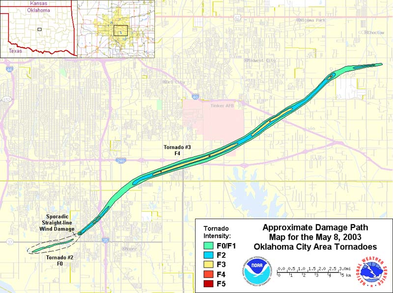
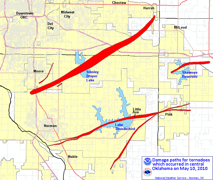
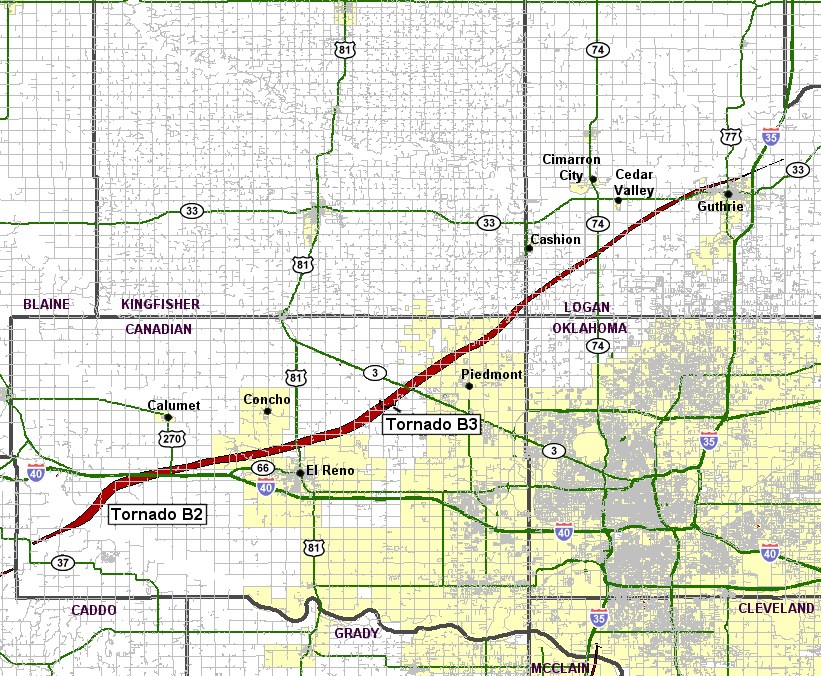
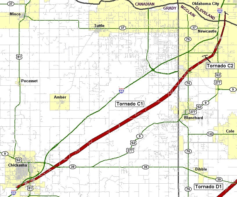