Strong to severe thunderstorms capable of damaging wind gusts, large hail, and perhaps a couple tornadoes, are likely Thursday from parts of the lower Ohio Valley into the southern Plains. An Enhanced Risk (Level 3 of 5) outlook has been issued. Further north, a warm front will bring areas of rain showers to portions of the Great Lakes and Northeast U.S. Read More >
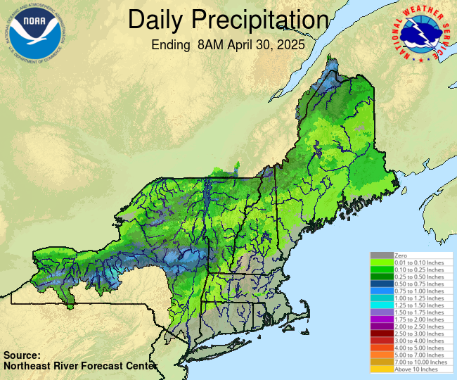
Observed Precipitation
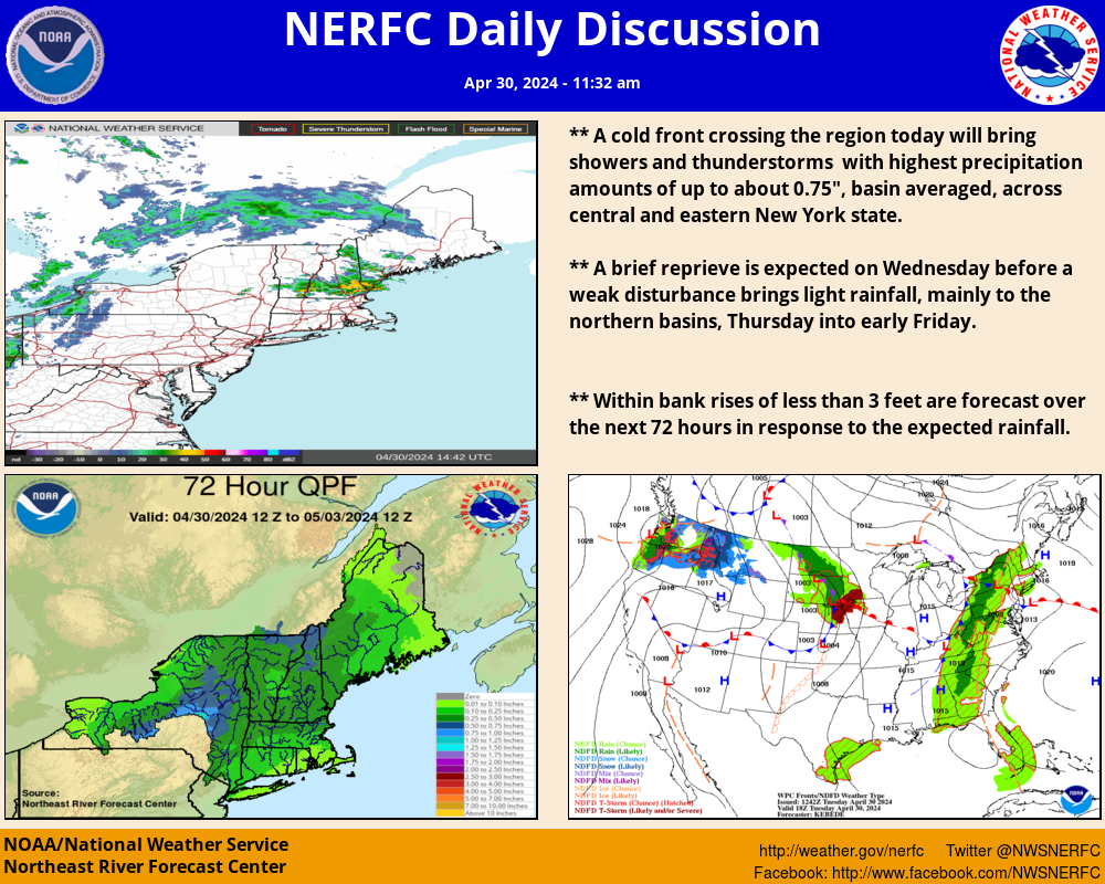
 Forecast Precipitation 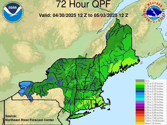 1 Hour Flash flood Guidance 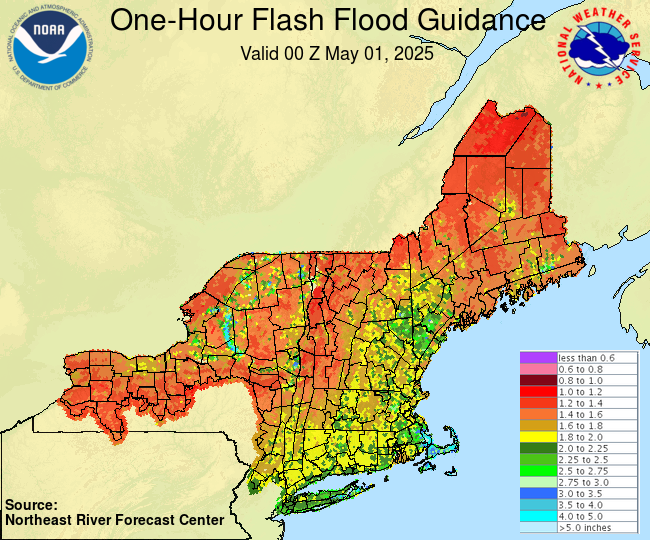 3 Hour Flash flood Guidance 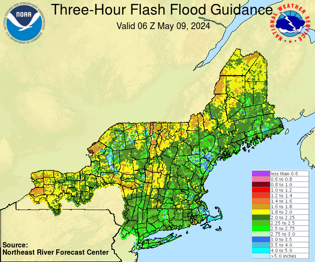 Flood Potential Outlook  Precipitation and Departures from Normal 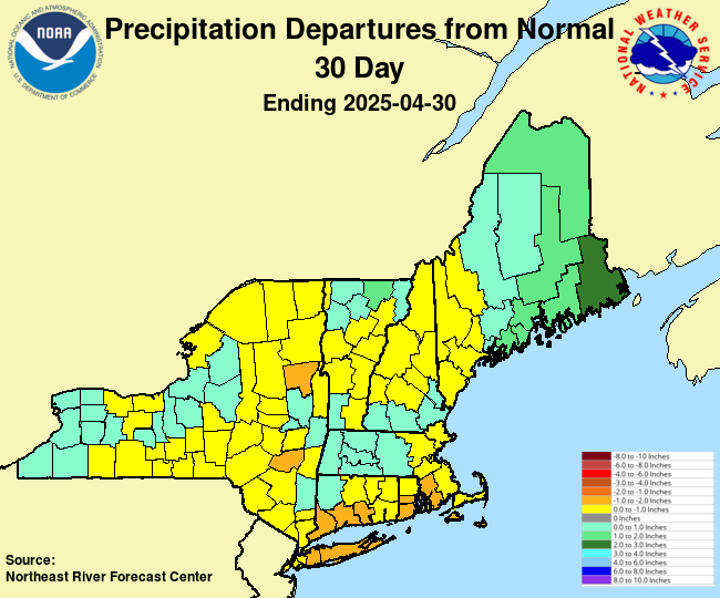 Short-Term Precipitation Totals 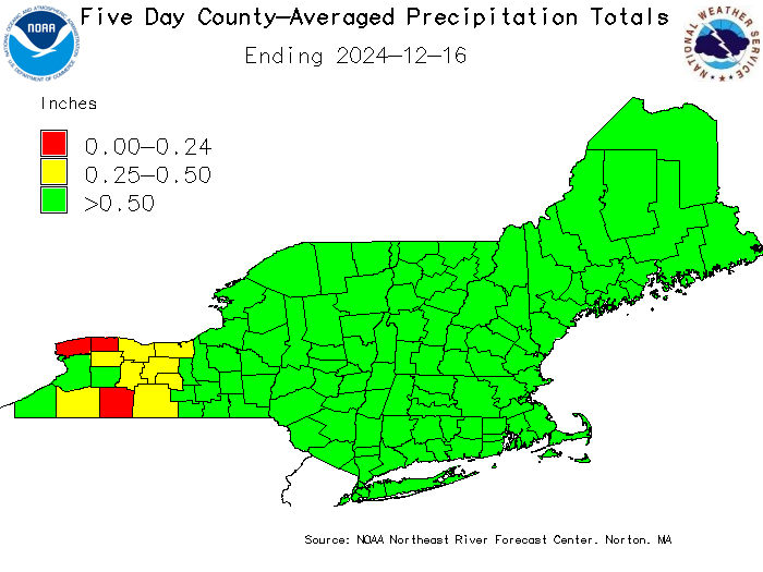 |
River Conditions Click here to link to AHPS page. 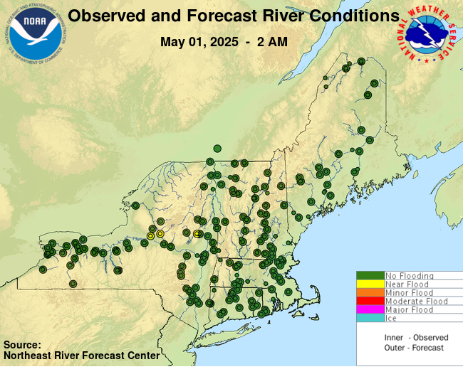
 |
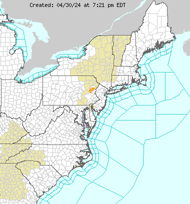
Eastern Region Hazards
 USGS WaterWatch 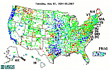 Short Range Forecast  Satellite Images  WPC 1-3 Day QPF 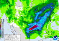 Excessive Rainfall Forecast  Drought Monitor  |
||||