| Flood Forecasts On Twitter |
|---|
River Locations Within Aberdeen, South Dakota Forecast Area
(Find other participating offices)
|
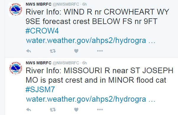
Are you interested in river forecasts for a specific location? Now you can follow forecasts on Twitter. Automated flood forecasts will be sent via Twitter from the Missouri Basin River Forecast Center. These tweets will be issued when a river forecast is near or above flood stage, and for every forecast update. Tweets will include a link to the official forecast page for that location and a hashtag containing the 5 character ID for that specific point (those sites are listed below the map on this page). Hashtag searches either through Twitter, Hootsuite or Tweetdeck, allow you to quickly monitor points of interest for new and updated forecasts. We have included instructions on how to set up live search streams using both Hootsuite and Tweetdeck, as well as notifications on your mobile device using Hootsuite. |
|
Instructions for Hootsuite (includes a list of WFO searches) Instructions for Tweetdeck Instructions for Hootsuite Mobile App |
For updates on rivers within the Aberdeen, South Dakota forecast area,
please follow the NWS Aberdeen Twitter Page.
For updates on all rivers within the Missouri Basin, please follow the NWS MBRFC Twitter Page.
Sample Tweets
| Aberdeen Forecast Area |
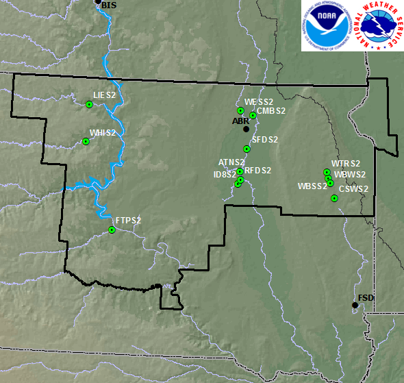 |
Select by the location of interest or river name. The far right-hand column is the hashtag to use.

