The National Weather Service (NWS) Marine Weather Services Program offers a broad range of marine forecast and warning products in graphical and text (low bandwidth) formats (See Tabs above). The NWS provides forecasts and warning services for the coastal waters along the mainland of the continental U.S., the Great Lakes and the Offshore and High Seas waters of the North Atlantic and North Pacific Oceans. Links to forecasts, warnings and products related to tropical cyclones and sea ice are near the bottom of the page. The program also provides important Tsunami information. You can also get an hourly marine forecast for a single point and marine channel forecasts for Tampa, FL and Mobile Bay, AL. Click here for the latest maps of official NWS marine forecast and warning zones (includes any recent changes to coastal, offshore and high seas zones).
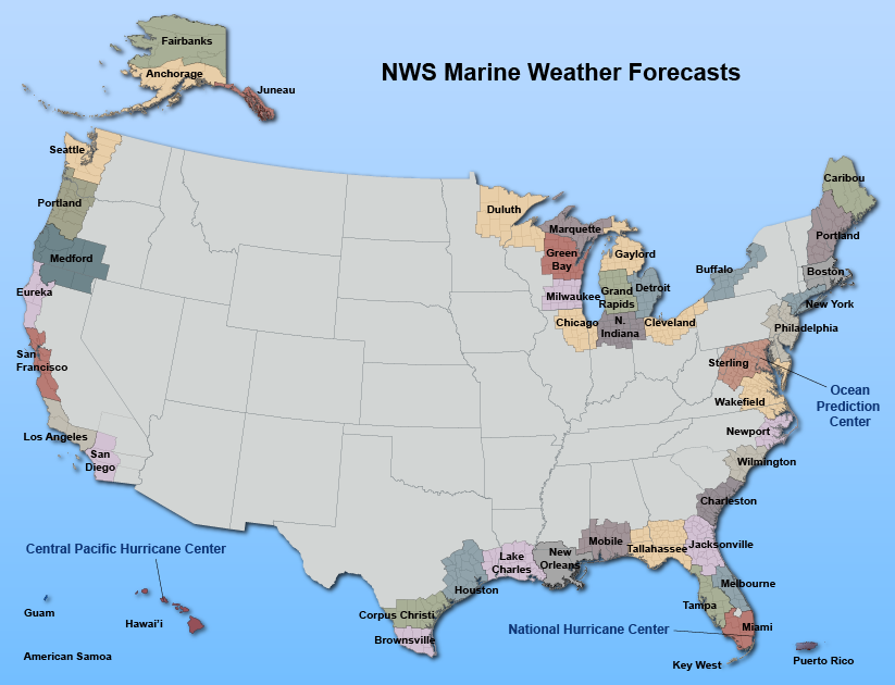
Clicking on an area of interest on the map below will take you to marine webpages of Weather Forecast Offices (WFOs) and to a web portal for the Great Lakes. Here is a list of NWS offices by region. Click here for maps showing all NWS marine forecast and warning zones.
If you are interested in receiving NWS marine products via email, mouse over the Get Products via Email menu item and click on the link that pops up. If you have questions about this site or the NWS Marine, Tropical or Tsunami programs, please contact us at: marine.weather@noaa.gov.