 |
|
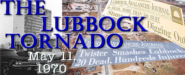
Wednesday, May 11th, 2024, will mark the 54th anniversary of the devastating tornado that struck Lubbock. To learn more about this campaign, read the PRESS RELEASE (pdf). The centerpiece of this campaign is an ESRI Story Map that highlights many of the important and interesting aspects of this terrible event. You can view the Story Map HERE. In 2010, for the 40th anniversary, the National Weather Service in Lubbock conducted an outreach campaign in commemoration of the tornado for Lubbock County schools. For this campaign, we produced a 20-minute long educational video that you can view HERE. To discover more about the 1970 Lubbock tornado read on. On May 11th, 1970, a devastating tornado struck Lubbock. The tornado, actually the second of two that struck the city that night, touched down around 9:30 in the evening southwest of downtown and moved northeast, causing terrible damage along its path, until it lifted around the Lubbock Municipal Airport shortly after 10:00 pm.
Image of two tornadoes that tracked across Lubbock on May 11, 1970. Click on the map for a larger view. (Image courtesy of Weatherwise magazine)
The tornado killed 26 people and injured more than 1500 along its 8.5 mile track, while covering about 15 square miles of Lubbock. Dr. Theodore "Ted" Fujita later determined that all but one of the deaths (96%) occurred along the path of suction spots (also know as suction swaths and suction marks). These suction spots, which create localized areas of increased damage, are created when smaller-scale vortices develop and rotate around the larger parent tornado forming a multiple-vortex tornado. The below map shows where the deaths from the tornado were in proximity to the suction spots.
Location of the deaths relative to the path of the Lubbock tornado. The dark semicircles are locations of suctions spots (or suction marks), as determined by Dr. Fujita, which were created by the multiple vortices within the tornado. Click on the image for a larger view. (Image courtesy of Weatherwise magazine)
The tornado caused extensive damage to the northeast side of Lubbock and resulted in approximately 250 million dollars worth of damage (in 1970 dollars), equivalent to about 1.25 billion dollars in 2005. The tornado was rated an F5 on the Fujita Tornado Damage Scale, which is the highest a tornado can be rated. No known photographs were taken of the tornado, which is attributed to the fact that the storm occurred after the sun had set. |
||||||||||||
|
10 am: Severe Local Storms (SELS) Unit amended the convective outlook issued earlier to include "Isolated thunderstorms with large hail expected in High Plains of West Texas east of Pecos late afternoon and early evening" 1:25 pm: SELS Unit advised that the air mass in the high country of West Texas was unstable, isolated thunderstorms would be severe, and that "local areas should be monitored for this possibility" 1 pm to 5 pm: Warm and dry conditions dominated Lubbock, with temperatures climbing from the middle 80s into the lower 90s and dewpoints holding steady around 40. 6:00 pm: Towering cumulus clouds began developing in the area. 6:30 pm: First radar echoes appear south of Lubbock on the Amarillo WSR-57 scope. 6:55 pm: The Lubbock radar detected a moderate thunderstorm 15 miles south of the Lubbock Airport or about 5 miles south of the Lubbock city limits near the community of Woodrow. 7 pm: Cumulonimbus clouds (Cb), which are dense, vertically developed clouds, reported by the Lubbock Weather Bureau (located at Lubbock Municipal Airport). Also, the following statement was transmitted over the weather wire: Moderate thunderstorm with a diameter of 10 miles indicated by Lubbock radar at 6:55 pm. 7:30 pm: Forecasts were revised to include thunderstorm activity for Lubbock and vicinity, and transmitted over the weather wire. 7:45 pm: The following statement was transmitted over the weather wire: The Lubbock radar detected a moderate thunderstorm 10 miles south of the Lubbock Airport near southern city limits; thunderstorm increasing in intensity. 7:47 pm: Lubbock forecasters called the Amarillo Weather Bureau Office (WBO) on the Federal Telecommunications Service (FTS) and talked to the radar operator. Amarillo radar indicated cloud tops near 46,000 feet and increasing. The 7:00 pm sounding observation at Amarillo indicated a tropopause of 48,000 ft, an increase of 7,000 ft since the 7:00 am observation. 7:50 pm: Severe Thunderstorm Warning Bulletin until 9:00 pm for Lubbock, Crosby, eastern Hale, and Floyd counties transmitted. Emergency Action Notification Signal (EANS) requested. Long form of Severe Thunderstorm Warning Bulletin with specific details sent near 8:00 pm. Also, Civil Defense was given warning by telephone. The switchboard operator was requested to notify Mr. Payne, the Civil Defense Director. 7:52 pm: The Texas Department of Public Safety (DPS) reported to the Lubbock WBO on marble-size hail in the 1300 block of 58th Street (southeast Lubbock). 7:59 pm: Radio Station KFYO used EANS to alert other radio and television stations that a special warning message is coming over the network. No "commercials" given by KFYO from this time until 7:30 am, May 14th. 8:05 pm: Public reported golf ball-size hail 3 miles south of Lubbock city limits. 8:08 pm: Severe Weather Statement transmitted reiterating warning and advising of golf ball to egg-size hail south of town 8:10 pm: Funnel cloud, associated with the first tornado, reported by an off-duty policeman 7 miles south of the airport. Also, golf ball- to grapefruit- size (4.00 inch diameter) hail was reported from Lubbock Downs (about 2 to 3 miles south of city limits). Lubbock WBO checked with Amarillo radar personnel on severe storm just south of Lubbock and found that cloud tops had increased to 55,000 ft. Additionally, another Severe Weather Statement transmitted reiterating the warning and advising of grapefruit-size hail 5 miles south of the city. 8:13 pm: Baseball-size hail reported by the public in southeast Lubbock. 8:15 pm: Tornado Warning Bulletin issued until 9:00 pm for Lubbock, western Crosby, eastern Hale, and Floyd counties transmitted on the Weather Wire. The warning noted the funnel cloud report along with a hook echo developing in that same location on the Lubbock WBO Weather Service Radar (WSR)-1 radar, apparently moving northeastward. The warning was transmitted on the weather wire and relayed by phone to the Civil Defense Director. 8:30 pm: First tornado touches down near Broadway and Quirt Avenue (now Martin Luther King Jr. Blvd) on the east side of town. 8:33 pm: Baseball-size hail reported to the Lubbock WBO by the public about 5 miles south of the airport. 8:40 pm: Severe Thunderstorm Watch Bulletin Number 225 issued by the national Severe Storms Forecast Center (NSSFC) for all of the South Plains valid until 2:00 am CDT Tuesday morning. 8:42 pm: Severe Weather Statement issued by Lubbock WBO included numerous reports of large hail reported in Lubbock area in past 30 minutes. The WSR-1 radar indicated hook at 8:40 pm, 5 miles south-southeast of the airport. 8:59 pm: Tornado Warning Bulletin continued for persons in Lubbock, western Crosby, southern Floyd, and southern Hale counties valid until 10:00 pm. 9:00 pm: A small tornado takes a roof off a barn located about 8 miles north of Crosbyton. 9:05 pm: Texas DPS informed Lubbock WBO of golf ball-size hail about 6 miles southeast of the airport. 9:08 pm: Public reported to Lubbock WBO baseball-size hail at Holiday Inn East and Mackenzie State Park about 4 miles south of the airport. 9:14 pm: Bulletin issued advising of latest radar report, recent reports of large hail in the Lubbock area, and reiterating the continuation of the tornado warning. 9:15 pm: Lubbock WBO advised the Texas DPS in Lubbock to notify Idalou police (10 miles east of Lubbock) to sound tornado warning. 9:30 pm: Lubbock WBO advised the Shallowater Fire Department by telephone of severe storm 5 miles south of their area. 9:31 pm: 2.00 inch diameter hail observed at the Lubbock Airport. 9:35 pm: Second larger and more destructive tornado touches down near 19th Street and University Avenue. The Lubbock WBO WSR-1 radar indicated a tornado about 7 miles southwest of the airport near 19th and Brownfield highway. This information was relayed by two-way radio and telephone to Civil Defense. Sirens were sounded at 9:35 pm (this was the time that a patrolman reported a funnel in this part of the city). Also, the Texas Zone Forecasts for Lubbock and vicinity are issued, including the severe thunderstorm watch. The remainder of the amended forecast was going to be issued after 10:00 pm, but because of the tornado hitting downtown Lubbock, loss of communications at 9:49 pm prevented transmission. 9:46 pm: Power failure at Civil Defense Headquarters. 9:47 pm: The last communications between Lubbock WBO and Lubbock Civil Defense reported that "hooks" were indicated on radar around 9:45 pm about 5 miles southwest of the airport. 9:49 pm: Lubbock WBO lost all communications. Power to the WSR-1 radar failed when the emergency generator died. 9:55 pm: Lubbock WBO personnel abandoned the WBO to take cover from the approaching tornado. 10:00 pm: 77 knot wind recorded at the Lubbock Airport. 10:03 pm: Second tornado passed over the Lubbock WBO. 10:10 pm: Lubbock WBO, using the two-way Lubbock Fire Department radio, relayed tornado warnings to the Abernathy, new Deal, and Petersburg areas. Sirens were sounded in Petersburg at an unknown time. Tornado warning was valid until 11:00 pm and included Lubbock, western Crosby, southern Hale, and southern Floyd counties. Message relayed by Fire Department operator. 11:30 pm: Lubbock WBO relayed information to EOC by two-way radio that the tornado warnings were officially cancelled for all areas as storms had decreased to moderate intensity in the Lorenzo area. |
||||||||||||
|
3.25 inches of precipitation was reported at the airport from all the rain and hail received The second, most destructive tornado, was 1 1/2 miles wide early on, before narrowing to about 1/4 mile wide by the time it reached the airport. 10,000 automobiles were damaged or destroyed 119 aircraft were demolished at the airport Area of the tornado damage covered 15 square miles. 600 apartment units were demolished, 250 businesses damaged or destroyed 8,800 family units damaged, of which 430 were destroyed In downtown Lubbock, an estimated 80% of all plate glass windows were smashed |
||||||||||||
|
The thunderstorm that spawned the Lubbock tornado was unique in that it formed on a retreating dryline. The dryline is a narrow boundary between dry continental air to the west and moist air from the Gulf of Mexico to the east. It is often present across the high plains of the U.S. during the springtime and is especially common in the south plains of West Texas. When there is not a strong storm system bringing winds that will overwhelm the dryline, the dryline will move east (advance) during the day as the air heats up and then will move back to the west (retreat) during the evening. While thunderstorms often form along advancing drylines during the afternoon and can produce large hail and even tornadoes, thunderstorms that form along retreating drylines are much less frequent, and only rarely produce tornadoes. This is due in part to the air becoming more stable (air temperature decreases less rapidly with height) as the air cools near the ground after the sun sets. The figures below show the atmospheric conditions that existed leading up to and during the Lubbock tornado. These are common maps that meteorologists use to examine the state of the atmosphere. In the 1970s, the only ways to collect information from the atmosphere above the surface was to use weather balloons. For more information on these balloons please click here.
Series of surface weather maps on May 11, 1970. The maps, from left to right, are at 4 pm CDT (2100 UTC), 7 pm CDT (0000 UTC), and 10 pm CDT (0300 UTC). Click on the maps for larger views.
The above series of surface weather maps concentrate on the dryline location throughout the late afternoon and evening of May 11, 1970. The dryline initially made its way east of Lubbock during the early afternoon, with winds shifting from south to west and dewpoints, which are a measure of the moisture in the air, dropping from lower 60s at 10 am CDT to mid 30s by 1 pm. Click here to view the hourly observations taken at the Lubbock Airport on May 10, 11, and 12, 1970. However, as the 4 pm surface map and observations show, the winds quickly switch back around to the south at the airport, preventing the moisture and dryline from advancing far from Lubbock. Although surface observations in West Texas were sparse in 1970, they did manage to pinpoint the area of confluence (air coming together) associated with the dryline to be located between Reese AFB, with a light west wind and the Lubbock airport, with a south wind. Temperatures had also warmed nicely, under sunny skies, into the lower and middle 90s. Three hours later, at 7 pm, the surface map continued to depict the dryline, and related confluence, between Reese AFB and the Lubbock airport. This extended period of confluence near Lubbock aided in the development of clouds and eventually thunderstorms as the warm and increasingly moist air that was coming together at the surface was forced to rise. Additionally, the 7 pm observation at the airport indicated that cumulonimbus clouds, which are dense, vertically developed clouds that produce thunderstorms, were visible to the south and distant northeast of the airport. The surface map indicates the approximate locations that the isolated thunderstorms had developed. Finally, the 10 pm surface map reveals that the dryline had continued its retreat more rapidly off to the west, with moisture and southeast winds returning to southeast New Mexico, Reese AFB, and Amarillo. The thunderstorms that were developing at 7 pm were now mature, feeding off of abundant low-level moisture supplied by strong southeast winds.
Upper-level weather maps at 7 pm CDT on May 11, 1970 (0000 UTC). The left image is the 850 mb map, with dewpoints over 10 C (50 F) shaded in lighter green and dewpoints over 15 C (59 F) shaded in darker green. The right image is the 500 mb map, with winds over 30 knots shaded in blue. Click on the maps for larger views.
The maps above are examples of maps meteorologists put together using the weather balloon data from May 11, 1970. These maps are called constant pressure maps because instead of measuring altitude in height, they measure it in pressure (recall that air becomes less dense with altitude. Air pressure also decreases with height because there are less air molecules above to exert downward pressure). On a constant pressure map, high(low) elevations correspond to higher(lower) than normal pressures at any given altitude. In this way, meteorologists can track high and low pressure systems as they move across the world. The 500 millibar map shows how the atmosphere looks at around 18,000 feet (5400 meters). The map shows a trough of low pressure across the northwest United States (heights decrease from 5880 meters over the Gulf of Mexico to 5460 meters near California and Oregon. In addition, look at the 5820 (labeled 582 on the map) line. You can see two small waves - one over Oklahoma and one moving through West Texas. This second wave trough (waves have ridges and troughs) is labeled with a red dashed line. Sometimes, subtle waves like this can provide just enough lift (thunderstorm development requires moisture, instability and lift) to get thunderstorms going. The stronger area of winds shaded in blue centered near Midland are also an indication of this wave. Winds in the atmosphere are created by pressure differences, which in turn are caused by temperature differences. Areas of higher winds at this altitude are often caused by sharp temperature contrasts. This enhanced temperature contrasts means that there may be a pocket of cold air aloft (cold air aloft provides the energy for instability and lift). The 850 millibar map shows how the atmosphere looks at only a few thousand feet above the ground. At this level, meteorologists look for areas of high moisture, the strength and direction of the winds, and any fronts that may be present. You can see on this map that there is a trough of low pressure stretching from a low pressure center in central Colorado south through New Mexico into northern Mexico. The green shading shows areas of deeper moisture with the darker green shade show very high moisture levels. You will notice that at 7 pm, the deeper moisture was located off to the southeast of Lubbock. However, the winds over central and southern Texas were from the south and southeast, and were bringing the moisture north and west. This moisture return coincided with the lift from the approaching wave that is depicted on the 500 millibar chart to greatly enhance the severe thunderstorm potential.
Soundings taken at 7 pm CDT on May 11, 1970 (0000 UTC). The soundings, from left to right, are Amarillo, Midland, and Abilene.The low-level thermodynamics (temperature and dewpoint) for the Amarillo sounding were modified to better represent the conditions experienced at Lubbock. Click on the soundings for larger views.
The above soundings display all the data gathered from the weather balloons, at a particular site, after they have ascended through the atmosphere. The solid red line in each image is the temperature recorded as the balloon ascended, while the dashed red line is the dewpoint. The wind speed and direction can be seen on the right hand side of each sounding. Additionally, a light green line, which shows the temperature air from the surface would have if it was lifted through the atmosphere, is drawn on each sounding. Whenever the air lifted from the surface is warmer than the environmental air at a given height, the lifted air is inclined to continue to rise, since warmer air is less dense than cooler air. Each sounding is shaded pink whenever the air lifted from the surface would be warmer than the environment around it. This pink area in each sounding is thus a measure of the amount of instability present in the atmosphere. Examining each sounding, significant amounts of pink area are present, indicating that the atmosphere on the evening of May 11, 1970, has plenty of instability to work with. This instability, coupled with the increasing moisture at the lower levels, confluence and lifting of air along the dryline, and the weak disturbance at 500 mb, conspired together to produce a couple of very intense thunderstorms across West Texas. Additionally, the change of the wind direction from southeast at the surface to southwestly aloft, among other factors, provided sufficient spin in the atmosphere to make the stronger storms rotate, and produce tornadoes.
Series of images taken from the Amarillo radar on the night of May 11 and early morning of May 12, 1970. Click on the image for a larger view. Lubbock is located approximately 4 range rings south of the radar (second range ring on the images where the range rings are less dense). Dots are located on the 8:30 and 9 pm images, at the location of the first tornado, and again on the 9:45 and 10 pm, at the location of the more destructive second tornado. Time is in CDT. (Image courtesy of Weatherwise magazine)
The above series of pictures taken from the Amarillo radar depict what meteorologists in Amarillo would have seen on their radar scope on the night of May 11. The radar, located in Amarillo, is centered in the middle of the range rings toward the top left-hand side of each image. Lubbock is located almost due south of Amarillo on the fourth range ring (second range ring on the images where the range rings are less dense). The bright white blobs are radar returns, or radar echoes. These radar echoes can represent many things found in the atmosphere, including rain and hail produced by thunderstorms. However, many of the radar echoes found close to the radar are "ground clutter" - caused by the reflection of energy back to the radar from trees, buildings, and other ground-based objects, and are not meteorological features of interest. The series of images show no radar echoes at 6 pm. The first storm starts off as a small radar echo south and southwest of Lubbock. Over time, this echo grows as it slowly moves off to the north and east. Then, at both 8:30 and 9 pm, the largest radar echo, located over the city of Lubbock, is associated with the first tornado that touches down on the east side of town (the location of the first tornado is plotted with a dot at both times). The thunderstorm over Lubbock continues to build over the city from 9 to 10:30 pm as it merges with smaller echoes that approach and get absorbed into the massive storm from the south and southwest. The location of the second more destructive tornado is plotted with a dot on the 9:45 and 10 pm images. After 10:30 pm, the storms generally decrease in areal coverage and organization as they move off to the east and northeast. As seen from the above images, the Amarillo radar perspective was helpful in identifying storm location, but less helpful in seeing the details of the storm, primarily because the radar was located so far away. Although not pictured here, radar images as seen from the radars located at Reese AFB and the Lubbock airport both depicted greater detail of the storm, which aided in the issuance of timely warnings. In particular, both nearby radars detected a hook shaped radar echo (known as a hook echo), which is a feature that is sometimes produced by a rotating storm, and can be a signature associated with the development or presence of a tornado.
|
||||||||||||
|
SOCIETAL IMPACTS AND LESSONS LEARNED: Although devastating to Lubbock, a number of positive outcomes resulted from the Lubbock tornado of 1970: 1. The tornado was used as inspiration and justification for the establishment of the Wind Science and Engineering (WISE) Research Center at Texas Tech University. WISE has developed voluminous information on windstorm mitigation and other wind-related subjects that are available to professionals and public alike. The WISE center has brought many professionals, much money, and tremendous recognition to the South Plains. 2. The tornado also helped in the selection of Lubbock as one of the very first NWS offices to receive a WSR-74C radar. The Lubbock WSR-74C radar became operational in 1978. 3. The study of the meteorological data from May 11, 1970, in combination with an extensive damage survey completed in Lubbock of the aftermath, helped, in part, in the development of the Fujita Tornado Damage Scale (F-scale) by Tetsuya Theodore (Ted) Fujita. The F-scale is the de facto standard used to rank tornadoes by the amount of damage that they inflict. 4. The study of the damage patterns, especially from overhead with aerial photos, allowed Dr. Fujita to further develop his theory that some tornadoes contained more than one vortex (i.e., there were multiple vortex tornadoes).
Photograph taken by NASA that shows the pattern of three suction swaths along Kent Street. The destructive damage from each vortex within the tornado (otherwise known as suction swaths) follows the arrows. Fujita noted that the damage was not necessarily related to the distance that the structures were from the center of the tornado path.Clck on the image for a larger view. (Image courtesy of Weatherwise magazine)
This was evident with the Lubbock tornado, where swaths of extreme damage were located immediately adjacent to locations of very light damage, all within the tornado path itself (see the above aerial photograph).
MORE INFORMATION ON THE LUBBOCK TORNADO
Personal Accounts Gathered by the Lubbock NWS Top Ten Deadliest Texas Tornadoes since 1900 (Amarillo NWS) Lubbock NWS News Release about the Lubbock Tornado
SEVERE WEATHER INFORMATION AND SAFETY
|
||||||||||||
|
"The Lubbock, Texas, Tornado May 11, 1970". Natural Disaster Survey Report 70-1. July 1970. "The Lubbock Tornadoes: A Study of Suction Spots". Weatherwise. August 1970. "The Lubbock Tornado". Boone Publications, Inc., 1970 Avalanche Journal, Private Citizens, Carl Hill, Bill Payne |
||||||||||||


 Follow us on YouTube