An updated summary was compiled for the 50th anniversary in 2009 and can be viewed below or here. The original summary can be found below the story map.
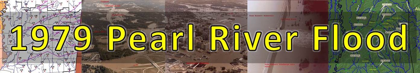
Event Summary
Heavy rain over the course of the winter of 1978-1979 produced extremely heavy rainfall over the ArkLaMiss region. Areas in the Pearl River basin received nearly 50-150% normal of rainfall, with some areas even higher percentages of normal rainfall for the months leading up to April 1979. Nearly 7-15 inches of rainfall fell between March and early April of 1979, exacerbating very highly saturated soils and rivers in the region.
Severe weather was anticipated in the region on April 10-11th as the Wichita Falls F4 tornado tore through Wichita Falls, Texas. As the squall line and severe weather moved east, the line stalled over the region on April 11-12th and produced nearly 4-5 inches in the Jackson metro area and nearly widespread 8-10 inches in the headwaters of the Pearl, Noxubee and Tombigbee rivers. There were even locally higher amounts approaching 15-20 inches in the northeastern areas in Winston, Oktibbeha, Lowndes and Noxubee counties. The heavy rain moved out of the region on April 13th, 1979, but rapid rises in the rivers were just about to begin.
As the front moved out of the region, fair weather and clear skies persisted all the way into Easter weekend of April 14-15th. However, the nice conditions would be overshadowed by the rapid rise of the Pearl River. The inflow of water into the Ross Barnett reservoir reached a peak of 162,000 cfs around midnight on April 16th and the Ross Barnett discharge reached a peak of 125,000 cfs around 930am on Easter Sunday on April 15th, 1979. The Pearl rapidly rose and finally reached a record crest of 43.28 feet at 300pm on April 17th, 1979. Other areas on the southern Pearl River basin also rapidly rose at Monticello and Columbia over the next several days.
The rapid rise in the Pearl River caused massive flooding in the downtown Jackson area and a flood of a magnitude many had never seen in their lifetimes. Damage was widespread as downtown Jackson flooded with many residential and business districts having massive flooding. The Pearl River flood of 1979 caused nearly $500-700 million dollars in damages, which is equivalent to over $1 billion dollars in damages today. Nearly 15,000 people were evacuated from Jackson due to rising flood waters. One fatality occurred in the Jackson area when a young girl fell off of her porch into the flood waters but remarkably, no other fatalities occurred. The Pearl River flood of 1979 will continue to be the benchmark of floods in the Jackson metro area for years to come.
Timeline of Events
| CHRONOLOGY | ANTECEDENT SOIL CONDITIONS RIPEN FOR A MAJOR FLOOD |
| December 1978 | North and Central Mississippi receive 150% normal rainfall for the month. |
| January 1979 | All of Mississippi had more than 150% the normal rainfall. Mid-sections of the Pearl River drainage basin (around Jackson, MS) had more than 300% the normal rainfall. |
| February 1979 | Mississippi had rainfall amounts more than 50% above normal for the month. |
| March 1979 | March 3-4 : 3 to 6 inches fall in the Pearl River Basin. March 23-24: 1 to 2 inches fall in the Pearl River Basin. |
| April 1979 | April 1-4: 2 to 4 inches fall in the Pearl River Basin April 8-9: 1 to3 inches fall in the Pearl River Basin |
| CHRONOLOGY | THE BIG EVENT BEGINS |
| April 10, 1979 | Storm system produced devastating F4 in Wichita Falls, TX. Mississippi residents are on alert for severe weather. |
| April 11, 1979 | Squall line ahead of a slow moving cold front extended from central Louisiana through northern Mississippi and Alabama. Heavy rainfall began to fall southeast of the squall line, mainly over western Mississippi. Just before midnight, heavy rainfall extended into the Jackson metropolitan area, dumping 4 to 5 inches. Flash flooding occurred in the metropolitan area. 6am Pearl River at Jackson stage: 27.8 feet 6am Ross Barnett discharge: 18,500 cubic feet per second (cfs) |
| April 12, 1979 | Cold front pushed into western Mississippi and became stationary. Early in the morning hours, extremely heavy rainfall, (8 to 10 inches), began falling over the headwaters of the Pearl, Noxubee, and Tombigbee Rivers. This rainfall was associated with the squall line. By late afternoon, an instability boundary formed across south central Mississippi. Heavy rain and thunderstorms continued to occur along and to the north of this boundary. Heavy rainfall occurred over areas hard hit during the early morning hours. 6am Pearl River at Jackson stage: 30.18 feet 6am Ross Barnett discharge: 33,200 cfs |
| April 13, 1979 | Instability boundary shifted to the south. Most heavy rainfall ended early in the morning hours. The cold front pushed through the state during the day, ending the threat of additional rainfall. 6am Pearl River at Jackson stage: 33.50 feet 6am Ross Barnett discharge: 50,375 cfs Pearl River at Philadelphia crest: 23.31 feet in the afternoon Yockanookany at Kosciusko crest: 23.06 feet late morning. |
| April 14, 1979 | Fair skies 6am Pearl River at Jackson stage: 37.56 feet (Flood of record exceeded) 6am Ross Barnett discharge: 101,325 cfs Tuscolameta Creek crest: 29.77 feet around 6am. Pearl River at Edinburg crest: 30.06 feet around 430pm Pearl River at Carthage crest: 28.74 feet around 11pm Yockanookany at Ofahoma crest: 28.27 feet around 11pm |
| April 15, 1979 | Fair skies (Easter Sunday) 6am Pearl River at Jackson stage: 41.15 feet 6am Ross Barnett discharge: 120,800 cfs Pearl River at Coal Bluff Park crest: 26.5 feet around noon Ross Barnett discharge peak: 125,000 cfs around 930am Inflow into Ross Barnett peak: 162,000 cfs around midnight |
| April 16, 1979 | Fair skies 6am Pearl River at Jackson stage: 42.56 feet 6am Ross Barnett discharge: 118,500 cfs |
| April 17, 1979 | 6am Pearl River at Jackson stage: 43.09 feet 6am Ross Barnett discharge: 119,100 cfs Pearl River at Jackson crest: 43.28 feet around 300pm |
| April 20, 1979 | Pearl River at Monticello crest: 34.08 feet |
| April 22, 1979 | Pearl River at Columbia crest: 27.80 feet |
Rainfall and Flood Crests
| 48 Hour Rainfall: April 11th - April 13th | Maximum Flood Crest Height |
 |
 |
Rainfall Totals
| Storm Total Precipitation: April 11th - April 14th |
 |
Pictures - Click to enlarge
Please submit your pictures to sr-jan.webmaster@noaa.gov !
Hinds and Rankin County
(Photo source: Unknown)
(Photo source: Mississippi District of the USGS)


 Follow us on YouTube