Severe Weather Outbreak
April 14, 2011
|
What happened: A line of severe thunderstorms produced a few brief tornadoes, several funnel clouds, quarter to tennis ball sized hail, and 70 mph winds on the evening of Thursday, April 14th, 2011.
Background: A powerful spring storm system over the Rocky mountains moved east and strengthened across the High Plains on April 14, 2011. Thunderstorms rapidly developed by mid-afternoon along a dryline extending from southern Kansas to Texas. With abundant instability and wind shear, the storms became severe and moved rapidly northeast across central and southeast Kansas. Thunderstorms initially developed near the intersection of the dry air behind the dryline and the moisture which surged north from the Gulf of Mexico.
|
|
|
|
|
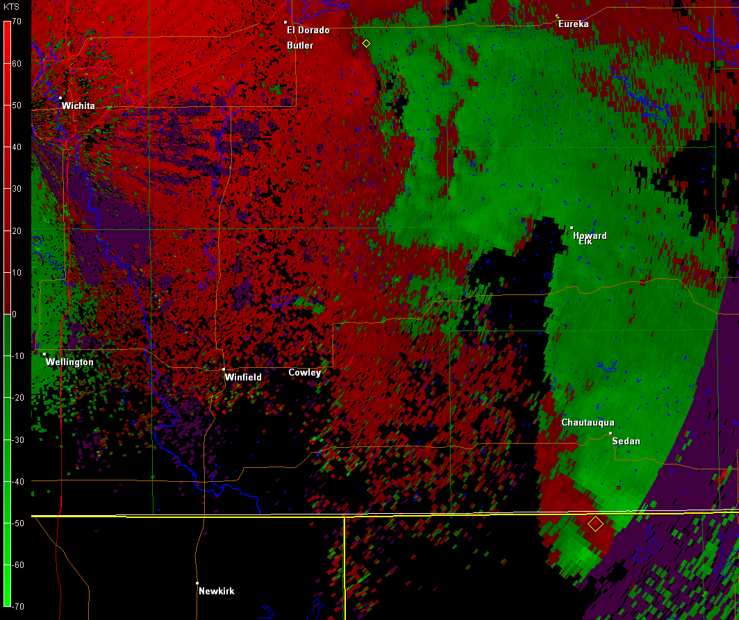
Multiple funnel clouds in Cowley, Chautauqua, and Greenwood Counties.
|
 |
 |
| KICT WSR-88D Base Reflectivity at 516 PM CDT | KICT WSR-88D Base Reflectivity at 517 PM CDT |
Images

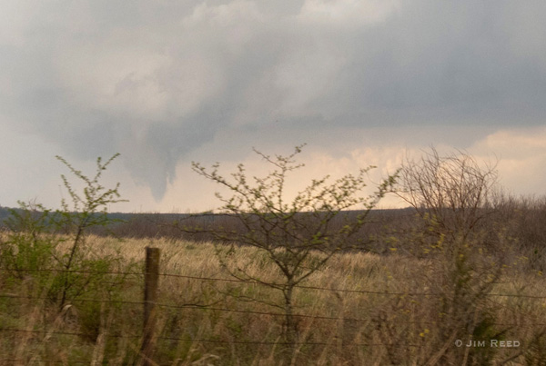
Tornado located on the Cowley/Elk County line. Courtesy of Jim Reed
|
|
Photo near Cowley/Elk county line at 504PM CDT. Photo courtsey Jim Reed |
Photo near Cowley/Elk county line at 504PM CDT. Photo courtsey Jim Reed |
Photo of funnel cloud in southwest Elk county at 514pm CDT. Photo courtsey Jim Reed |
|
2 Tornadoes occurred in Saline County.
|
 |
 |
| KICT WSR-88D Base Reflectivity at 507 PM CDT | KICT WSR-88D Base Velocity at 507 PM CDT |
Images
|
EF0 tornado damage 5 miles south of Tescott, KS. |
EF0 tornado damage 5 miles south of Tescott, KS. |
EF0 tornado damage 5 miles south of Tescott, KS. |


 Follow us on YouTube