ABBY (TS - August 7th landfall)
Tropical Storm Abby formed and made landfall near Matagorda within 48 hours. Lowest pressure observed was 29.66 inches, and winds were 45 mph with gusts to 65 mph.
CINDY (Cat. 1 Hurricane - September 17th landfall)
Hurricane Cindy formed and made landfall near Galveston within 24 hours. The storm raised tides 3-4' on Padre and dropped an inch of rain here on the way to Galveston on the 16th, and another inch on the way back down the coast, inland, three days later. In East Texas, rainfall totals of up to 23.5" were recorded when the storm became stationary west of Port Arthur. Damage totaled $10 to $15 million, and Cindy killed one person.
Statistics:
Winds (mph): Galveston at 74, Sabine estimated at 75, High Island 60-69, Houston Yacht Club at 64;
Pressure (inches): High Island at 29.45, Houston at 29.73.
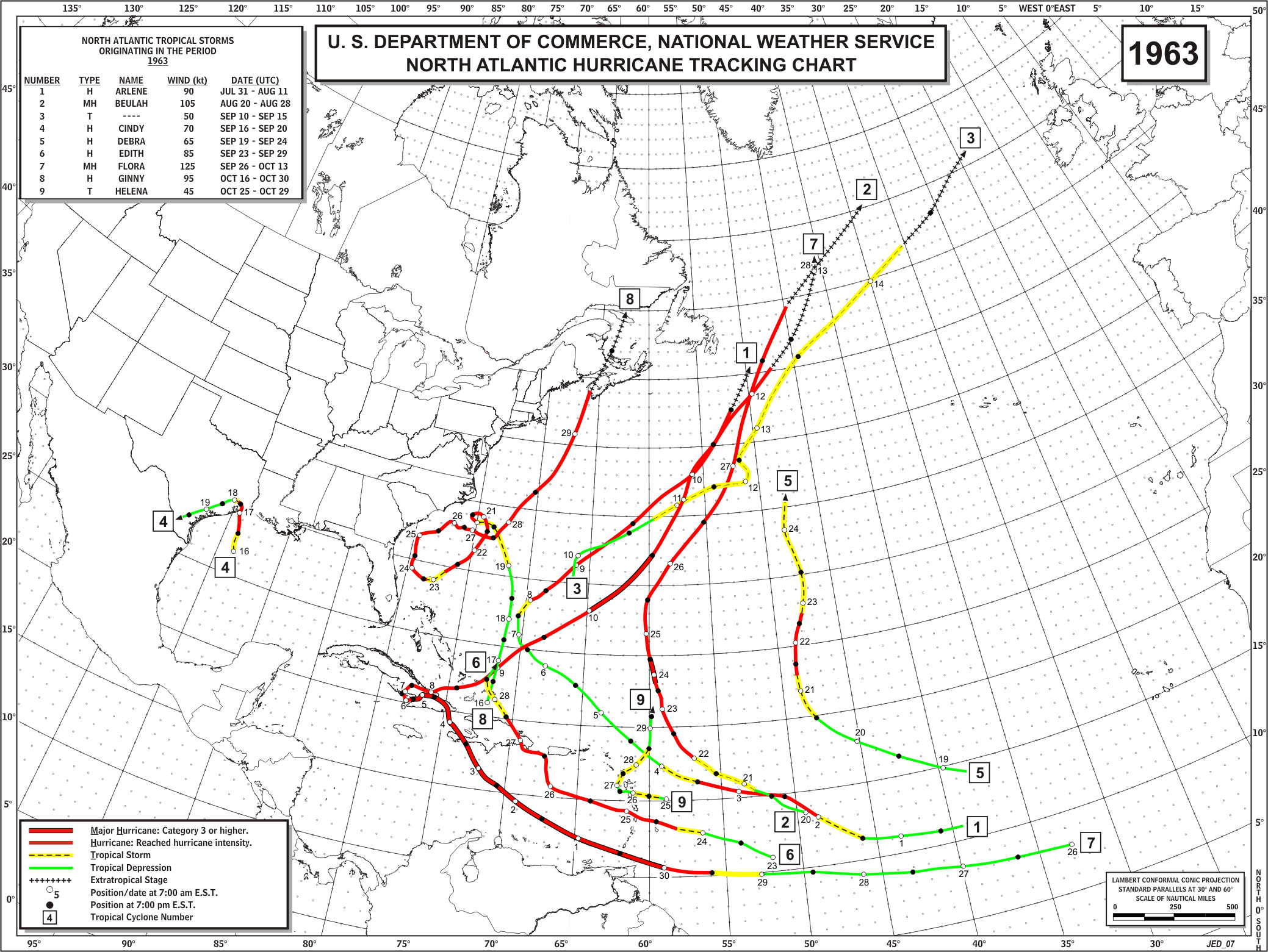
CARLA (Cat. 4 Hurricane - September 11th landfall)
Carla was a severe hurricane which made landfall near Port Lavaca, bringing flooding from her storm surge 10 miles inland. Originating in the Caribbean Sea, Carla moved slowly across the Gulf, made a small loop east of Corpus Christi, and came ashore near Matagorda Bay with a 22' storm surge. Carla had 150 mph sustained winds, 175 mph gusts, and a central pressure of 27.49". Rainfall totals ranged from 19" at Votan, near Beaumont, to 1.08" at Brownsville. As may happen in large slow moving hurricanes, the surge was higher in the bays than at the coastline, being 22' at the head of Matagorda Bay and only 12.3' on the Gulf shoreline. Eleven tornadoes spun out of the rear portion of the storm in Texas, and deaths totaled 34 in the state, including 22 persons who drowned. Worth noting was the estimated 200,000 people that evacuated the Beaumont-Port Arthur area in a six hour period as Hurricane Carla approached the Texas coast.
Statistics:
Winds (mph): Gusts to 175 mph at Port Lavaca.
Tides (feet): 15.2 at Matagorda, 14.8 at the Houston Ship Channel, 14.5 at Port O'Connor


 Follow us on YouTube