Heavy Rainfall For Much of Hawaii
October 31-November 2, 2006
Andy Nash & Kevin Kodama
Summary:
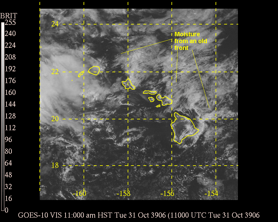
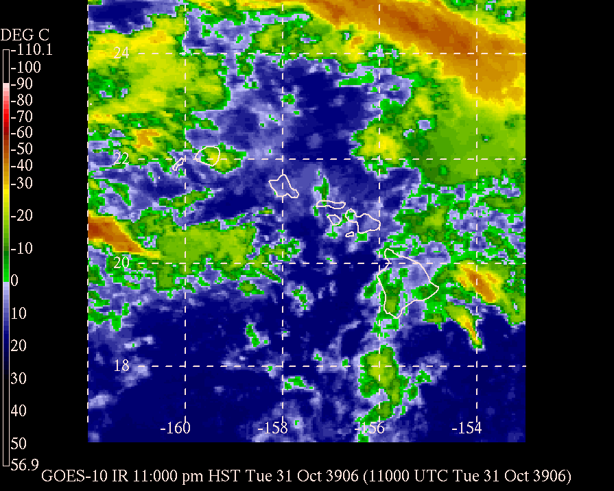
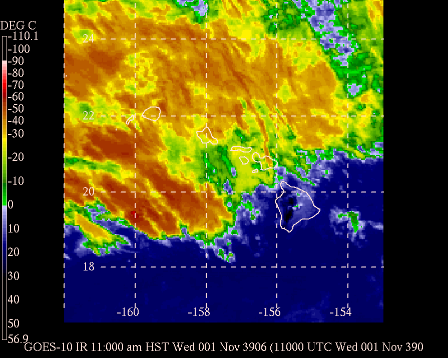
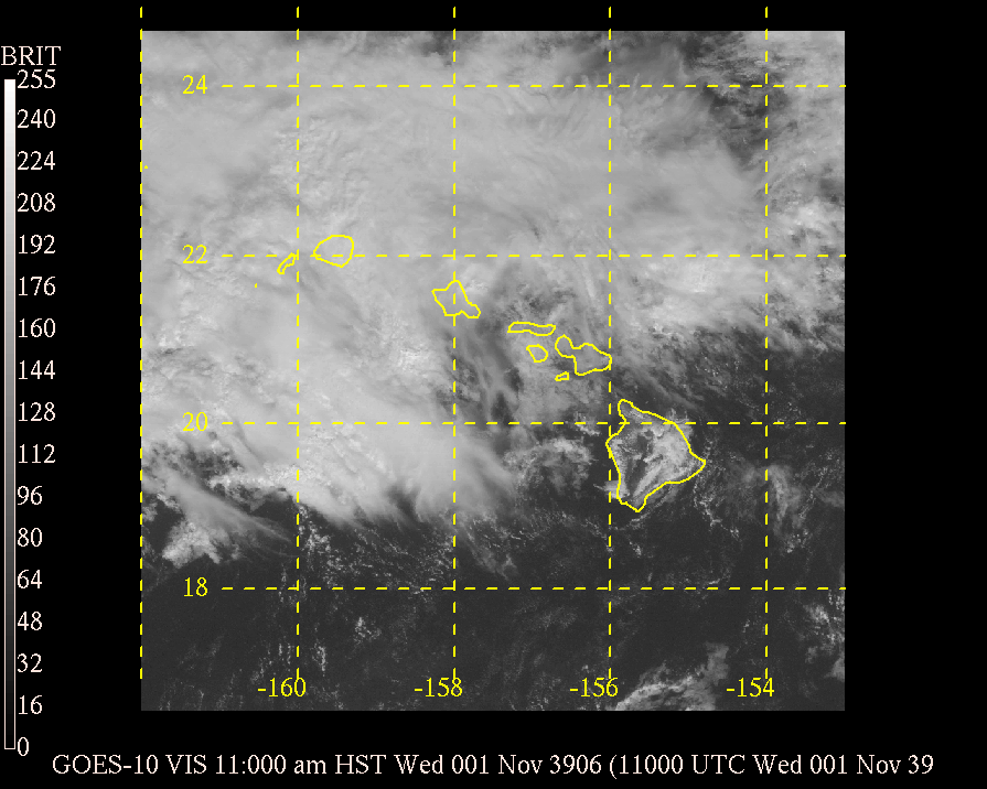
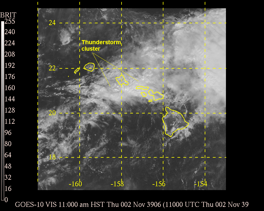
Heavy rainfall across much of Hawaii during the period was the result of two systems. The first being left over moisture from an old front that pooled along the windward sides of the islands. The light easterly wind flow helped push the moisture over windward sections of the islands, resulting in some showers on October 30. By October 31, the destabilized further as an upper level trough of low pressure moved toward Hawaii. The more unstable conditions resulted in locally heavy rainfall that persisted into the afternoon hours of November 1. The excessive rains produced flooding over portions of windward Kauai and Oahu and triggered a significant landslide that closed Oahu's Pali Highway. As the upper level low pushed across the state on November 2, it once again triggered the development of a cluster of thunderstorms near Oahu during the late morning. These thunderstorms brought one last round of flooding to portions of Oahu and then to Molokai and Maui during the afternoon as it slid southeast down the island chain. Such heavy rain events due to the combination of an old front, or shearline, and an upper level low pressure are not uncommon and happen several times a year. Click here to read a summary of heavy rainfall in late 2003 under similar circumstances.
Rainfall amounts during the period were quite large, especially along windward sections of Kauai and Oahu, with some locations receiving well over 15 inches of rainfall. Some locations received over 3 inches in just a matter of 1 or 2 hours.
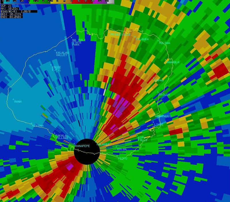
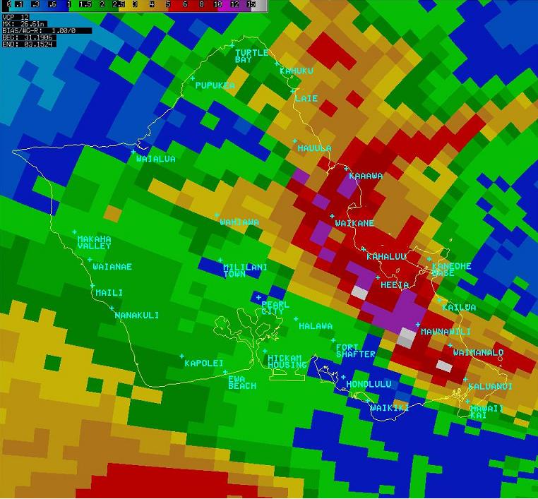
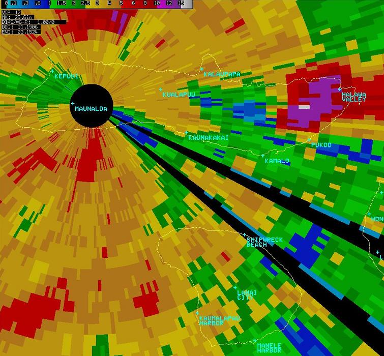
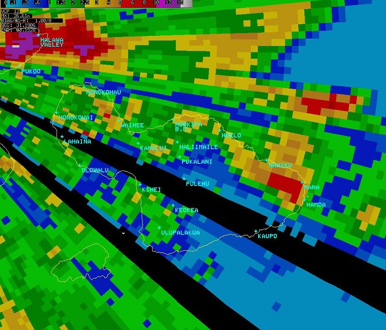
Radar Estimated Rainfall:
Notes:
Color scale -Blue <1" Greens 1 to 2 1/2" Orange 2 1/2 to 5" Red 5 to 10" Purple 10 to 15" White >15"
The black circles are areas that are too close to the radar for accurate rainfall estimations to be made.
Selected Rainfall Amounts (in inches) from
| Mt Waialeale | 10.87 |
| Hanalei River | 4.85 |
| Wailua UH Station | 4.81 |
| Princeville Airport | 4.76 |
| Opaekaa Stream | 4.39 |
| Kapahi | 4.21 |
| Kalaheo | 3.42 |
| Hanalei | 3.13 |
| Lihue Variety Station | 2.22 |
| St. Stephens Seminary | 22.39 |
| Maunawili | 21.00 |
| Ahuimanu Loop | 18.63 |
| Luluku | 18.25 |
| Wilson Tunnel | 18.11 |
| Oahu Forest Wildlife Refuge | 14.76 |
| Waihee Pump | 14.40 |
| Kaneohe Marine Base | 8.95 |
| Hakipuu Mauka | 8.52 |
| Manoa Lyon Arboretum | 8.47 |
| Olomana Fire Station | 7.50 |
| Waimanalo | 6.37 |
| Poamoho | 6.19 |
| Kaneohe | 5.46 |
| Kahuku Training Area | 5.10 |
| Nuuanu Upper | 4.31 |
| Niu Valley | 4.28 |
| Kii Wildlife Refuge | 4.00 |
| Hawaii Kai Golf Course | 3.85 |
| Makua Ridge | 3.78 |
| Kamehame | 3.54 |
| Palisades Reservoir | 3.38 |
| Bellows AFS | 3.34 |
| Kahuku | 3.29 |
| Molokai 1 | 6.51 |
| Makapulapai | 4.09 |
| Kaunakakai | 3.74 |
| Lanai 1 | 1.90 |
| Lanai City | 1.81 |
| West Wailuaiki Stream | 14.06 |
| Kahakuloa | 8.50 |
| Oheo Gulch | 8.44 |
| Wailuku | 4.66 |
| Mahinahina Camp | 4.64 |
| Haiku | 4.32 |
| Hana Airport | 4.00 |
| Kaupo Gap | 3.84 |
| Waikapu Country Club | 3.60 |
| Kahului Airport | 2.82 |
| Lahainaluna | 2.64 |
| Pukalani | 1.99 |
| Kihei | 1.82 |
| Ulupalakua Ranch | 1.78 |
| Kula | 1.31 |
| Kahoolawe NWS Site | 2.24 |
| Honokanaia | 1.06 |
| Laupahoehoe | 3.38 |
| Piihonua | 2.57 |
| Volcano Park - Hilina Pali | 2.51 |
| Kapapala Ranch | 2.27 |
| Honokaa | 2.20 |
| South Point | 1.97 |
| Waiakea-Uka | 1.77 |
| Pahoa Beacon | 1.75 |
| Waiaha Stream | 1.38 |
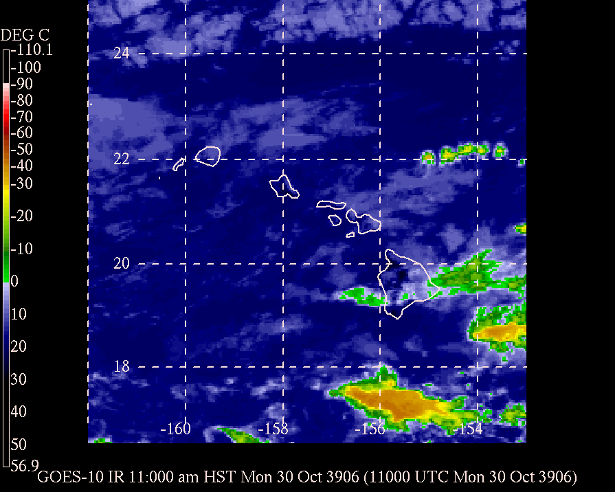
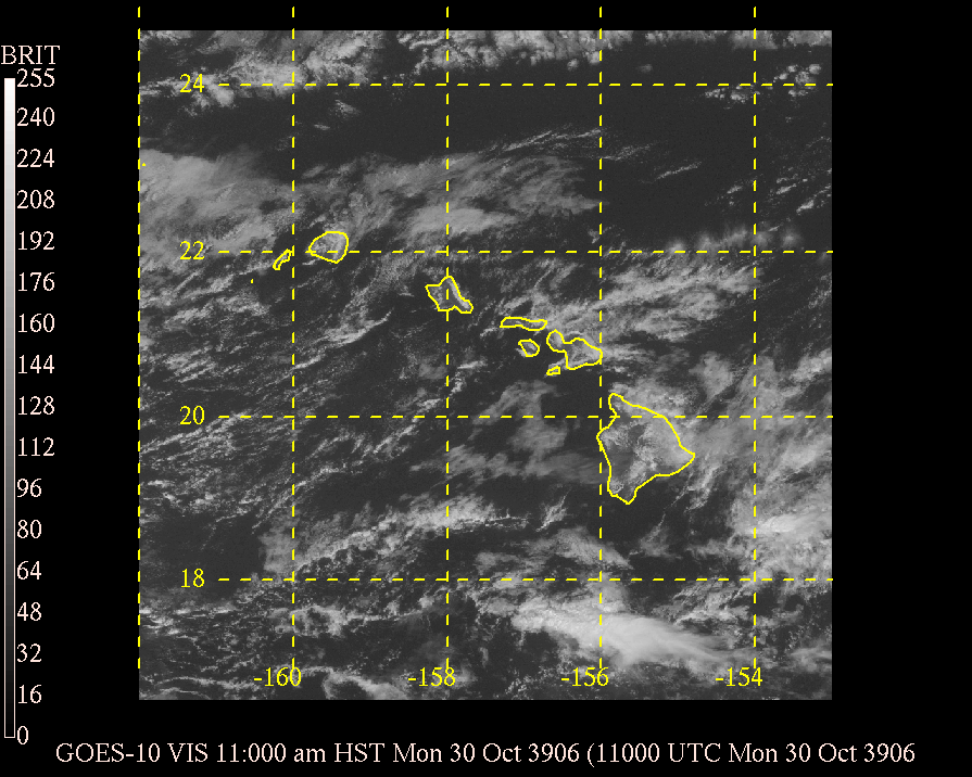
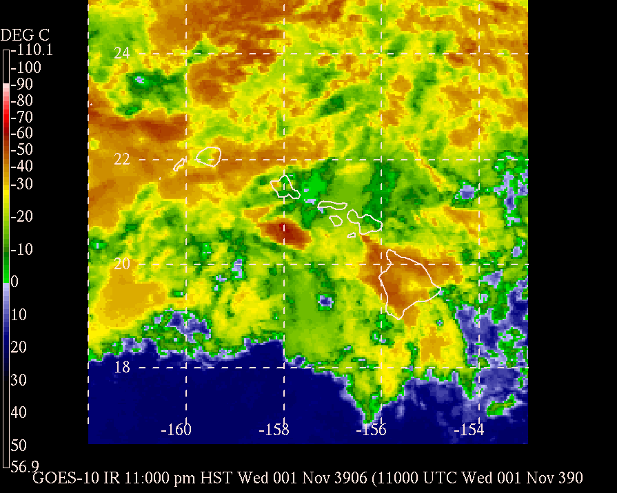
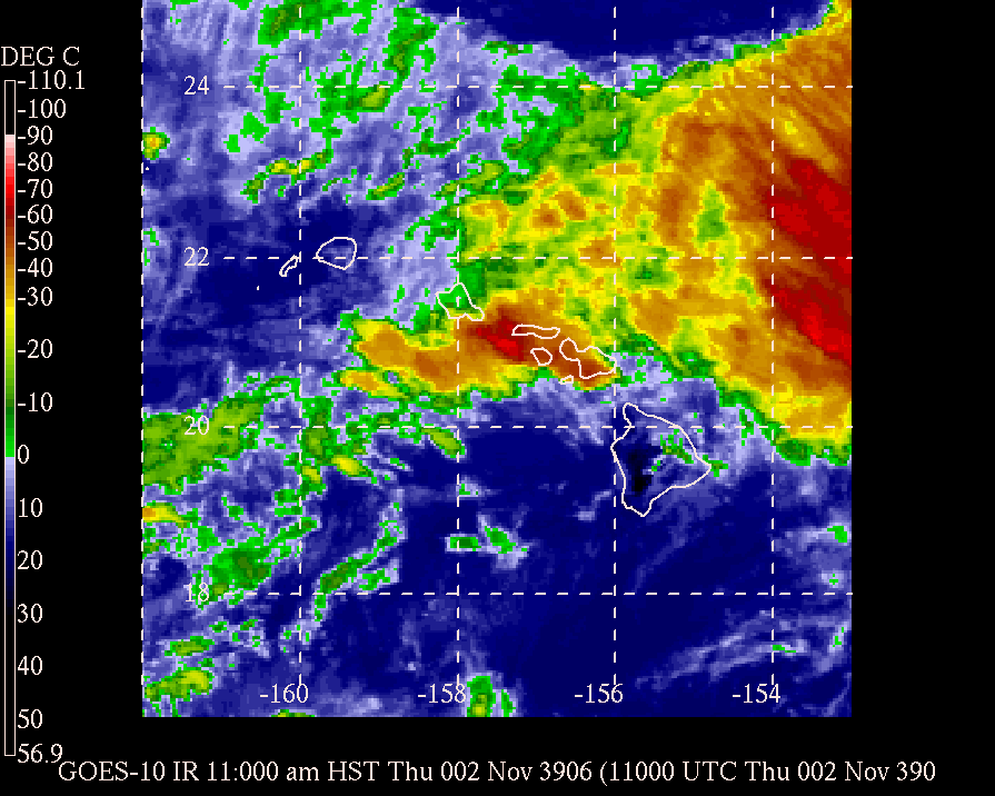
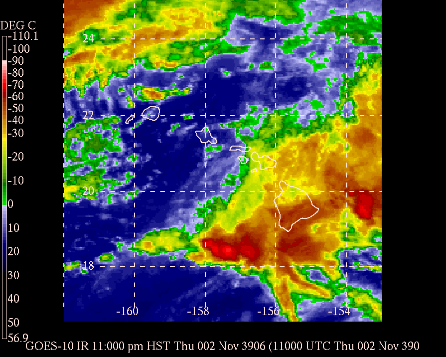
| October 30 11am | Infrared | Visible |
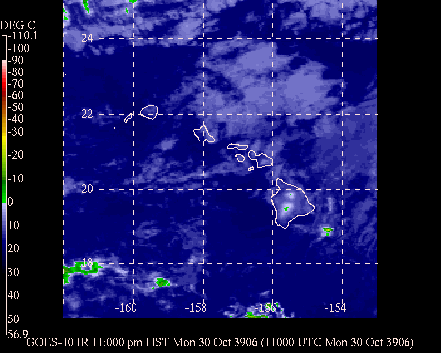
| October 30 11pm | Infrared | |
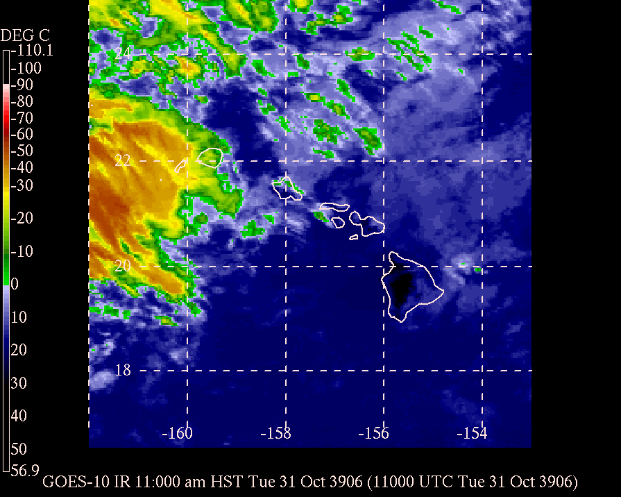
| October 31 11am | Infrared | Visible |
| October 31 11pm | Infrared | |
| November 1 11am | Infrared | Visible |
| November 1 11pm | Infrared | |
| November 2 11am | Infrared | Visible |
| November 2 11pm | Infrared |
Significant Storm Reports:
October 31
245 pm - Oahu - Flooding closes Kapaa Quary Road near Kaneohe
545 pm - Oahu - Small landslide along Kapaa Quary Road
November 1
1045 am- Oahu - Landslide closes the Pali Highway
1215 pm - Kauai - Hanalei River overflows and closes the Kuhio Highway
November 2
1230 pm - Maui - Waterspouts occur in Maalaea Bay
130 pm - Oahu - Flooding of Waikane Stream forces the closure of Kamehameha Highway
215 pm - Maui - Flooding in and around Kahului to Paia closes several roads
215 pm - Molokai - Flooding closes Highway 450 between mile markers 4 and 13.
250 pm - Maui - Flooding in and around Kihei closes several roads
Watch/Warning/Advisory Summary:
During the period, the Forecast Office issued a number of watches, warnings and advisories primarily for the flood threat, although the upper level system responsible for the unsettled weather also brought strong winds to the highest summits. Winds over 50 mph were measured on Mauna Kea.
Flash Flood Warnings - Total 13 (Kauai 3, Oahu 4, Molokai 4, Maui 2)
Flood Advisories - Total 22 (Kauai 2, Oahu 12, Molokai 2, Lanai 1, Maui 2, Big Island 3)
Flood Watch - In effect from early morning November 1 until late on November 2.
High Wind Warning - For Mauna Kea and Mauna Loa summits on the Big Island
Wind Advisory - Total 2 (Haleakala on Maui and Mauna Kea/Mauna Loa on the Big Island)


 Follow us on YouTube