Upper Air Observations
Twice a day, seven days a week, nearly 900 stations around the world (including at the NWS Weather Forecast Office in Green Bay) release weather balloons into the atmosphere to obtain upper air weather information. (Click here for a map of stations in the U.S.) Under the helium or hydrogen-filled balloon a small instrument, called a radiosonde, dangles on a string broadcasting continuous weather data back to the launch site. The NWS Green Bay office is the only one in Wisconsin to launch the radiosondes (launched locally shortly after 5 AM / 5 PM CST and 6 AM / 6 PM CDT).
The radiosonde consists of a radio transmitter, GPS, temperature sensor (called a thermistor), humidity sensor (called a hygristor), and pressure sensor. The winds aloft are computed from the measured elevations and location of the radiosonde at a given pressure (recall pressure decreases with elevation). The height of the balloon is also calculated. So, from this simple instrument, the complete temperature, moisture, wind and pressure field in the vicinity of the launch station can be obtained during its two hour journey to nearly 100,000 feet up into the atmosphere.
Weather Balloon Launch--In All Kinds of Weather (click on images below for larger view):
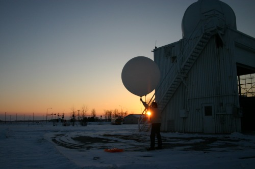
Winter launch (photos by Peg Zenko, Green Bay):
 |
 |
 |
| Balloon is inflated using hydrogen. | Getting ready for launch. | And it's launched. |
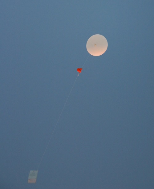
Summer launch (photos by Linda Skowronski, NWS Green Bay):
 |
 |
 |
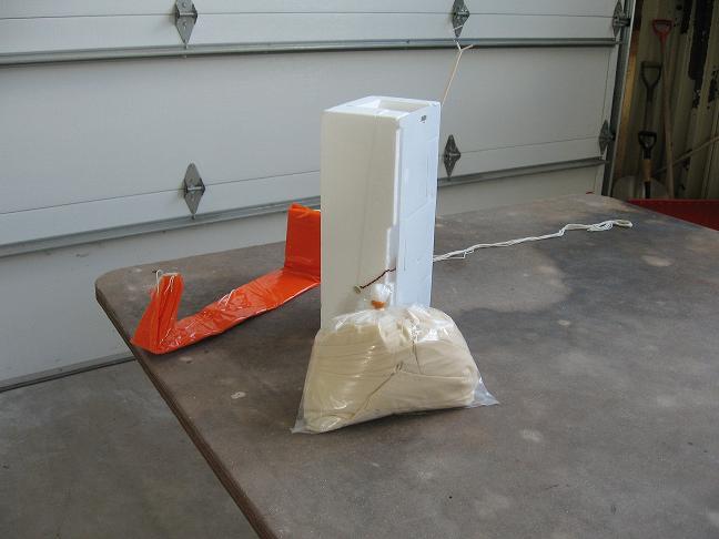
| Parachute, radiosonde and balloon. | Ready to let the balloon go. | Up, up and away. |
In the pictures on the far right, the radiosonde instrument is visible against the sky as a small white box. The object just below the balloon is the parachute, which allows the instrument to float safely back to earth once the balloon bursts. Some (perhaps 20% nationwide) are found and returned to the NWS for refurbishing so that the instrument can be re-used. Many, though, fall harmlessly into a forest or a large body of water.
Here's an example of how the collected data are displayed for meteorologists (click for larger image).
 |
The upper air "sounding" allows forecasters to evaluate the vertical distribution of temperature, humidity and wind, which is critical to forecasting severe thunderstorms and tornadoes in the summer and winter storms in the winter. Click here for the latest upper air soundings from the U.S.
The data collected by the network of radiosonde stations is also the basic ingredient that goes into computer models, or simulations, of how the atmosphere flows across the Northern Hemisphere. From the models, weather charts and information are developed from which all forecasts are derived. The radiosonde data are transmitted over computer networks to all NWS Weather Forecast Offices and to weather stations across the world.


 Follow us on YouTube