Overview
|
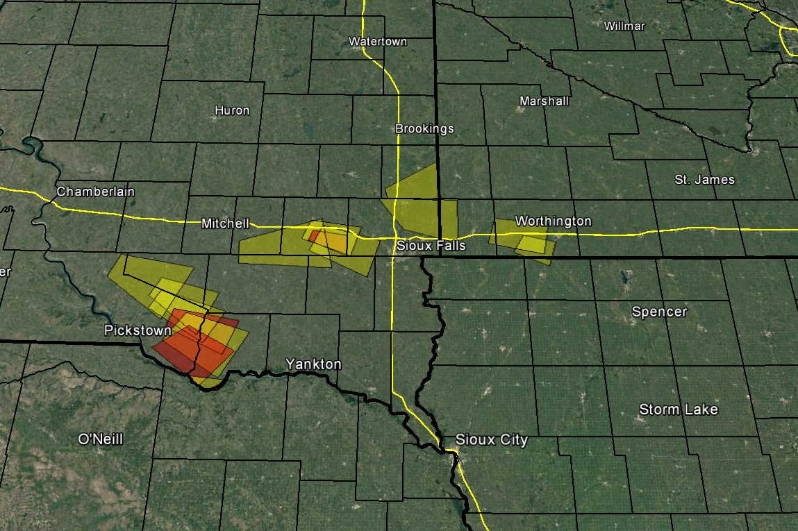
A few clusters of thunderstorms developed Sunday afternoon and quickly became severe across southeast South Dakota, and continued along the I-90 corridor into southwest Minnesota during the evenings hours. These scattered strong to severe storms produced large hail up to golf ball size, and localized heavy rain to over 2 inches. |
 Caption |
Photos & Video:
Header
 |
 |
 |
|
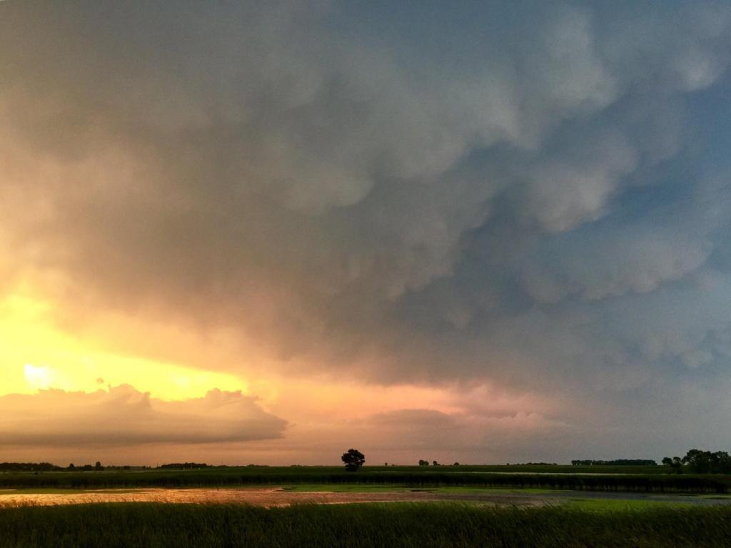
Mammatus clouds near Worthing, South Dakota Credit: Derek Thompson |
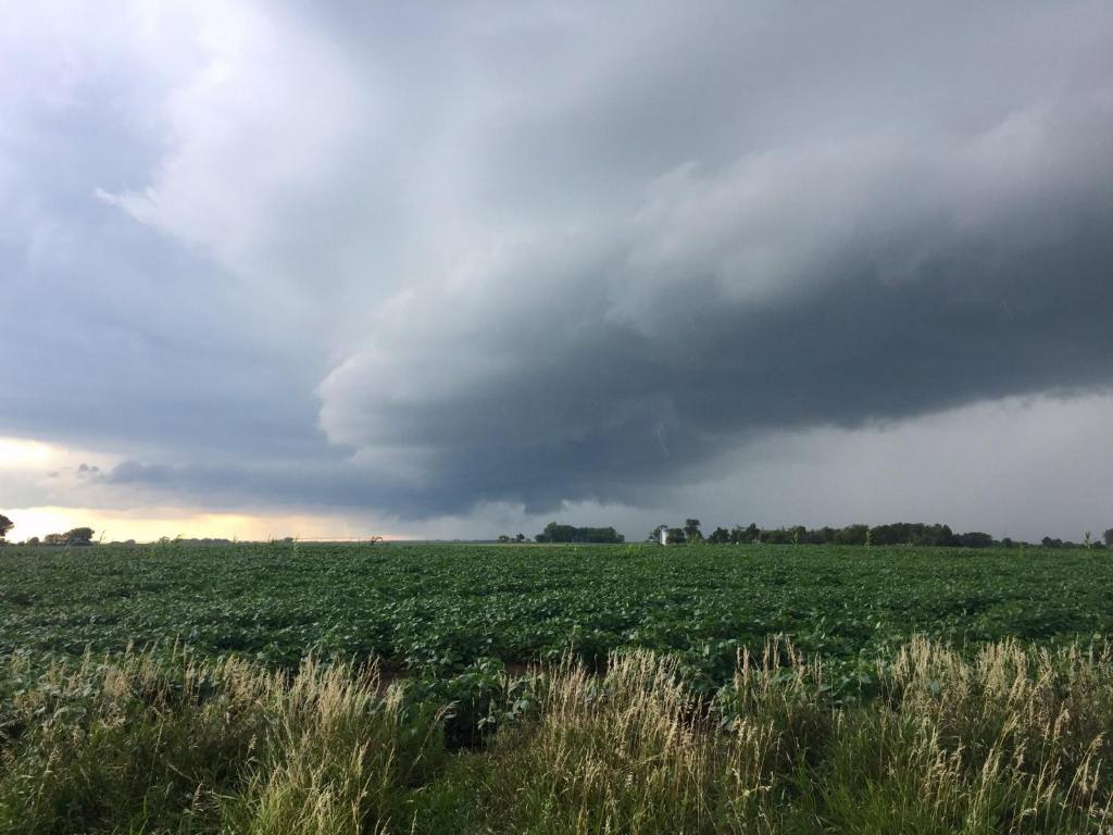
Wall colud 8 miles NE of Verdel, Nebraska Credit: Derek Thompson |
Storm Based Warnings Yellow Polygons: Severe Thunderstorm Warnings Red Polygons: Tornado Warnings |
Radar:
|
Storm Reports
PRELIMINARY LOCAL STORM REPORT...SUMMARY
NATIONAL WEATHER SERVICE SIOUX FALLS SD
1205 AM CDT MON AUG 14 2017

..TIME...   ...EVENT...      ...CITY LOCATION...     ...LAT.LON...
..DATE...   ....MAG....      ..COUNTY LOCATION..ST.. ...SOURCE....
            ..REMARKS..

0918 PM     HAIL             RUSHMORE                43.62N 95.80W
08/13/2017  E1.75 INCH       NOBLES             MN   LAW ENFORCEMENT


0900 PM     HAIL             ADRIAN                  43.63N 95.93W
08/13/2017  E1.00 INCH       NOBLES             MN   TRAINED SPOTTER


0845 PM     HEAVY RAIN       LUVERNE                 43.65N 96.21W
08/13/2017  M3.50 INCH       ROCK               MN   PUBLIC

            REPORT VIA SOCIAL MEDIA.

0800 PM     HEAVY RAIN       5 E CANISTOTA           43.60N 97.19W
08/13/2017  M2.30 INCH       MCCOOK             SD   BROADCAST MEDIA

            RAINFALL IN ABOUT 2 HOURS.

0645 PM     HAIL             8 WSW SPRINGFIELD       42.80N 98.04W
08/13/2017  E1.00 INCH       BON HOMME          SD   PUBLIC

            MOSTLY DIMES WITH A FEW NICKELS AND
            QUARTERS.

0556 PM     HAIL             2 W TRENT               43.91N 96.70W
08/13/2017  E1.75 INCH       MOODY              SD   TRAINED SPOTTER


0524 PM     HAIL             3 N DANTE               43.08N 98.18W
08/13/2017  E1.25 INCH       CHARLES MIX        SD   EMERGENCY MNGR


0424 PM     HAIL             7 ESE ETHAN             43.51N 97.85W
08/13/2017  E1.00 INCH       HANSON             SD   PUBLIC


0408 PM     HAIL             4 WSW DELMONT           43.25N 98.25W
08/13/2017  E1.00 INCH       DOUGLAS            SD   PUBLIC


0351 PM     HAIL             1 SW ARMOUR             43.31N 98.36W
08/13/2017  E1.00 INCH       DOUGLAS            SD   PUBLIC


0915 AM     HEAVY RAIN       8 WSW PLATTE            43.33N 98.97W
08/13/2017  M2.56 INCH       CHARLES MIX        SD   MESONET

            MESONET STATION PCPS2, 7 WSW PLATTE.

0914 AM     HEAVY RAIN       1 WSW FAIRFAX           43.02N 98.90W
08/13/2017  M2.27 INCH       GREGORY            SD   MESONET

            MESONET STATION E7290, FAIRFAX.

0841 AM     HEAVY RAIN       3 W GEDDES              43.26N 98.76W
08/13/2017  M1.21 INCH       CHARLES MIX        SD   MESONET

            MESONET STATION RLAS2, LAKE ANDES RAWS.

0700 AM     HEAVY RAIN       HERRICK                 43.12N 99.19W
08/13/2017  M1.12 INCH       GREGORY            SD   COCORAHS

            COCORAHS STATION SD-GY-13, HERRICK.

0700 AM     HEAVY RAIN       2 NE BURKE              43.21N 99.26W
08/13/2017  M1.22 INCH       GREGORY            SD   COCORAHS

            COCORAHS STATION SD-GY-17, BURKE 2.4 NE.

0700 AM     HEAVY RAIN       ALEXANDRIA              43.65N 97.78W
08/13/2017  M1.00 INCH       HANSON             SD   CO-OP OBSERVER

            CO-OP OBSERVER STATION ALXS2, ALEXANDRIA.

0700 AM     HEAVY RAIN       8 SSW HERRICK           43.00N 99.23W
08/13/2017  M1.70 INCH       GREGORY            SD   COCORAHS

            COCORAHS STATION SD-GY-12, 7 WNW NAPER.

0700 AM     HEAVY RAIN       6 SSW HERRICK           43.04N 99.23W
08/13/2017  M2.01 INCH       GREGORY            SD   COCORAHS

            COCORAHS STATION SD-GY-18, BURKE 10.5 SSE.
Rain Reports


 |
Media use of NWS Web News Stories is encouraged! Please acknowledge the NWS as the source of any news information accessed from this site. |
|


 Weather Story
 Weather Map
 Local Radar
 Follow us on YouTube