Overview
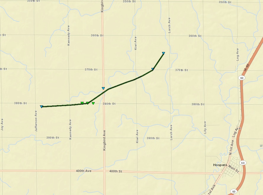
A strong supercell thunderstorms developed over extreme southeast South Dakota on Sunday evening. This storm produced a tornado near Spink, South Dakota around 7:32 pm CDT. After doing some damage near a farmstead, the tornado lifted and the storm continued to move northeast into Iowa. Around 8:35 pm CDT, a tornado formed 6 miles west-northwest of Hospers, IA. The tornado was on the ground a little over 4 miles and lasted approximately 11 minutes. While it was on a ground it did damage to 3 farmsteads. The worst damage was to a dairy farm where $3 million in damage was estimated. The tornado was rated EF-1 by the National Weather Service.
| EF Scale Rating | EF-1 |
| Estimated Peak Wind | 96 mph |
| Path Length in statute miles | 4 |
| Maximum path width | 100 yards |
| Fatalities | 0 |
| Injuries | 0 |
| Start Date | May 11, 2014 |
| Start Time | 8:35 pm CDT |
| Start Location | 6 miles west-northwest of Hospers, IA |
| Lat/Lon | 43.0973oN 96.0144oW |
| End Date | May 11, 2014 |
| End Time | 8:46 pm CDT |
| End Location | 4 miles northwest of Hospers, IA |
| Lat/Lon | 43.1199oN 95.9434oW |
Map of Hospers, IA tornado track
A link to a video take by a deputy of the Sioux County Sheriff Department.
Radar images of the tornadic supercell as the tornado formed 6 miles west-northwest of Hospers, IA
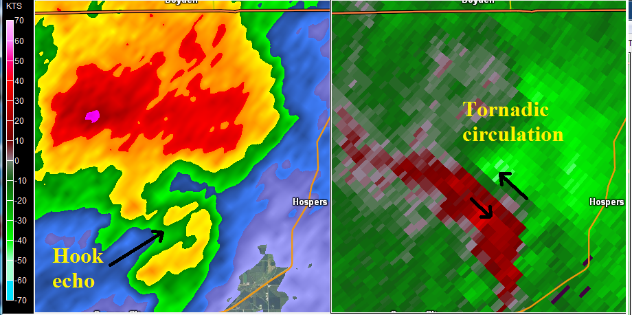
This radar picture is from 8:37 pm CDT, May 11, 2014. The tornado has just formed to the west-northwest of Hospers, IA - a little over a mile from the dairy farm that sustained the greatest damage. This storm has an hook echo with the tornado located between the heavy precipitation to the north and the "hook" west of Hospers. The velocity image on the west shows a strong circulation associated with the tornado. While the radar cannot see the actual tornado it does see the parent circulation in which the tornado is embedded.
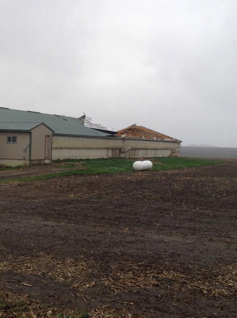
Here are links to photos of damage near Hospers:
An outbuilding damaged along 380th Street.
Damage to outbuildings of a dairy farm.
Damage to windows and a roof of a home.
| EF Scale Rating | EF-0 |
| Estimated Peak Wind | 85 mph |
| Path Length in statute miles | 2.5 |
| Maximum path width | Unknown |
| Fatalities | 0 |
| Injuries | 0 |
| Start Date | May 11, 2014 |
| Start Time | 7:32 pm CDT |
| Start Location | 8 miles west-northwest of Akron, IA |
| Lat/Lon | 42.8713oN 96.7332oW |
| End Date | May 11, 2014 |
| End Time | 7:38 pm CDT |
| End Location | 6 miles west-northwest of Akron, IA |
| Lat/Lon | 42.8686oN 96.6859oW |
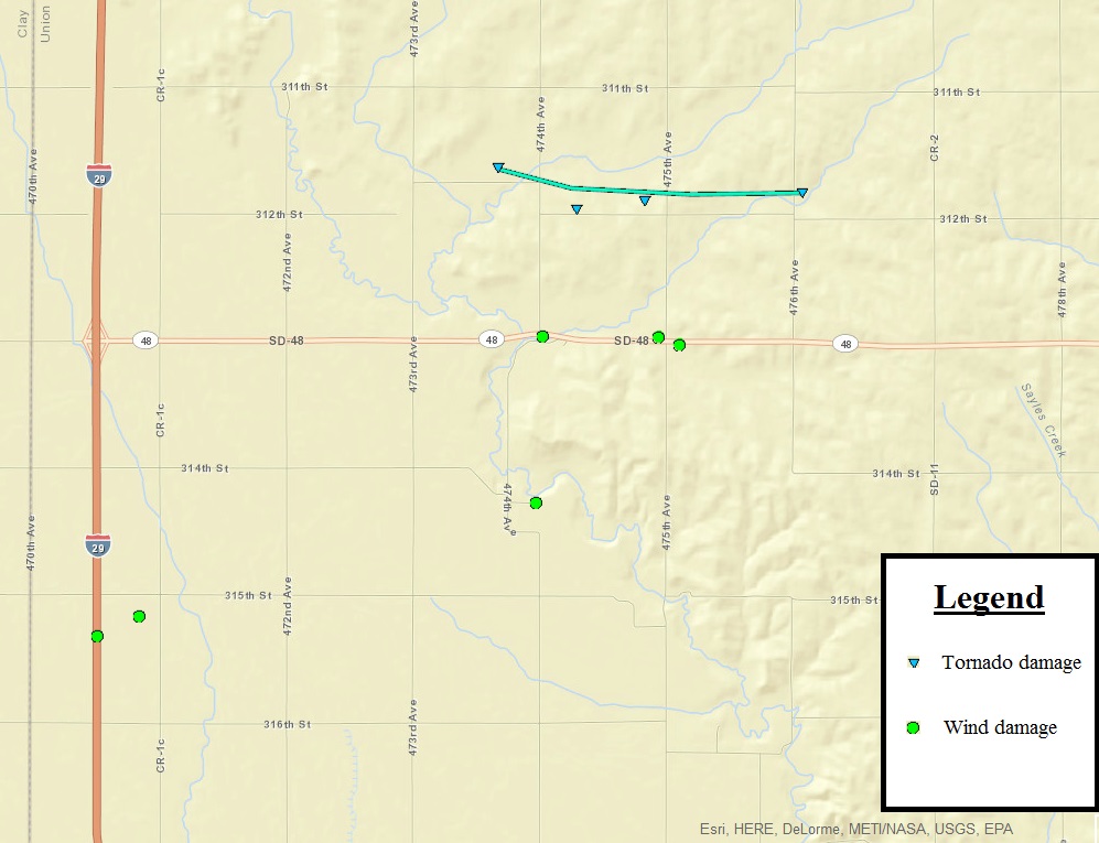
Map of Spink, SD tornado track and wind damage
Radar images of the tornadic supercell when the tornado was approximately 6 miles west-northwest of Akron, IA
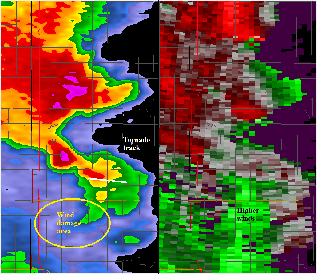
This radar picture is from 7:36 pm CDT, May 11, 2014. The tornado was nearing the end of its life and would lift 2 minutes later. This storm also shows a hook echo in the area where the tornado tracked (shown in white above). However, the velocity field does not show the strong circulation that was seen with the tornado that touched down near Hospers, IA an hour later. South of where the tornado tracked, there was an area of wind damage. The radar does show an area of higher winds (the greens on the image to the right) where the wind damage did occur. The winds in this area were estimated to be as strong as the winds associated with the tornado. Winds were estimated between 70 and 90 mph based upon damage reported to the National Weather Service.
Other tornadoes:
2 miles north of Hospers, IA - EF-0
Link to video of tornado 2 miles north of Hospers, IA taken by Sioux County deputy sheriff at 8:51 pm CDT
1 mile east of Sheldon, IA - EF-0


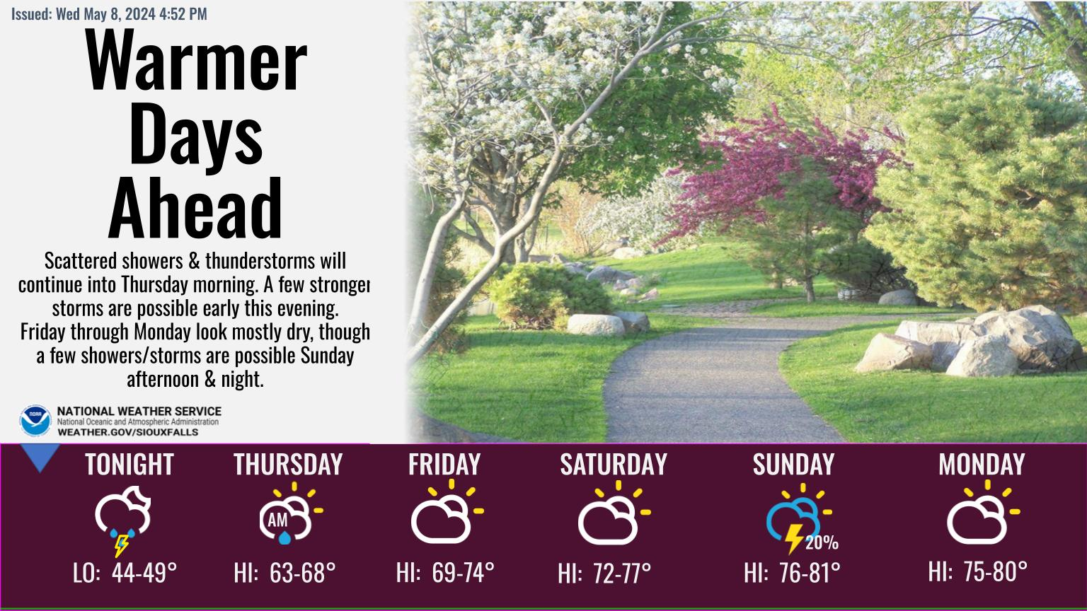 Weather Story
 Weather Map
 Local Radar
 Follow us on YouTube