.gif)
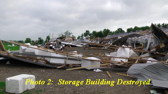
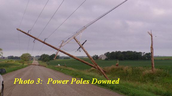
Earlier this morning, the National Weather Service in Sioux Falls completed a storm survey of the damage that resulted from very strong winds on Saturday, July17 2010. Widespread damage was seen across most of the Great Lakes area of Dickinson County in northwest Iowa. The greatest amount of damage occurred along a line from Montgomery to Triboji, and finally to West Okoboji. Most of the damage was done to trees and boats, but also a few farm out buildings and storage sheds were either severely damaged or destroyed. All of the damage that occurred was a result of very strong winds associated with a severe thunderstorm that moved through the area Saturday evening from 10:15 PM to 11:30 PM CDT. Sustained winds of 50 to 60 mph, along with gusts to 80 to 100 mph occurred for a prolonged period of time. In some cases, residents reported experiencing these strong winds for 20 minutes. Despite the strong winds and all of the damage that occurred, there were no deaths or injuries reported to local authorities.
Warnings were issued for this area of Dickinson county beginning at 10:04 PM CDT Saturday evening and continued through 11:40 PM CDT. Numerous residents reported hearing the warnings and took shelter before the storm hit and credited the National Weather Service in issuing the life-saving warnings.
The Great Lakes area of northwest Iowa is a very popular vacation location for people all around the Midwest. On weekends, the population of this area increases dramatically with many people enjoying water recreational activities. Besides being a popular area for vacations, the Great Lakes area including Dickinson county, has been recognized by the National Weather Service as being a StormReady community and county. In order for a community or county to be recognized as StormReady, there are a number of requirements that need to be met by the community or county. A few examples include having outdoor warning sirens or other methods to notify residents of warnings, as well as working closely with the National Weather Service.
.jpg)
.jpg)
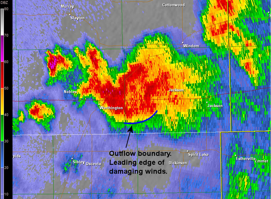
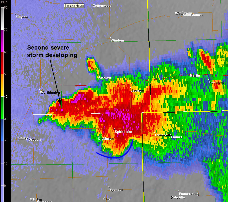
Shortly after 10 pm, the storm developed a very strong circulation over southern Jackson county in southern Minnesota. On the image below you can see the storm started to take on a bowing structure indicating the potential for strong damaging winds.
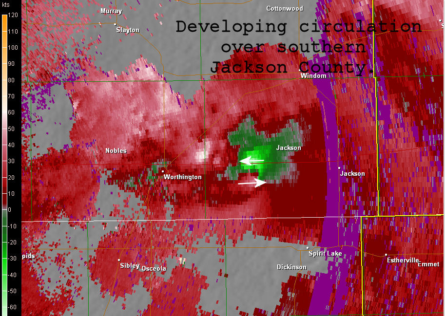
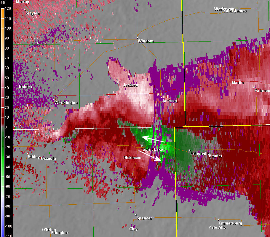
The image below is the velocity detected by the radar at 10:02 pm. The area of green indicate winds moving towards the radar (which is located on the left hand side of the image) and the red indicates winds moving away from the radar. The tight circulation associated with this storm indicates rotation of over 110 mph! This was detected at nearly 6000 feet above the ground, but given the subsequant damage, it is evident much of this wind was translating to the surface.
Below is the storm at 1047 pm when it was centered over the Iowa Great Lakes. At this time, the leading edge of the strong winds were surging south towards the Dickinson/Clay county line. The storm continued to develop along the western edge, creating a prolonged period of damaging winds across much of Dickinson County.
Below is the associated velocity at 1047 pm. Despite some missing data (shown in purple), the strong circulation is still evident over eastern Dickinson County with over 120 mph of circulation indicated at 7000 feet agl.


 Weather Story
 Weather Map
 Local Radar
 Follow us on YouTube