Four consecutive nights of rainfall in the Northern Plains has resulted in 96 hour rainfall totals up to 8 inches across portions of southeast South Dakota and northeast Nebraska. Average rainfall for the entire month of June in these areas ranges from 3.5 to 4.5 inches; therefore many sites exceeded the average monthly totals within the span of four days. The following graphic shows rainfall estimates from June 9th at 7 AM CDT through June 13th at 7 AM CDT. These data are derived from a combination of radar estimated precipitation and rain gauge measurements, and is provided by the National Weather Service River Forecast Centers.

Listed in the table below are rainfall totals from June 9th at 7 AM CDT to June 13th at 7 AM CDT for selected automated stations and COOP observing stations.
| Location | 96 hr total |
| Carthage | 7.53" |
| Mitchell | 6.62" |
| Marion | 5.28" |
| Astoria | 5.19" |
| Menno | 5.00" |
| Chamberlain | 4.68" |
| Brookings | 3.78" |
| Sioux City, IA | 3.77" |
| Wessington Springs | 3.74" |
| Winfred | 3.35" |
| Madison | 3.33" |
| Huron | 3.28" |
| White Lake | 3.25" |
| Academy | 3.19" |
| Sioux Falls | 3.10" |
| Remsen, IA | 3.04" |
| Worthington, MN | 2.60" |
| Marshall, MN | 2.38" |
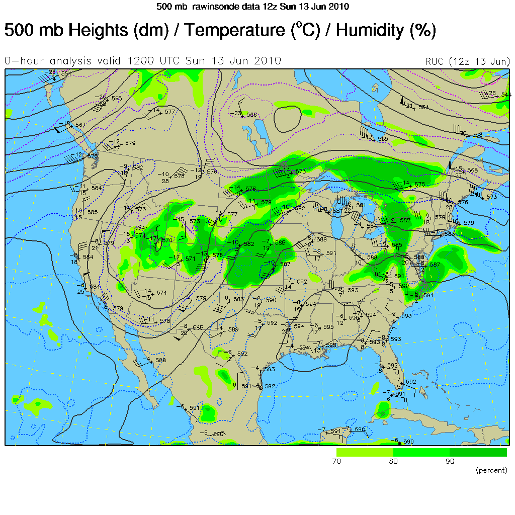
These overnight rainfall events are a result of the large scale pattern over the Northern Plains, which features a trough of low pressure to the west and southwest flow aloft. Smaller-scale disturbances can then develop over the eastern Rockies and persistently travel into the area. Throughout the next seven days, troughs will continue to develop in the west, bringing unsettled weather to the Northern Plains throughout the week.


 Weather Story
 Weather Map
 Local Radar
 Follow us on YouTube