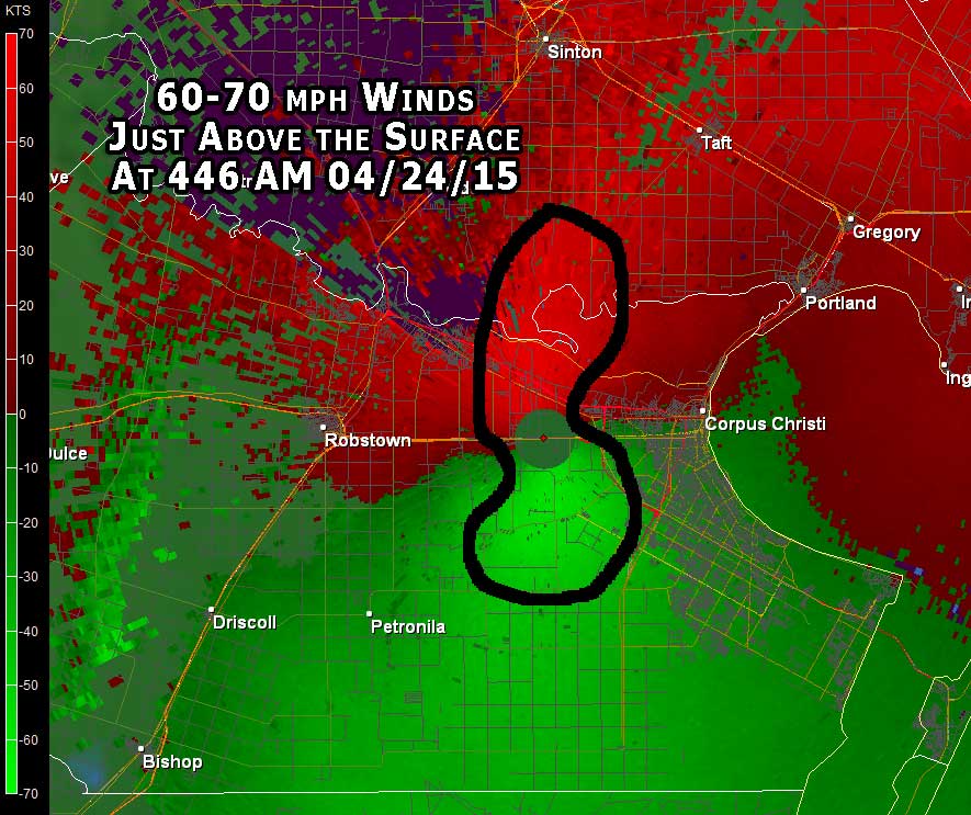
High winds between 35 and 60 mph developed between 430 and 630 AM on April 24th, 2015 across portions of the Coastal Bend and adjacent waters. These winds were produced by a meteorological phenomena called a "wake low". High winds from a wake low are normally caused by rapid warming and drying on the back edge of a trailing stratiform region of rain (usually associated with weakening thunderstorm complexes). This physical process can lead to falling pressure which in turn causes the winds to increase dramatically. Winds several hundred feet above the surface reached speeds close to 90 mph at the peak of this event! Pressure falls averaged between 5 and 7 millibars with this wake low event.
 |
| KCRP Reflectivity at 505 AM showing rapid drying | KCRP Velocity at 446 AM showing 60-70 mph winds above the surface |
|---|---|
 |
 |
| KCRP radar loop showing the diminishing stratiform region of a weakening thunderstorm complex |
|---|
 |


 Follow us on YouTube