Summary:
During the late afternoon and early evening hours of 23 July 2010, thunderstorms developed over portions of central South Dakota. Several storms quickly became severe in an environment favorable for supercell thunderstorms. In particular, one very strong supercell thunderstorm moved southeastward across portions of Stanley, Jones, and Lyman counties. One of the hardest hit locations was the community of Vivian, South Dakota, where extremely large hail, destructive winds to 80 mph, and a brief tornado were reported.
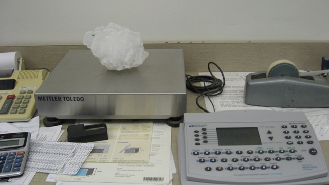
A record setting hailstone was ultimately discovered in Vivian, measuring 8.0 inches in diameter, 18.625 inches in circumference, and weighing in at an amazing 1.9375 pounds!! This hailstone broke the previous United States hail size record for diameter (7.0 inches - 22 June 2003 in Aurora, NE) and weight (1.67 pounds - 3 September 1970 in Coffeyvile, KS). The Aurora, Nebraska hailstone will retain the record for circumference (18.75 inches).
The hailstone's official record dimensions were as of the time personnel from the NWS in Aberdeen first observed and measured it. The stone did shrink considerably (melting and sublimation) between impact and when it was first measured by NWS personnel due in part to a power outgage at the residence of the individual who found the stone. It should also be noted that many other stones with diameters exceeding 6 inches were also noted during the storm survey!
To view the official NOAA Press Release regarding this event click HERE.
Hail and Damage Photos (click to enlarge):
 |
 |
 |
 |
 |
 |
|
Diameter = 8.0 inch |
Circumference = 18.625 inch |
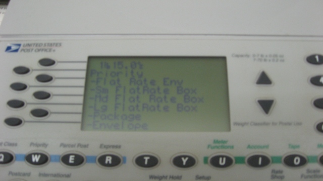
Weight = 1 lb 15/16 oz (1.9375 lbs) |
Weight = 1 lb 15/16 oz (1.9375 lbs) |
Hail Divot | Hail stone crashes through deck |
Radar Imagery (click to enlarge):
|
|
|
|
|
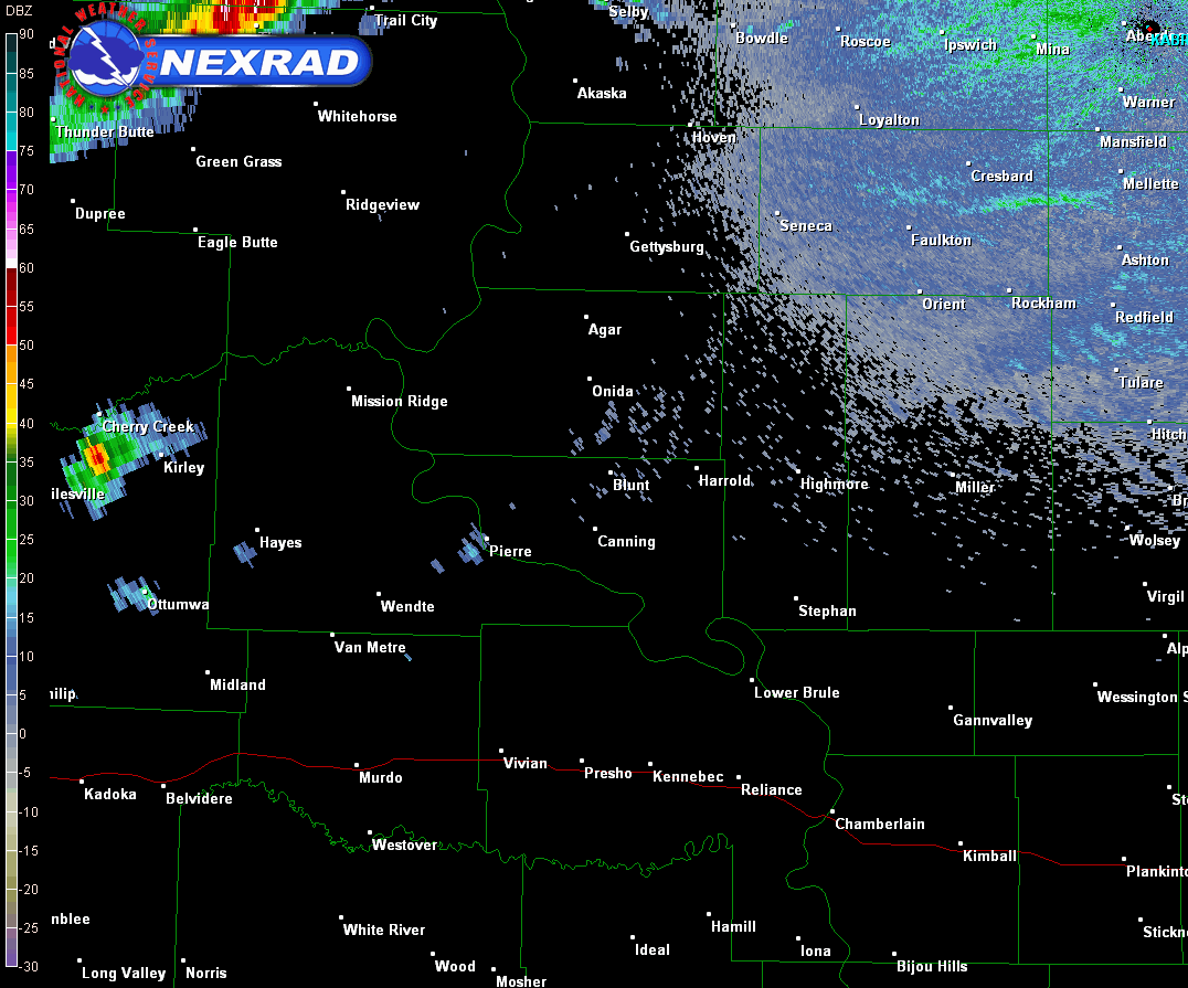
0.5 Degree Reflectivity
Loop of Event
|
4 Panel Radar Reflectivity
valid at 2258 UTC (0.5, 0.9,
1.3, 1.8 degrees)
|
4 Panel Storm Relative Velocity
valid at 2258 UTC (0.5, 0.9, 1.3,
1.8 degrees)
|
The storm scale structure of the storm was very impressive. In the images above, three body scatter spikes (TBSSs) are noted at several elevation angles at 2258 UTC. In addition, a very pronouced bounded weak echo region (BWER), and very intense mesocyclone are also indicative of a strongly rotating updraft.
Initial estimates indicate that the updraft strength in the Vivian hail storm likely ranged from 160-180 mph!
Additional Storm Reports from July 23, 2010:

| Time | Event | Location | County/State | Remarks/Source |
| 5:15 PM 07/23/2010 |
1.50 Inch Hail | 10 S Akaska | Potter, SD |
From: MESONET
|
| 5:33 PM 07/23/2010 |
1.00 Inch Hail | 6 E Hayes | Stanley, SD |
From: CO-OP OBSERVER
|
| 5:35 PM 07/23/2010 |
1.25 Inch Hail | 8 ESE Hayes | Stanley, SD |
From: TRAINED SPOTTER
|
| 5:35 PM 07/23/2010 |
1.75 Inch Hail | 6 E Hayes | Stanley, SD |
From: TRAINED SPOTTER
|
| 5:45 PM 07/23/2010 |
1.50 Inch Hail | 10 N Murdo | Jones, SD |
DAMAGED SIDING AND BROKE WINDOWS
From: PUBLIC |
| 5:48 PM 07/23/2010 |
85 mph Thunderstorm Wind Gust | 4 NNE Draper | Jones, SD |
APRS SITE
From: MESONET |
| 5:57 PM 07/23/2010 |
Tornado | Vivian | Lyman, SD |
LAW ENFORCEMENT RELAYED A PUBLIC REPORT OF A TORNADO EAST OF DRAPER...NEAR VIVIAN
From: LAW ENFORCEMENT |
| 6:00 PM 07/23/2010 |
1.75 Inch Hail | 8 N Vivian | Lyman, SD |
GOLFBALL HAIL
From: PUBLIC |
| 6:10 PM 07/23/2010 |
1.75 Inch Hail | 1 W Seneca | Faulk, SD |
From: LAW ENFORCEMENT
|
| 6:10 PM 07/23/2010 |
4.75 Inch Hail | Vivian | Lyman, SD |
SOFTBALL SIZE HAIL. POSSIBLE TORNADO SPOTTED 2 SOUTH OF VIVIAN.
From: LAW ENFORCEMENT |
| 6:10 PM 07/23/2010 |
1.75 Inch Hail | 1 W Seneca | Faulk, SD |
From: LAW ENFORCEMENT
|
| 6:15 PM 07/23/2010 |
1.75 Inch Hail | Seneca | Faulk, SD |
From: CO-OP OBSERVER
|
| 6:22 PM 07/23/2010 |
1.75 Inch Hail | Presho | Lyman, SD |
HAIL AND 70 MPH WINDS
From: CO-OP OBSERVER |
| 6:35 PM 07/23/2010 |
2.00 Inch Hail | Lyman | Lyman, SD |
GOLFBALL TO HEN EGG SIZE HAIL WITH 60 MPH WINDS
From: STORM CHASER |
| 7:00 PM 07/23/2010 |
3.00 Inch Hail | 6 SSE Kennebec | Lyman, SD |
COCORAHS SPOTTER...DURATION OF HAIL 20 MINUTES
From: TRAINED SPOTTER |
| 7:04 PM 07/23/2010 |
73 mph Thunderstorm Wind Gust | Oacoma | Lyman, SD |
From: MESONET
|
| 7:49 PM 07/23/2010 |
60 mph Thunderstorm Wind Gust | 2 SW Doland | Spink, SD |
From: PUBLIC
|
| 7:50 PM 07/23/2010 |
Tornado | 6 S Doland | Spink, SD |
MINOR DAMAGE TO FARMSTEAD AND TREES. PRELIMINARY WIND SPEED ESTIMATED AT 80MPH CONSISTENT WITH EF0 RATING
From: PUBLIC |
| 7:50 PM 07/23/2010 |
1.75 Inch Hail | Doland | Spink, SD |
From: PUBLIC
|
| 8:00 PM 07/23/2010 |
60 mph Thunderstorm Wind Gust | 3 SSW Raymond | Clark, SD |
From: PUBLIC
|
| 8:58 PM 07/23/2010 |
60 mph Thunderstorm Wind Gust | 2 N Bryant | Hamlin, SD |
DIME HAIL REPORTED WITH THESE WINDS
From: TRAINED SPOTTER |
Meteorological Analysis (click to enlarge):
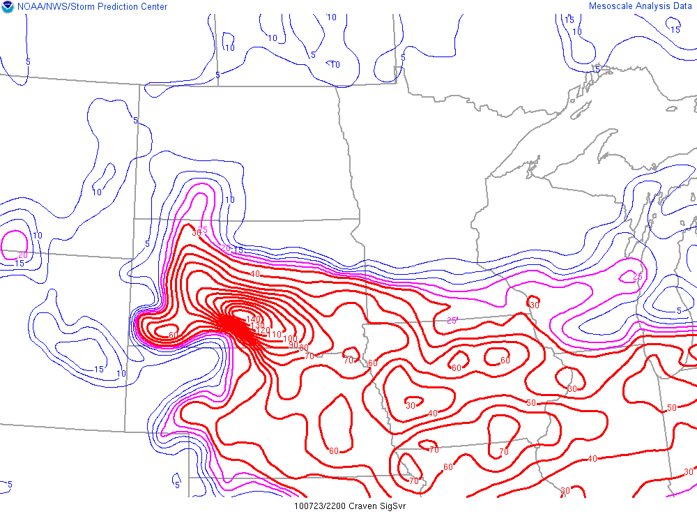
The images below depict the synoptic and mesoscale environment at 22:00 UTC (6PM CDT) - about one hour before the record hailstone fell in Vivian. Note that the kinematic and thermodynamic environment was very supportive of supercell thunderstorms due to the high shear and high CAPE environment.
|
|
|
|
|
22Z - Surface MSLP, Temperature, Dewpoint
|
22Z - Lowest 100mb MLCAPE
|
22Z - 0-6KM Bulk Shear Magnitude
|
|
|
|
|
|
22Z - Supercell Composite Parameter
|
22Z - Craven/Brooks Significant Severe (MLCAPE*0-6KM Shear)
|
22Z - Significant Hail Parameter (SHIP)
|


 Follow us on YouTube